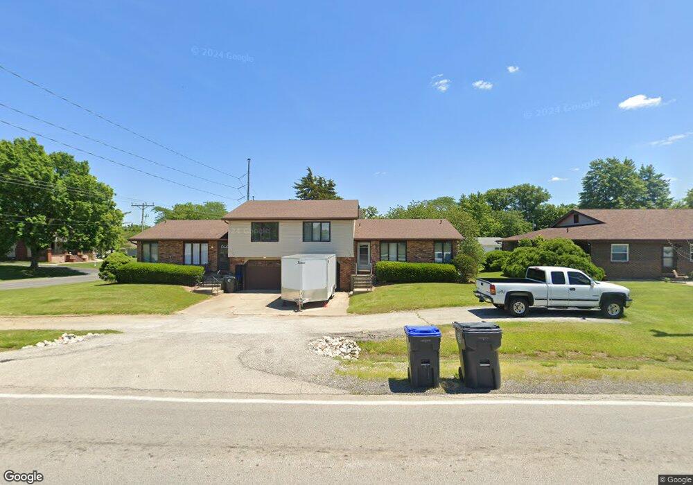
1702 Baltimore Ave Mount Zion, IL 62549
Estimated Value: $221,000 - $415,000
--
Bed
4
Baths
2,316
Sq Ft
$125/Sq Ft
Est. Value
About This Home
This home is located at 1702 Baltimore Ave, Mount Zion, IL 62549 and is currently estimated at $290,591, approximately $125 per square foot. 1702 Baltimore Ave is a home located in Macon County with nearby schools including McGaughey Elementary School, Mt. Zion Elementary School, and Mt. Zion Intermediate School.
Ownership History
Date
Name
Owned For
Owner Type
Purchase Details
Closed on
Feb 6, 2016
Sold by
Gracia Geronimo V
Bought by
Garcia Family Properties Llc and Estrada Garcia Dolores
Current Estimated Value
Purchase Details
Closed on
Oct 6, 2005
Sold by
Derby James M and Derby Catherine E
Bought by
Garcia Geronimo and Garcia Dolores A Estrada
Home Financials for this Owner
Home Financials are based on the most recent Mortgage that was taken out on this home.
Original Mortgage
$105,000
Interest Rate
5.83%
Mortgage Type
New Conventional
Purchase Details
Closed on
Apr 1, 2000
Create a Home Valuation Report for This Property
The Home Valuation Report is an in-depth analysis detailing your home's value as well as a comparison with similar homes in the area
Home Values in the Area
Average Home Value in this Area
Purchase History
| Date | Buyer | Sale Price | Title Company |
|---|---|---|---|
| Garcia Family Properties Llc | -- | Attorney | |
| Garcia Geronimo | $150,000 | None Available | |
| -- | $115,000 | -- |
Source: Public Records
Mortgage History
| Date | Status | Borrower | Loan Amount |
|---|---|---|---|
| Previous Owner | Garcia Geronimo | $105,000 |
Source: Public Records
Tax History Compared to Growth
Tax History
| Year | Tax Paid | Tax Assessment Tax Assessment Total Assessment is a certain percentage of the fair market value that is determined by local assessors to be the total taxable value of land and additions on the property. | Land | Improvement |
|---|---|---|---|---|
| 2024 | $5,842 | $74,847 | $6,050 | $68,797 |
| 2023 | $5,685 | $69,612 | $5,627 | $63,985 |
| 2022 | $5,464 | $66,027 | $5,338 | $60,689 |
| 2021 | $5,336 | $61,856 | $5,000 | $56,856 |
| 2020 | $5,197 | $60,945 | $5,335 | $55,610 |
| 2019 | $5,197 | $60,945 | $5,335 | $55,610 |
| 2018 | $5,052 | $59,389 | $5,199 | $54,190 |
| 2017 | $4,993 | $58,247 | $5,099 | $53,148 |
| 2016 | $4,953 | $57,234 | $5,010 | $52,224 |
| 2015 | $4,795 | $56,667 | $4,960 | $51,707 |
| 2014 | $4,622 | $56,667 | $4,960 | $51,707 |
| 2013 | $5,422 | $65,705 | $4,960 | $60,745 |
Source: Public Records
Map
Nearby Homes
- 1610 Robin Ct
- 50 Sundance Dr
- 860 W Wildwood Dr
- 1820 Buckhead Ln
- 2125 Buckhead Ave
- 925 S Wildwood Dr
- 2130 Buckhead Ave
- 2110 Buckhead Ln
- 3330 S Baltimore Ave
- 1935 Buckhead Ct
- 2020 Buckhead Ln
- 2030 Buckhead Ln
- 1625 Ridgewood Ct
- 570 Fawn Ct
- 3930 S Mount Zion Rd
- 1440 N Alexander Dr
- 265 Carrington Ave
- 2675 S Lake Pkwy
- 4090 S Lake Ct
- 125 W Walnut St
- 4121 Harry Land Rd
- 4121 Harry Land Rd
- 1695 Westside Dr
- 4118 Harryland Rd
- 1685 Westside Dr
- 1190 Nottingham Ct
- 1675 Westside Dr
- 1802 Baltimore Ave
- 1802 S Baltimore Ave
- 1 Buttonridge Place
- 1681 S Baltimore Ave
- 1145 Nottingham Ct
- 1679 S Baltimore Ave
- 1665 Westside Dr
- 1677 S Baltimore Ave
- 1660 Westside Dr
- 2 Buttonridge Place
- 2 Buttonridge Place
- 1180 Nottingham Ct
- 1675 S Baltimore Ave