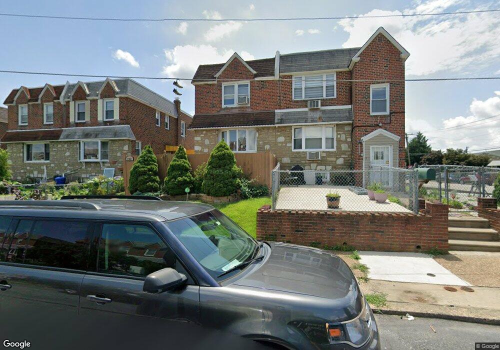
1702 Danforth St Philadelphia, PA 19152
Rhawnhurst NeighborhoodEstimated Value: $322,919 - $331,000
3
Beds
2
Baths
1,236
Sq Ft
$264/Sq Ft
Est. Value
About This Home
This home is located at 1702 Danforth St, Philadelphia, PA 19152 and is currently estimated at $326,730, approximately $264 per square foot. 1702 Danforth St is a home with nearby schools including Farrell Louis H School, Northeast High School, and Tacony Academy Charter School.
Ownership History
Date
Name
Owned For
Owner Type
Purchase Details
Closed on
Jun 19, 2003
Sold by
Breslow Fred Jay
Bought by
Kerensky Alison
Current Estimated Value
Purchase Details
Closed on
Feb 26, 2003
Sold by
Breslow Theodora
Bought by
Breslow Fred Jay
Home Financials for this Owner
Home Financials are based on the most recent Mortgage that was taken out on this home.
Original Mortgage
$75,000
Interest Rate
5.94%
Create a Home Valuation Report for This Property
The Home Valuation Report is an in-depth analysis detailing your home's value as well as a comparison with similar homes in the area
Home Values in the Area
Average Home Value in this Area
Purchase History
| Date | Buyer | Sale Price | Title Company |
|---|---|---|---|
| Kerensky Alison | -- | -- | |
| Breslow Fred Jay | $100,000 | -- |
Source: Public Records
Mortgage History
| Date | Status | Borrower | Loan Amount |
|---|---|---|---|
| Closed | Breslow Fred Jay | $75,000 |
Source: Public Records
Tax History Compared to Growth
Tax History
| Year | Tax Paid | Tax Assessment Tax Assessment Total Assessment is a certain percentage of the fair market value that is determined by local assessors to be the total taxable value of land and additions on the property. | Land | Improvement |
|---|---|---|---|---|
| 2025 | $3,270 | $292,600 | $58,520 | $234,080 |
| 2024 | $3,270 | $292,600 | $58,520 | $234,080 |
| 2023 | $3,270 | $233,600 | $46,720 | $186,880 |
| 2022 | $2,706 | $233,600 | $46,720 | $186,880 |
| 2021 | $2,706 | $0 | $0 | $0 |
| 2020 | $2,706 | $0 | $0 | $0 |
| 2019 | $2,464 | $0 | $0 | $0 |
| 2018 | $2,308 | $0 | $0 | $0 |
| 2017 | $2,308 | $0 | $0 | $0 |
| 2016 | $2,308 | $0 | $0 | $0 |
| 2015 | $2,210 | $0 | $0 | $0 |
| 2014 | -- | $164,900 | $33,773 | $131,127 |
| 2012 | -- | $21,952 | $3,184 | $18,768 |
Source: Public Records
Map
Nearby Homes
- 1712 Tustin St
- 1716 Bergen St
- 1711 Kendrick St
- 1804 Megargee St
- 1828 Megargee St
- 1832 Mower St
- 1834 Mower St
- 8606 Frontenac St
- 8614 Agusta St
- 1907 Tustin St
- 1617 Solly Ave
- 8562 Benton Ave
- 8523 Benton Ave
- 1702 Arthur St
- 8563 Benton Ave
- 1704 Stanwood St
- 2155 Benson St
- 2162 Strahle St
- 1625 Rhawn St
- 2201 Strahle St Unit C302
- 1700 Danforth St
- 1704 Danforth St
- 1706 Danforth St
- 1701 Bergen St
- 1703 Bergen St
- 1705 Bergen St
- 1708 Danforth St
- 1710 Danforth St
- 1707 Bergen St
- 1709 Bergen St
- 1711 Bergen St
- 1712 Danforth St
- 1701 Danforth St
- 1705 Danforth St
- 8382 Summerdale Ave
- 8384 Summerdale Ave
- 8380 Summerdale Ave
- 1714 Danforth St
- 1707 Danforth St
- 8386 Summerdale Ave