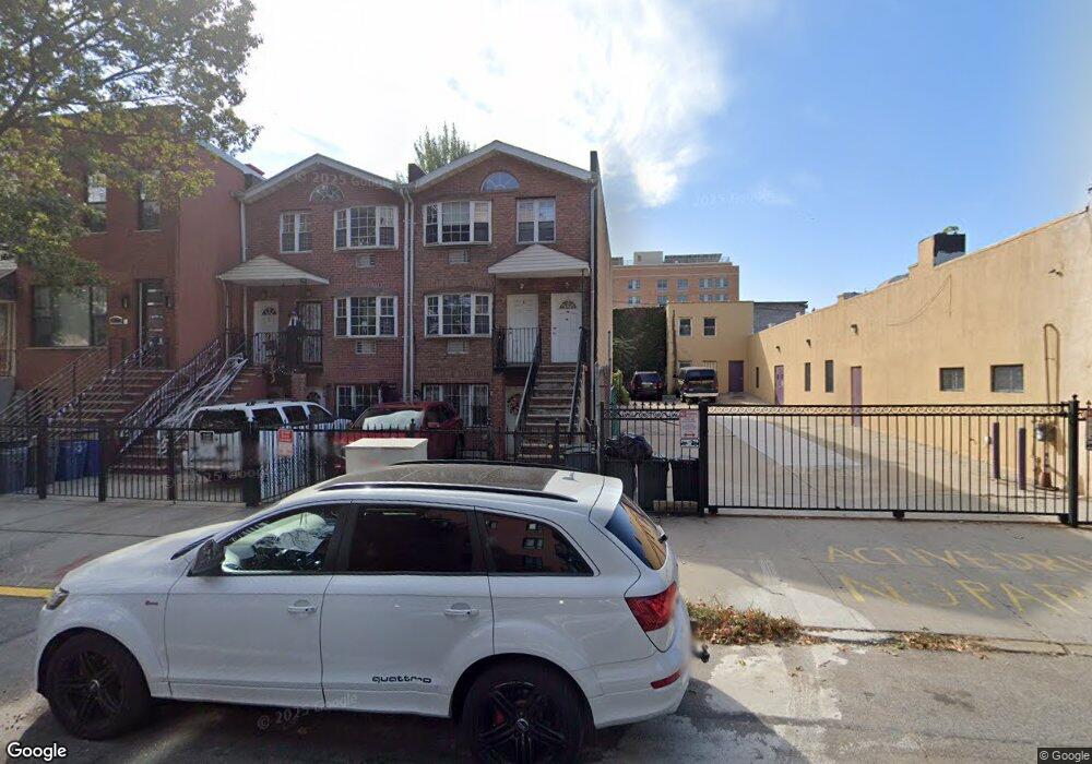
1702 Dean St Brooklyn, NY 11213
Crown Heights NeighborhoodEstimated Value: $1,139,000 - $1,590,000
Studio
--
Bath
3,952
Sq Ft
$345/Sq Ft
Est. Value
About This Home
This home is located at 1702 Dean St, Brooklyn, NY 11213 and is currently estimated at $1,364,500, approximately $345 per square foot. 1702 Dean St is a home located in Kings County with nearby schools including P.S. 243K- The Weeksville School and KIPP AMP Middle School.
Ownership History
Date
Name
Owned For
Owner Type
Purchase Details
Closed on
Feb 13, 2015
Sold by
Ag2 Equities Inc
Bought by
1702 Dean Llc
Current Estimated Value
Purchase Details
Closed on
Sep 11, 2013
Sold by
Bertrand Gerald J
Bought by
Ag2 Equities Inc
Purchase Details
Closed on
Jul 25, 2013
Sold by
Bertrand Gerald
Bought by
1702 Dean Llc
Purchase Details
Closed on
Nov 10, 2007
Sold by
Bertrand Gerald J
Bought by
Bertrand Gerald J
Purchase Details
Closed on
Nov 16, 2005
Sold by
Harris Sylvester L
Bought by
Dean Utica Llc
Purchase Details
Closed on
Jul 11, 1995
Sold by
Slade Olivia A
Bought by
Harris Sylvester L
Create a Home Valuation Report for This Property
The Home Valuation Report is an in-depth analysis detailing your home's value as well as a comparison with similar homes in the area
Home Values in the Area
Average Home Value in this Area
Purchase History
| Date | Buyer | Sale Price | Title Company |
|---|---|---|---|
| 1702 Dean Llc | -- | -- | |
| Ag2 Equities Inc | -- | -- | |
| 1702 Dean Llc | -- | -- | |
| Bertrand Gerald J | -- | -- | |
| Dean Utica Llc | $499,000 | -- | |
| Harris Sylvester L | $15,000 | Chicago Title Insurance Co |
Source: Public Records
Tax History
| Year | Tax Paid | Tax Assessment Tax Assessment Total Assessment is a certain percentage of the fair market value that is determined by local assessors to be the total taxable value of land and additions on the property. | Land | Improvement |
|---|---|---|---|---|
| 2025 | $9,786 | $96,300 | $21,480 | $74,820 |
| 2024 | $9,786 | $87,420 | $21,480 | $65,940 |
| 2023 | $9,335 | $98,520 | $21,480 | $77,040 |
| 2022 | $9,176 | $85,680 | $21,480 | $64,200 |
| 2021 | $9,601 | $84,720 | $21,480 | $63,240 |
| 2020 | $4,502 | $70,800 | $21,480 | $49,320 |
| 2019 | $8,494 | $64,440 | $21,480 | $42,960 |
| 2018 | $7,808 | $38,304 | $16,057 | $22,247 |
| 2017 | $7,808 | $38,304 | $12,961 | $25,343 |
| 2016 | $7,600 | $38,016 | $17,359 | $20,657 |
| 2015 | $4,457 | $35,865 | $20,747 | $15,118 |
| 2014 | $4,457 | $33,835 | $23,501 | $10,334 |
Source: Public Records
Map
Nearby Homes
- 111 Schenectady Ave
- 1770 Pacific St
- 1351 Prospect Place
- 153 Schenectady Ave
- 1218 Saint Marks Ave
- 1226 St Marks Ave Unit 3 B
- 1226 St Marks Ave Unit 1 B
- 1226 St Marks Ave Unit 2 A
- 1226 St Marks Ave Unit 4 A
- 139 Rochester Ave
- 1644 Atlantic Ave
- 1248 Prospect Place
- 1293 Park Place
- 99 Chauncey St
- 1271 Park Place
- 1285A Saint Marks Ave
- 1292 Saint Marks Ave Unit 2
- 88 Marion St Unit 4 A
- 88 Marion St Unit 1 B
- 88 Marion St Unit 3 A
- 1704 Dean St
- 1704 Dean St Unit 3
- 1700 Dean St
- 1706 Dean St
- 1708 Dean St
- 1710 Dean St
- 1694 Dean St
- 1712 Dean St
- 1714 Dean St
- 1565 Bergen St
- 1716 Dean St
- 1571 Bergen St
- 1559-1563 Bergen St
- 1573 Bergen St
- 1705 Dean St Unit 5D
- 1705 Dean St Unit 5B
- 1705 Dean St Unit 4D
- 1705 Dean St Unit 2B
- 1705 Dean St Unit 1B
- 1718 Dean St
Your Personal Tour Guide
Ask me questions while you tour the home.