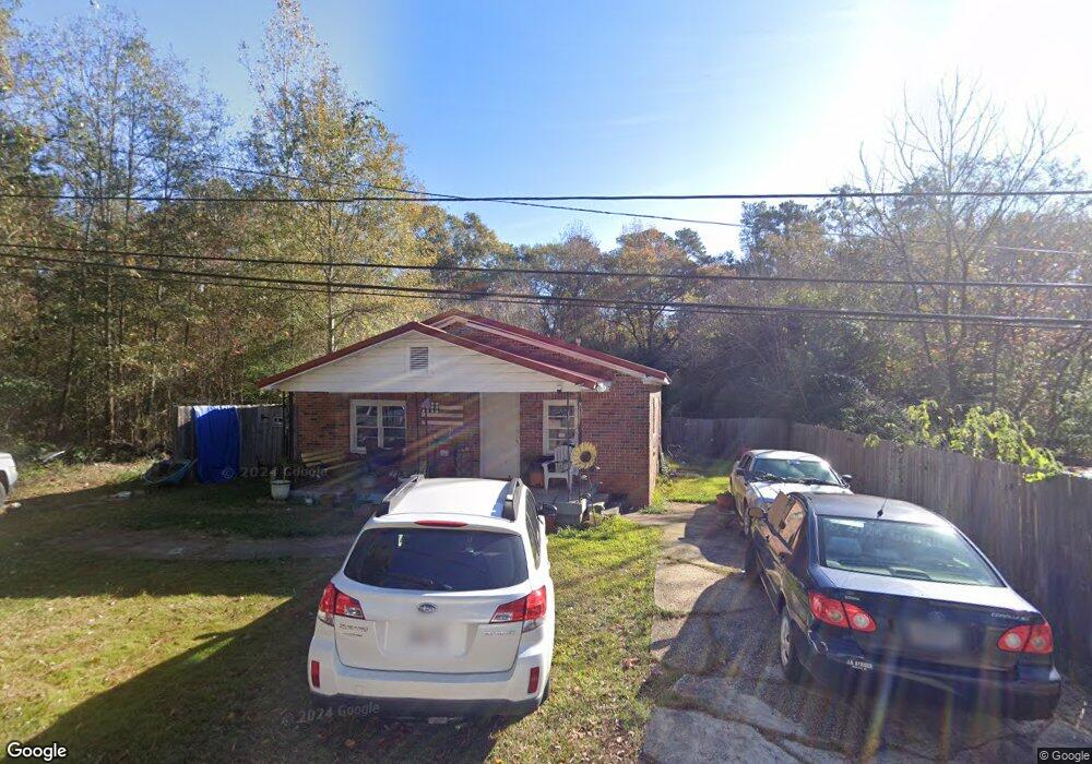
1702 Fir St West Point, GA 31833
Estimated Value: $82,000 - $125,000
2
Beds
1
Bath
1,129
Sq Ft
$86/Sq Ft
Est. Value
About This Home
This home is located at 1702 Fir St, West Point, GA 31833 and is currently estimated at $97,085, approximately $85 per square foot. 1702 Fir St is a home located in Troup County with nearby schools including West Point Elementary School, Long Cane Elementary School, and Berta Weathersbee Elementary School.
Ownership History
Date
Name
Owned For
Owner Type
Purchase Details
Closed on
Mar 8, 2023
Sold by
Finley Tammy J
Bought by
Williams April
Current Estimated Value
Purchase Details
Closed on
Nov 2, 2004
Sold by
Tammy F Daughtrey
Bought by
Finley Tammy J
Purchase Details
Closed on
Apr 15, 1993
Sold by
Tammy F Swanger
Bought by
Tammy F Daughtrey
Purchase Details
Closed on
Dec 31, 1991
Sold by
Home Federal S & L
Bought by
Tammy F Swanger
Purchase Details
Closed on
Sep 1, 1987
Bought by
Home Federal S & L
Purchase Details
Closed on
Feb 20, 1986
Purchase Details
Closed on
Oct 1, 1985
Purchase Details
Closed on
May 1, 1985
Purchase Details
Closed on
Jan 1, 1985
Purchase Details
Closed on
Jul 14, 1983
Purchase Details
Closed on
Jan 1, 1957
Purchase Details
Closed on
Aug 18, 1909
Create a Home Valuation Report for This Property
The Home Valuation Report is an in-depth analysis detailing your home's value as well as a comparison with similar homes in the area
Home Values in the Area
Average Home Value in this Area
Purchase History
| Date | Buyer | Sale Price | Title Company |
|---|---|---|---|
| Williams April | -- | -- | |
| Finley Tammy J | -- | -- | |
| Tammy F Daughtrey | -- | -- | |
| Tammy F Swanger | $21,000 | -- | |
| Home Federal S & L | -- | -- | |
| -- | $20,600 | -- | |
| -- | -- | -- | |
| -- | -- | -- | |
| -- | -- | -- | |
| -- | -- | -- | |
| -- | -- | -- | |
| -- | -- | -- |
Source: Public Records
Tax History Compared to Growth
Tax History
| Year | Tax Paid | Tax Assessment Tax Assessment Total Assessment is a certain percentage of the fair market value that is determined by local assessors to be the total taxable value of land and additions on the property. | Land | Improvement |
|---|---|---|---|---|
| 2024 | $866 | $24,480 | $800 | $23,680 |
| 2023 | $3 | $23,960 | $800 | $23,160 |
| 2022 | $134 | $22,560 | $800 | $21,760 |
| 2021 | $99 | $18,640 | $800 | $17,840 |
| 2020 | $262 | $18,640 | $800 | $17,840 |
| 2019 | $190 | $16,280 | $800 | $15,480 |
| 2018 | $169 | $15,560 | $800 | $14,760 |
| 2017 | $169 | $15,560 | $800 | $14,760 |
| 2016 | $155 | $15,082 | $800 | $14,282 |
| 2015 | $387 | $15,082 | $800 | $14,282 |
| 2014 | $434 | $14,330 | $800 | $13,530 |
| 2013 | -- | $15,333 | $800 | $14,533 |
Source: Public Records
Map
Nearby Homes
- 508 Pine St
- 1903 Ridgewood Dr
- 1505 Wisteria Dr
- 0 Ga Highway 0116 Unit 10619139
- 0 Sunset Dr Unit 10451831
- 1008 E 12th St
- 106 Sunset Dr
- 0 Arrowhead Dr Unit 10451860
- 713 Avenue H
- 1410 Roper Ave
- 509 Cleveland St
- 804 E 6th St
- 1314 4th Ave
- 311 E 4th St
- 712 4th Ave
- 210 N 14th St
- 111 Tudor Way
- 112 Hillcrest Rd
- 8035 County Road 289
- 107 Garden Walk