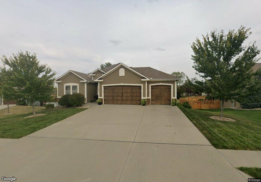
1702 NW Cottonwood Cir Grain Valley, MO 64029
Estimated Value: $435,000 - $615,000
3
Beds
2
Baths
1,828
Sq Ft
$276/Sq Ft
Est. Value
About This Home
This home is located at 1702 NW Cottonwood Cir, Grain Valley, MO 64029 and is currently estimated at $504,943, approximately $276 per square foot. 1702 NW Cottonwood Cir is a home with nearby schools including Grain Valley High School.
Ownership History
Date
Name
Owned For
Owner Type
Purchase Details
Closed on
Oct 22, 2020
Sold by
Sundermann Ashlee and Sundermann Wade
Bought by
Sundermann Wade
Current Estimated Value
Home Financials for this Owner
Home Financials are based on the most recent Mortgage that was taken out on this home.
Original Mortgage
$278,400
Outstanding Balance
$247,622
Interest Rate
2.9%
Mortgage Type
New Conventional
Estimated Equity
$257,321
Purchase Details
Closed on
Apr 30, 2014
Sold by
Dave Richards Home Building Inc
Bought by
Sundermann Wade L and Sundermann Ashlee J
Home Financials for this Owner
Home Financials are based on the most recent Mortgage that was taken out on this home.
Original Mortgage
$207,815
Interest Rate
4.38%
Mortgage Type
New Conventional
Purchase Details
Closed on
Dec 5, 2013
Sold by
Ward Development & Investment Co
Bought by
Dave Richards Homes Inc
Create a Home Valuation Report for This Property
The Home Valuation Report is an in-depth analysis detailing your home's value as well as a comparison with similar homes in the area
Home Values in the Area
Average Home Value in this Area
Purchase History
| Date | Buyer | Sale Price | Title Company |
|---|---|---|---|
| Sundermann Wade | -- | Servicelink | |
| Sundermann Wade L | -- | First United Title Agency Ll | |
| Dave Richards Homes Inc | -- | First American Title |
Source: Public Records
Mortgage History
| Date | Status | Borrower | Loan Amount |
|---|---|---|---|
| Open | Sundermann Wade | $278,400 | |
| Previous Owner | Sundermann Wade L | $207,815 |
Source: Public Records
Tax History Compared to Growth
Tax History
| Year | Tax Paid | Tax Assessment Tax Assessment Total Assessment is a certain percentage of the fair market value that is determined by local assessors to be the total taxable value of land and additions on the property. | Land | Improvement |
|---|---|---|---|---|
| 2025 | $7,216 | $66,084 | $10,919 | $55,165 |
| 2024 | $6,946 | $87,603 | $8,594 | $79,009 |
| 2023 | $6,946 | $87,603 | $13,604 | $73,999 |
| 2022 | $4,530 | $49,970 | $7,819 | $42,151 |
| 2021 | $4,424 | $49,970 | $7,819 | $42,151 |
| 2020 | $4,274 | $47,620 | $7,819 | $39,801 |
| 2019 | $4,187 | $47,620 | $7,819 | $39,801 |
| 2018 | $1,739,749 | $45,984 | $5,828 | $40,156 |
| 2017 | $4,327 | $45,984 | $5,828 | $40,156 |
| 2016 | $4,217 | $44,832 | $6,080 | $38,752 |
| 2014 | -- | $20 | $20 | $0 |
Source: Public Records
Map
Nearby Homes
- 816 NW Cedar Ln
- 1403 NW Burr Oak Ct
- 1515 NW Whispering Ct
- 2003 NW Elmwood Dr
- 1702 NW Hedgewood Dr
- 1310 NW Sycamore Dr
- 804 NW Hickory Ridge Dr
- 1103 NW Hickory Ct
- 803 NW Hickory Ridge Dr
- 801 NW Hickory Ridge Dr
- 952 NW Maplewood Ct
- 1601 NW Nicholas Dr
- 809 NW Poplar Ct
- 2211 NW Hedgewood Dr
- 1800 NW Mya Ct
- 408 NW Rust Ct
- 401 NW Europa Dr
- 505 NW Whitney Dr
- TBD E Duncan Rd
- 1208 NW Golfview Dr
- 1700 NW Cottonwood Cir
- 1704 NW Cottonwood Cir
- 1612 NW Cottonwood Cir
- 1701 NW Woodbury Dr
- 1703 NW Cottonwood Cir
- 1703 NW Woodbury Dr
- 1701 NW Cottonwood Cir
- 1611 NW Woodbury Dr
- 1706 NW Cottonwood Cir
- 1705 NW Cottonwood Cir
- 1611 NW Cottonwood Cir
- 1609 NW Woodbury Dr
- 1610 NW Cottonwood Cir
- 1707 NW Cottonwood Cir
- 1705 NW Woodbury Dr
- 1609 NW Cottonwood Cir
- 1405 NW Cedar Ct
- 1403 NW Cedar Ct
- 1608 NW Cottonwood Cir
- 1607 NW Woodbury Dr