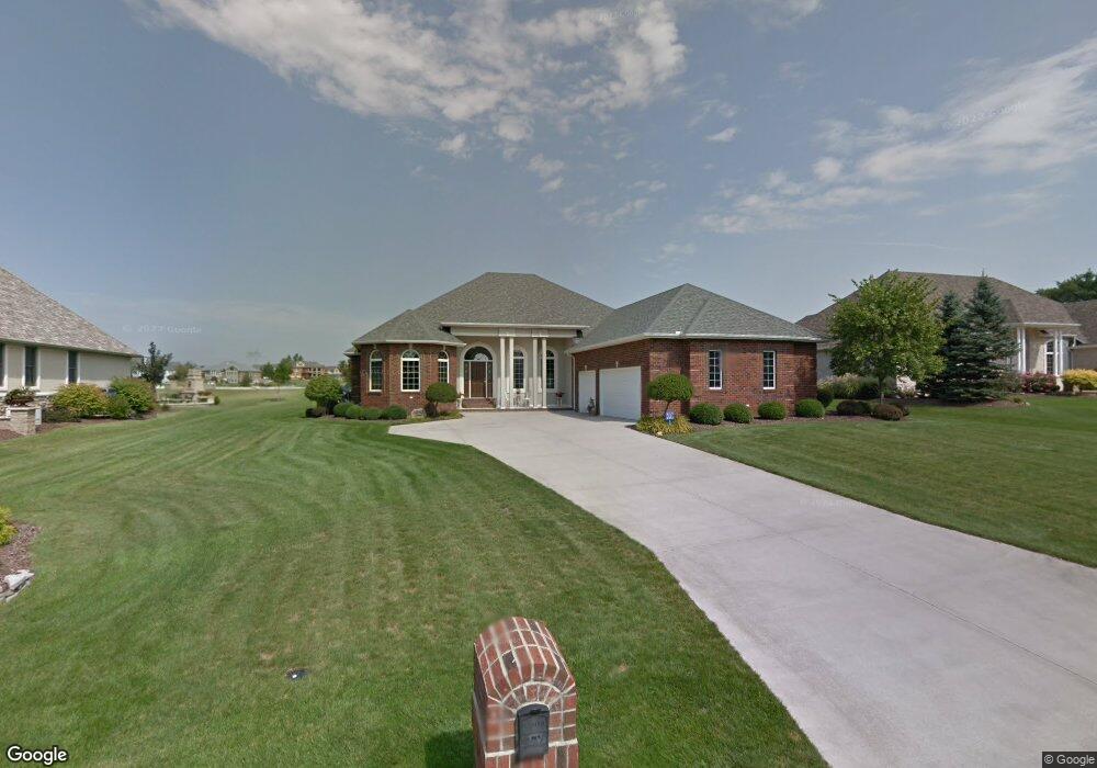
1702 Pinehurst Dr Findlay, OH 45840
Estimated Value: $620,361 - $679,000
4
Beds
4
Baths
3,170
Sq Ft
$204/Sq Ft
Est. Value
About This Home
This home is located at 1702 Pinehurst Dr, Findlay, OH 45840 and is currently estimated at $647,787, approximately $204 per square foot. 1702 Pinehurst Dr is a home located in Hancock County with nearby schools including Liberty-Benton Elementary School, Liberty-Benton Middle School, and Liberty-Benton High School.
Ownership History
Date
Name
Owned For
Owner Type
Purchase Details
Closed on
Sep 3, 2015
Bought by
Simons Charlotte A
Current Estimated Value
Home Financials for this Owner
Home Financials are based on the most recent Mortgage that was taken out on this home.
Interest Rate
3.89%
Purchase Details
Closed on
May 14, 2003
Sold by
Country Club Acres Inc
Bought by
Hunter Dean P and Hunter Beth A
Home Financials for this Owner
Home Financials are based on the most recent Mortgage that was taken out on this home.
Original Mortgage
$320,000
Interest Rate
5.87%
Mortgage Type
Construction
Create a Home Valuation Report for This Property
The Home Valuation Report is an in-depth analysis detailing your home's value as well as a comparison with similar homes in the area
Home Values in the Area
Average Home Value in this Area
Purchase History
| Date | Buyer | Sale Price | Title Company |
|---|---|---|---|
| Simons Charlotte A | $480,500 | -- | |
| Hunter Dean P | $71,000 | Mid Am |
Source: Public Records
Mortgage History
| Date | Status | Borrower | Loan Amount |
|---|---|---|---|
| Closed | Simons Charlotte A | -- | |
| Previous Owner | Hunter Dean P | $320,000 |
Source: Public Records
Tax History Compared to Growth
Tax History
| Year | Tax Paid | Tax Assessment Tax Assessment Total Assessment is a certain percentage of the fair market value that is determined by local assessors to be the total taxable value of land and additions on the property. | Land | Improvement |
|---|---|---|---|---|
| 2024 | $6,800 | $178,980 | $26,330 | $152,650 |
| 2023 | $6,644 | $178,980 | $26,330 | $152,650 |
| 2022 | $6,581 | $178,980 | $26,330 | $152,650 |
| 2021 | $6,252 | $150,320 | $26,330 | $123,990 |
| 2020 | $6,304 | $150,320 | $26,330 | $123,990 |
| 2019 | $6,054 | $150,320 | $26,330 | $123,990 |
| 2018 | $5,185 | $141,550 | $17,560 | $123,990 |
| 2017 | $5,350 | $141,550 | $17,560 | $123,990 |
| 2016 | $5,183 | $141,550 | $17,560 | $123,990 |
| 2015 | $5,937 | $157,620 | $17,560 | $140,060 |
| 2014 | $5,824 | $157,620 | $17,560 | $140,060 |
| 2012 | $6,081 | $157,620 | $17,560 | $140,060 |
Source: Public Records
Map
Nearby Homes
- 1405 Cypress Lake
- 3106 Saddlebrook
- 6535 Silver Lake Dr
- 0 County Road 95 Unit 6097574
- 3018 Gleneagle Dr
- 0 Rock Candy Rd Or Bushwillow Dr Unit Lot 173
- 0 Bushwillow Dr Or Rock Candy Rd Unit Lot 157
- 0 Rock Candy Rd Unit Lot 159
- 0 Rock Candy Rd Unit Lot 170
- 0 Rock Candy Rd Unit Lot 172 206819
- 0 Rock Candy Rd Unit Lot 162
- 0 Rock Candy Rd Unit Lot 171
- 0 Rock Candy Rd Unit Lot 168
- 0 Bearcat Way Or Rock Candy Rd Unit Lot 167
- 1310 Muirfield Dr
- 0 County Road 140
- 933 Laurel Ln
- 925 W Melrose Ave
- 0 Allen Township 142
- 905 W Melrose Ave
- 1708 Pinehurst Dr
- 1634 Pinehurst Dr
- 1714 Pinehurst Dr
- 1701 Pinehurst Dr
- 1624 Pinehurst Dr
- 1709 Pinehurst Dr
- 1631 Pinehurst Dr
- 56 Pinehurst Dr
- 66 Pinehurst Dr
- 0 Pinehurst Dr
- 1717 Pinehurst Dr
- 1621 Pinehurst Dr
- 1614 Pinehurst Dr
- 1720 Pinehurst Dr
- 1702 Bay Hill Dr
- 1710 Bay Hill Dr
- 1628 Bay Hill Dr
- 1725 Pinehurst Dr
- 1807 Lakeland Dr
- 1718 Bay Hill Dr