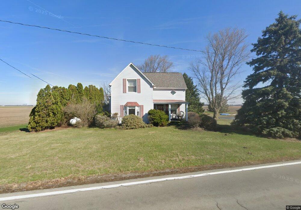
1702 State Route 12 Mount Cory, OH 45868
Estimated Value: $143,000 - $234,000
3
Beds
1
Bath
1,552
Sq Ft
$126/Sq Ft
Est. Value
About This Home
This home is located at 1702 State Route 12, Mount Cory, OH 45868 and is currently estimated at $195,551, approximately $125 per square foot. 1702 State Route 12 is a home located in Hancock County with nearby schools including Cory-Rawson Elementary School and Cory-Rawson High School.
Ownership History
Date
Name
Owned For
Owner Type
Purchase Details
Closed on
Aug 14, 2012
Sold by
Davis Deborah K
Bought by
Phillips Valerie L
Current Estimated Value
Purchase Details
Closed on
Feb 11, 2004
Sold by
Williams Linda J and Williams Scott
Bought by
Phillips Valerie L and Davis Deborah K
Home Financials for this Owner
Home Financials are based on the most recent Mortgage that was taken out on this home.
Original Mortgage
$100,000
Interest Rate
5.91%
Mortgage Type
Purchase Money Mortgage
Purchase Details
Closed on
Mar 25, 1993
Bought by
Roe Linda J
Purchase Details
Closed on
Oct 6, 1986
Bought by
Roe Lewis W and Roe Linda J
Purchase Details
Closed on
Mar 25, 1982
Bought by
Ebbatson Arthur J
Purchase Details
Closed on
Jun 17, 1981
Bought by
Mcnamara Associates Home
Create a Home Valuation Report for This Property
The Home Valuation Report is an in-depth analysis detailing your home's value as well as a comparison with similar homes in the area
Home Values in the Area
Average Home Value in this Area
Purchase History
| Date | Buyer | Sale Price | Title Company |
|---|---|---|---|
| Phillips Valerie L | -- | Attorney | |
| Phillips Valerie L | $125,000 | -- | |
| Roe Linda J | -- | -- | |
| Roe Lewis W | $37,500 | -- | |
| Ebbatson Arthur J | $40,000 | -- | |
| Mcnamara Associates Home | -- | -- |
Source: Public Records
Mortgage History
| Date | Status | Borrower | Loan Amount |
|---|---|---|---|
| Previous Owner | Phillips Valerie L | $100,000 | |
| Closed | Phillips Valerie L | $10,000 |
Source: Public Records
Tax History Compared to Growth
Tax History
| Year | Tax Paid | Tax Assessment Tax Assessment Total Assessment is a certain percentage of the fair market value that is determined by local assessors to be the total taxable value of land and additions on the property. | Land | Improvement |
|---|---|---|---|---|
| 2024 | $1,374 | $53,190 | $7,070 | $46,120 |
| 2023 | $1,389 | $53,190 | $7,070 | $46,120 |
| 2022 | $1,409 | $53,190 | $7,070 | $46,120 |
| 2021 | $1,077 | $39,520 | $7,030 | $32,490 |
| 2020 | $1,079 | $39,520 | $7,030 | $32,490 |
| 2019 | $1,056 | $39,520 | $7,030 | $32,490 |
| 2018 | $1,021 | $39,670 | $7,180 | $32,490 |
| 2017 | $1,015 | $39,670 | $7,180 | $32,490 |
| 2016 | $1,026 | $39,670 | $7,180 | $32,490 |
| 2015 | $833 | $35,310 | $7,180 | $28,130 |
| 2014 | $840 | $35,310 | $7,180 | $28,130 |
| 2012 | $823 | $32,750 | $7,180 | $25,570 |
Source: Public Records
Map
Nearby Homes
- 11698 Township Rd
- 132 Main St
- 307 Lincoln St
- 16134 Township Road 56
- 17297 Township Road 51
- 9984 State Route 235
- 110 Magnolia Ln
- 106 Riley St
- 18101 County Road 12
- 101 Maplewood Dr
- 222 N Lawn Ave
- 210 N Jackson St
- 0 Ohio 103
- 208 E Monroe St
- 212 S Lawn Ave
- 11741 Township Road 10
- 222 Grove St
- 217 Grove St
- 17429 Road 5
- 0 Columbus Grove-Bluffton Rd
- 1815 St Route
- 1815 Ohio 12
- 1815 State Route 12
- 1530 Ohio 12 Unit 4
- 0 State Route 12 Unit 130304
- 0 State Route 12 Unit 6115324
- 0 State Route 12
- 13280 Township Road 53
- 13466 Township Road 53
- 2201 Ohio 12
- 1240 State Route 12
- 3276 State Route 12
- 3283 State Route 12
- 2229 State Route 12
- 2229 Ohio 12
- 0 Twp Road 37 Unit H122452
- 12515 Township Road 53
- 13862 C R 53
- 12707 Township Road 51
- 2388 State Route 12