Estimated Value: $554,284 - $649,000
3
Beds
2
Baths
1,680
Sq Ft
$361/Sq Ft
Est. Value
About This Home
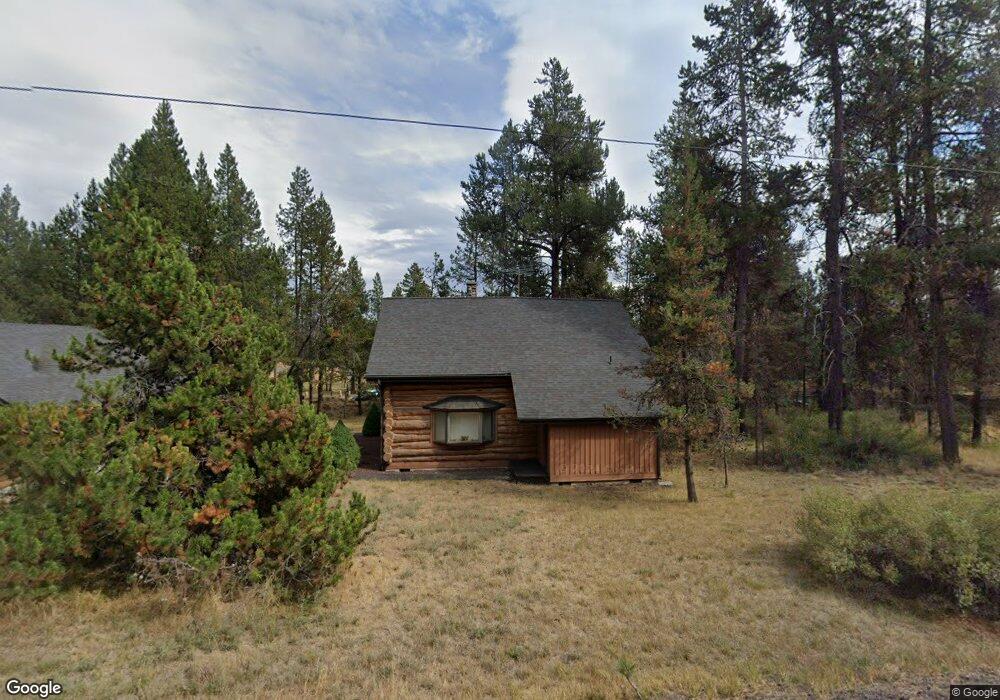
This home is located at 17021 Bakersfield Rd, Bend, OR 97707 and is currently estimated at $606,571, approximately $361 per square foot. 17021 Bakersfield Rd is a home located in Deschutes County with nearby schools including Elk Meadow Elementary School, Cascade Middle School, and Summit High School.
Ownership History
Date
Name
Owned For
Owner Type
Purchase Details
Closed on
Jun 11, 2010
Sold by
Sweeney Robert N and Sweeney Shirley M
Bought by
Aebi Kaprice L and Aebi Martin W
Current Estimated Value
Home Financials for this Owner
Home Financials are based on the most recent Mortgage that was taken out on this home.
Original Mortgage
$152,000
Interest Rate
4.99%
Mortgage Type
New Conventional
Purchase Details
Closed on
Mar 27, 2008
Sold by
Sweeney Robert N and Sweeney Shirley M
Bought by
Sweeney Robert N and Sweeney Shirley M
Purchase Details
Closed on
Oct 16, 2006
Sold by
Mcgrath Aaron W and St John Petra D
Bought by
Sweeney Robert N and Sweeney Shirley M
Home Financials for this Owner
Home Financials are based on the most recent Mortgage that was taken out on this home.
Original Mortgage
$296,800
Interest Rate
6.46%
Mortgage Type
Unknown
Create a Home Valuation Report for This Property
The Home Valuation Report is an in-depth analysis detailing your home's value as well as a comparison with similar homes in the area
Home Values in the Area
Average Home Value in this Area
Purchase History
| Date | Buyer | Sale Price | Title Company |
|---|---|---|---|
| Aebi Kaprice L | $190,000 | First American Title | |
| Sweeney Robert N | -- | None Available | |
| Sweeney Robert N | -- | Amerititle |
Source: Public Records
Mortgage History
| Date | Status | Borrower | Loan Amount |
|---|---|---|---|
| Closed | Aebi Kaprice L | $152,000 | |
| Previous Owner | Sweeney Robert N | $296,800 |
Source: Public Records
Tax History Compared to Growth
Tax History
| Year | Tax Paid | Tax Assessment Tax Assessment Total Assessment is a certain percentage of the fair market value that is determined by local assessors to be the total taxable value of land and additions on the property. | Land | Improvement |
|---|---|---|---|---|
| 2025 | $4,449 | $242,080 | -- | -- |
| 2024 | $4,270 | $235,030 | -- | -- |
| 2023 | $4,172 | $228,190 | $0 | $0 |
| 2022 | $3,729 | $215,100 | $0 | $0 |
| 2021 | $3,750 | $208,840 | $0 | $0 |
| 2020 | $3,562 | $208,840 | $0 | $0 |
| 2019 | $3,463 | $202,760 | $0 | $0 |
| 2018 | $3,364 | $196,860 | $0 | $0 |
Source: Public Records
Map
Nearby Homes
- 56675 Stellar Dr
- 56718 Bandley Rd
- 17113 Covina Rd
- 17097 Covina Rd
- 17083 Azusa Rd
- 17037 Downey Rd
- 16998 Downey Rd
- 17107 Covina
- 17079 Spring River Rd
- 16963 Downey Rd
- 17125 Azusa Rd
- 17115 Spring River Rd
- 17154 Covina Rd
- 16925 Downey Rd
- 17123 Spring River Rd Unit 14
- 17087 Bakersfield Rd
- 17095 Bakersfield Rd
- 17133 Spring River Rd
- 17156 Azusa Rd
- 17189 Covina Rd
- 17035 Bakersfield Rd
- 56705 Stellar Dr
- 56711 Stellar Dr
- 56695 Stellar Dr
- 17020 Covina Rd
- 56719 Stellar Dr
- 56685 Stellar Dr
- 56726 Stellar Dr
- 56721 Stellar Dr
- 17057 Bakersfield Rd
- 17030 Bakersfield Rd
- 56724 Bandley Rd
- 16996 Covina Rd
- 17067 Bakersfield Rd
- 17052 Bakersfield Rd
- 56741 Stellar Dr
- 17029 Covina Rd
- 17019 Covina Rd
- 16990 Covina Rd