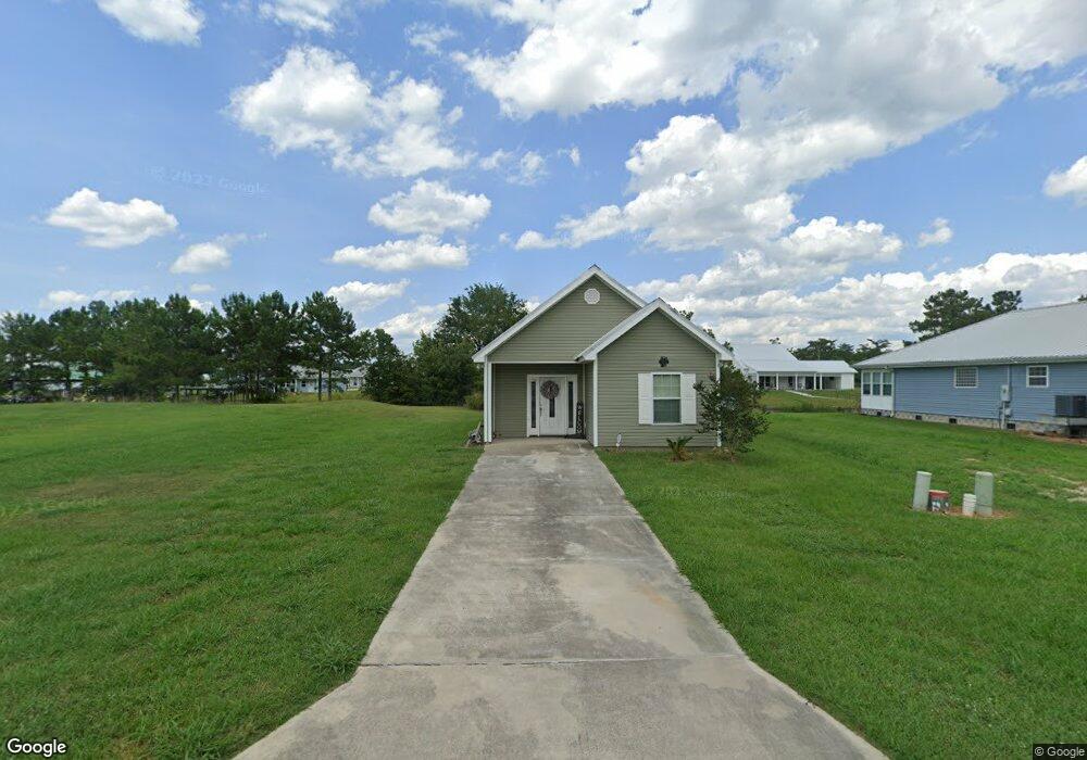
17026 Peace Point Dr Springfield, LA 70462
Estimated Value: $183,000 - $202,055
3
Beds
2
Baths
1,100
Sq Ft
$175/Sq Ft
Est. Value
About This Home
This home is located at 17026 Peace Point Dr, Springfield, LA 70462 and is currently estimated at $192,764, approximately $175 per square foot. 17026 Peace Point Dr is a home located in Livingston Parish with nearby schools including Springfield Elementary School, Springfield Middle School, and Springfield High School.
Ownership History
Date
Name
Owned For
Owner Type
Purchase Details
Closed on
Jun 18, 2025
Sold by
Wattigney Brittany Lee
Bought by
Jg 17
Current Estimated Value
Purchase Details
Closed on
Aug 4, 2021
Sold by
Abigail Land Holdings 6
Bought by
Interstate Lien Resources
Purchase Details
Closed on
Aug 12, 2020
Sold by
Wattigney Brittany L
Bought by
Abigail Land Holdings 6
Purchase Details
Closed on
Oct 23, 2017
Sold by
Cooper Sue M
Bought by
Wattigney Brittany Lee
Purchase Details
Closed on
Feb 7, 2013
Sold by
Barry Dale Robin and Tate Dale Shanda
Bought by
Ridgedell Charles and Ridgedell Debra Lynn
Purchase Details
Closed on
Jun 7, 2006
Sold by
Pugh Suzonne T
Bought by
Dale Robin
Create a Home Valuation Report for This Property
The Home Valuation Report is an in-depth analysis detailing your home's value as well as a comparison with similar homes in the area
Home Values in the Area
Average Home Value in this Area
Purchase History
| Date | Buyer | Sale Price | Title Company |
|---|---|---|---|
| Jg 17 | -- | -- | |
| Interstate Lien Resources | $500 | None Available | |
| Abigail Land Holdings 6 | $1,083 | None Available | |
| Wattigney Brittany Lee | $121,000 | None Available | |
| Ridgedell Charles | $5,500 | Hammond Title Company Inc | |
| Dale Robin | $455 | None Available |
Source: Public Records
Tax History
| Year | Tax Paid | Tax Assessment Tax Assessment Total Assessment is a certain percentage of the fair market value that is determined by local assessors to be the total taxable value of land and additions on the property. | Land | Improvement |
|---|---|---|---|---|
| 2024 | $1,102 | $13,495 | $1,000 | $12,495 |
| 2023 | $861 | $9,880 | $1,000 | $8,880 |
| 2022 | $870 | $9,880 | $1,000 | $8,880 |
| 2021 | $873 | $9,880 | $1,000 | $8,880 |
| 2020 | $868 | $9,880 | $1,000 | $8,880 |
| 2019 | $753 | $8,430 | $550 | $7,880 |
| 2018 | $753 | $8,430 | $550 | $7,880 |
| 2017 | $749 | $8,430 | $550 | $7,880 |
| 2015 | $49 | $550 | $550 | $0 |
| 2014 | $50 | $550 | $550 | $0 |
Source: Public Records
Map
Nearby Homes
- 17097 Peace Point Dr
- 17270 Tchula Dr
- 17240 Tchula Dr
- 26265 Riverscape Dr
- 0 Riverscape Dr
- 0 Riverscape Dr Unit 2547026
- 0 Riverscape Dr Unit 2442889
- 0 Riverscape Dr Unit 2442888
- 26277 Riverscape Dr
- 26309 Riverscape Dr
- 16704 Meisner Rd
- BD-4 Meisner Rd
- 16683 Meisner Rd
- BD-2 Meisner Rd
- 0 Lower Rome Rd Unit 2543345
- 0 Lower Rome Rd Unit LotWP001
- 29794 Lower Rome Rd
- 28001 Poche Rd
- 29814 Lower Rome Rd
- 29882 Lower Rome Rd
- 17030 Peace Point Dr
- 17018 Peace Point Dr
- 17016 Peace Point Dr
- 0 Peacepoint Dr
- 17012 Peace Point Dr
- 17033 Peace Point Dr
- 17046 Peace Point Dr
- 17021 Peace Point Dr
- 17039 Cole's Creek Dr
- 17039 Coles Creek Dr
- 17039 Coles Creek None
- 14050 Peace Point Dr
- 17025 Coles Creek Dr
- 17025 Cole's Creek Dr
- 17041 Peace Point Dr
- 17049 Cole's Creek Dr
- 17050 Peace Point Dr
- LOT 17 Peace Point Dr
- 17029 Cole's Creek Dr
- 17013 Coles Creek Dr
Your Personal Tour Guide
Ask me questions while you tour the home.