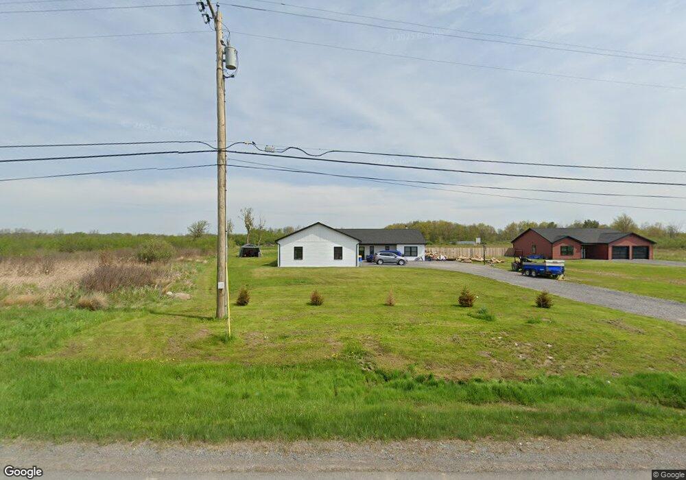
17029 State Route 12f Dexter, NY 13634
Estimated Value: $365,000 - $467,149
4
Beds
3
Baths
2,304
Sq Ft
$177/Sq Ft
Est. Value
About This Home
This home is located at 17029 State Route 12f, Dexter, NY 13634 and is currently estimated at $407,537, approximately $176 per square foot. 17029 State Route 12f is a home with nearby schools including General Brown Junior/Senior High School.
Ownership History
Date
Name
Owned For
Owner Type
Purchase Details
Closed on
Jan 18, 2023
Sold by
Crestani Isaac
Bought by
Crumpton Sean and Crumpton Brandy
Current Estimated Value
Purchase Details
Closed on
Jul 25, 2022
Sold by
Shortsleeve David J
Bought by
Crestani Isaac G and Crestani Kayla M
Purchase Details
Closed on
Jun 19, 2007
Sold by
Heise Scott
Bought by
Shortsleeve David
Purchase Details
Closed on
Jan 5, 2006
Sold by
Livingston Elizabeth
Bought by
Heise Scott
Create a Home Valuation Report for This Property
The Home Valuation Report is an in-depth analysis detailing your home's value as well as a comparison with similar homes in the area
Home Values in the Area
Average Home Value in this Area
Purchase History
| Date | Buyer | Sale Price | Title Company |
|---|---|---|---|
| Crumpton Sean | $199,000 | -- | |
| Crestani Isaac G | $25,000 | Timothy A Farley Pc | |
| Shortsleeve David | $35,500 | Mark Gebo | |
| Heise Scott | $9,000 | -- |
Source: Public Records
Tax History Compared to Growth
Tax History
| Year | Tax Paid | Tax Assessment Tax Assessment Total Assessment is a certain percentage of the fair market value that is determined by local assessors to be the total taxable value of land and additions on the property. | Land | Improvement |
|---|---|---|---|---|
| 2024 | $6,063 | $370,500 | $43,500 | $327,000 |
| 2023 | $4,298 | $206,500 | $46,700 | $159,800 |
| 2022 | $614 | $16,600 | $16,600 | $0 |
| 2021 | $607 | $16,600 | $16,600 | $0 |
| 2020 | $607 | $16,600 | $16,600 | $0 |
| 2019 | $602 | $16,600 | $16,600 | $0 |
| 2018 | $602 | $16,600 | $16,600 | $0 |
| 2017 | $580 | $16,600 | $16,600 | $0 |
| 2016 | $562 | $16,600 | $16,600 | $0 |
| 2015 | -- | $16,600 | $16,600 | $0 |
| 2014 | -- | $16,600 | $16,600 | $0 |
Source: Public Records
Map
Nearby Homes
- 214 E Bronson St
- 220 Water St
- 107 W Kirby St
- 15764 Maynard Ave S
- 15625 Foster Park Rd
- 17467 Evans Rd
- 15541 Foster Park Rd
- 0 Evans Rd
- 118 Patrician Ln
- 219-221 W Main St
- 115 Patrician Ln
- 109 St Lawrence Ave W
- 0 Bonney Rd Unit S1642943
- 104 Brown Rd
- 305 Washington St
- 205 Pike St
- 218 E Main St
- 17106 State Route 3
- 213 Pike St
- 24142 County Route 54
- 17058 State Route 12f
- 16904 State Route 12f
- 16897 State Route 12f
- 23050 Hickory Dr
- 22960 Hickory Dr
- 23018 Hickory Dr
- 16705 State Route 12f
- 16653 State Route 12f
- 16611 State Route 12f
- 17447 State Route 12f
- 17447 State Route 12f
- 17333 Nys Route 12f
- 16602 State Route 12f
- 16602 New York 12f
- 17589 State Route 12f
- 23486 Fetterly Rd
- 16487 Lee Rd
- 23505 Fetterly Rd
- 16492 Lee Rd
- 17664 State Route 12e