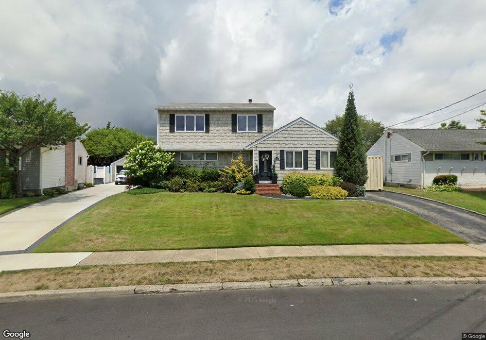
1703 Michael William Rd Merrick, NY 11566
Estimated Value: $793,000 - $882,742
5
Beds
2
Baths
1,894
Sq Ft
$442/Sq Ft
Est. Value
About This Home
This home is located at 1703 Michael William Rd, Merrick, NY 11566 and is currently estimated at $837,871, approximately $442 per square foot. 1703 Michael William Rd is a home located in Nassau County with nearby schools including Merrick Avenue Middle School, Sanford H Calhoun High School, and Progressive School of Long Island.
Ownership History
Date
Name
Owned For
Owner Type
Purchase Details
Closed on
Aug 11, 2014
Sold by
Pulizzi Jean and Pulizzi John
Bought by
Voelkle Christopher and Volkle Jessica
Current Estimated Value
Home Financials for this Owner
Home Financials are based on the most recent Mortgage that was taken out on this home.
Original Mortgage
$417,302
Outstanding Balance
$315,313
Interest Rate
3.87%
Mortgage Type
FHA
Estimated Equity
$522,558
Purchase Details
Closed on
Apr 9, 1997
Purchase Details
Closed on
Nov 8, 1995
Sold by
Oconnell Daniel and Oconnell Louise
Bought by
Oconnell Louise
Create a Home Valuation Report for This Property
The Home Valuation Report is an in-depth analysis detailing your home's value as well as a comparison with similar homes in the area
Home Values in the Area
Average Home Value in this Area
Purchase History
| Date | Buyer | Sale Price | Title Company |
|---|---|---|---|
| Voelkle Christopher | $425,000 | Fidelity National Title | |
| -- | -- | -- | |
| Oconnell Louise | -- | -- |
Source: Public Records
Mortgage History
| Date | Status | Borrower | Loan Amount |
|---|---|---|---|
| Open | Voelkle Christopher | $417,302 |
Source: Public Records
Tax History
| Year | Tax Paid | Tax Assessment Tax Assessment Total Assessment is a certain percentage of the fair market value that is determined by local assessors to be the total taxable value of land and additions on the property. | Land | Improvement |
|---|---|---|---|---|
| 2025 | $13,467 | $465 | $161 | $304 |
| 2024 | $3,822 | $518 | $179 | $339 |
| 2023 | $14,299 | $556 | $192 | $364 |
| 2022 | $14,299 | $567 | $196 | $371 |
| 2021 | $19,454 | $555 | $192 | $363 |
| 2020 | $14,032 | $842 | $468 | $374 |
| 2019 | $15,671 | $1,091 | $607 | $484 |
| 2018 | $19,128 | $1,091 | $0 | $0 |
| 2017 | $11,368 | $1,027 | $607 | $420 |
| 2016 | $15,962 | $1,027 | $607 | $420 |
| 2015 | -- | $1,027 | $607 | $420 |
| 2014 | -- | $1,027 | $607 | $420 |
| 2013 | $3,962 | $1,027 | $607 | $420 |
Source: Public Records
Map
Nearby Homes
- 1709 Camp Ave
- 1713 Camp Ave
- 1721 Michael William Rd
- 1750 Henry Rd
- 57 Maeder Ave
- 1826 Camp Ave
- 1526 Rhode Ave
- 45 Richard Ave
- 1719 William St
- 1772 Rose St
- 1871 Relyea Dr
- 49 Prospect St
- 379 Washington Ave
- 49 Elizabeth St
- 1415 Rhode Ave
- 25 Bainbridge St
- 132 Webster St
- 1656 Michalicki Place
- 37 Decatur St
- 1741 Bushwick Ave
- 1709 Michael William Rd
- 1697 Michael William Rd
- 1698 Camp Ave
- 1710 Camp Ave
- 1715 Michael William Rd
- 1692 Camp Ave
- 1645 Michael William Rd
- 1704 Michael William Rd
- 1635 Meadowbrook Rd
- 1716 Camp Ave
- 1676 Michael William Rd
- 1629 Meadowbrook Rd
- 1710 Michael William Rd
- 1716 Michael William Rd
- 1722 Camp Ave
- 1663 Meadowbrook Rd
- 1676 Camp Ave
- 1623 Bridge St
- 1623 Northridge Ave
- 1722 Michael William Rd
Your Personal Tour Guide
Ask me questions while you tour the home.