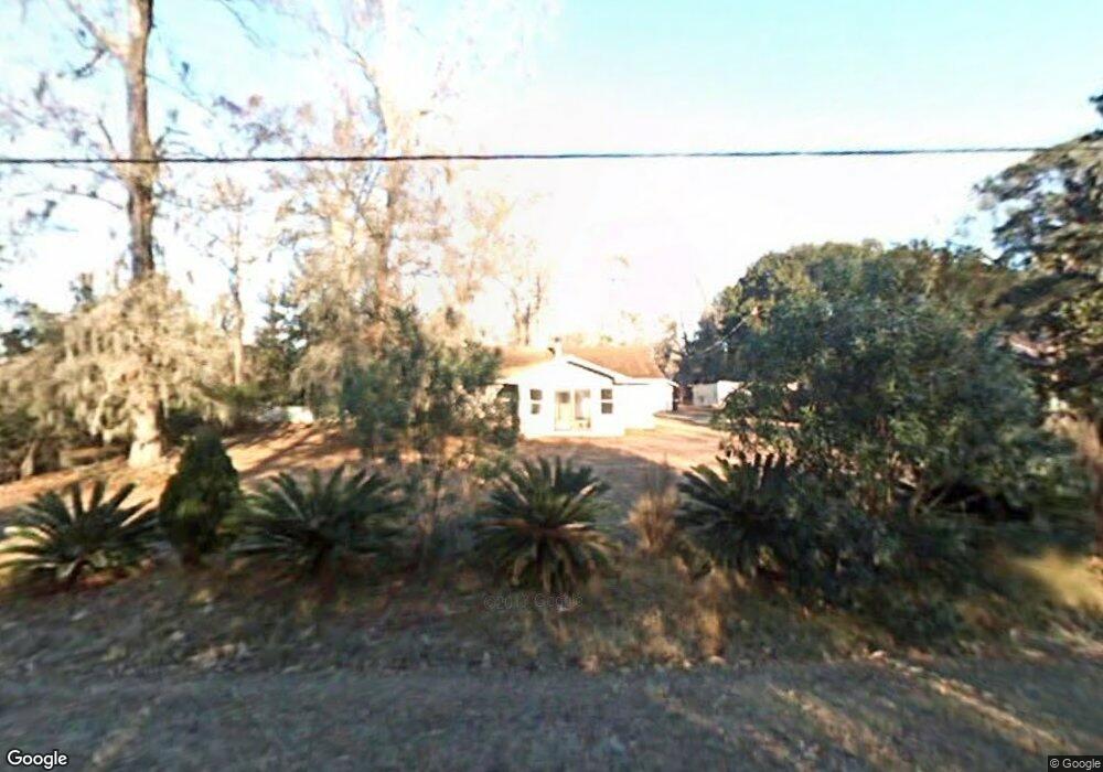
1703 Red Drum Dr Moncks Corner, SC 29461
Estimated Value: $220,000 - $289,064
Studio
--
Bath
1,200
Sq Ft
$200/Sq Ft
Est. Value
About This Home
This home is located at 1703 Red Drum Dr, Moncks Corner, SC 29461 and is currently estimated at $240,016, approximately $200 per square foot. 1703 Red Drum Dr is a home located in Berkeley County with nearby schools including Foxbank Elementary School, Berkeley Middle School, and Berkeley High School.
Ownership History
Date
Name
Owned For
Owner Type
Purchase Details
Closed on
Nov 13, 2025
Sold by
Burnett Christopher
Bought by
West Branch Homes Llc
Current Estimated Value
Home Financials for this Owner
Home Financials are based on the most recent Mortgage that was taken out on this home.
Original Mortgage
$165,000
Outstanding Balance
$164,684
Interest Rate
6.22%
Mortgage Type
New Conventional
Estimated Equity
$75,332
Purchase Details
Closed on
Jan 20, 2021
Sold by
Delk Joy and Raybon Vicki
Bought by
Burnett Christopher
Purchase Details
Closed on
Apr 7, 2009
Sold by
Cunningham John Alexander
Bought by
Miller Dianne L
Purchase Details
Closed on
Apr 24, 2003
Sold by
Bishop Glenn T
Bought by
Cunningham John A
Purchase Details
Closed on
May 28, 1999
Sold by
Herring Larry L
Bought by
Bishops Glenn T
Create a Home Valuation Report for This Property
The Home Valuation Report is an in-depth analysis detailing your home's value as well as a comparison with similar homes in the area
Purchase History
| Date | Buyer | Sale Price | Title Company |
|---|---|---|---|
| West Branch Homes Llc | $220,000 | None Listed On Document | |
| Burnett Christopher | $125,750 | None Available | |
| Miller Dianne L | -- | -- | |
| Cunningham John A | $104,500 | -- | |
| Bishops Glenn T | $87,000 | -- |
Source: Public Records
Mortgage History
| Date | Status | Borrower | Loan Amount |
|---|---|---|---|
| Open | West Branch Homes Llc | $165,000 |
Source: Public Records
Tax History
| Year | Tax Paid | Tax Assessment Tax Assessment Total Assessment is a certain percentage of the fair market value that is determined by local assessors to be the total taxable value of land and additions on the property. | Land | Improvement |
|---|---|---|---|---|
| 2025 | $2,354 | $146,855 | $48,865 | $97,990 |
| 2024 | $2,354 | $8,811 | $2,932 | $5,879 |
| 2023 | $2,291 | $8,811 | $2,932 | $5,879 |
| 2022 | $2,209 | $7,662 | $1,740 | $5,922 |
| 2021 | $2,435 | $8,350 | $2,700 | $5,652 |
| 2020 | $2,444 | $8,352 | $2,700 | $5,652 |
| 2019 | $2,439 | $8,352 | $2,700 | $5,652 |
| 2018 | $2,299 | $7,326 | $2,400 | $4,926 |
| 2017 | $2,259 | $7,326 | $2,400 | $4,926 |
| 2016 | $2,279 | $7,330 | $2,400 | $4,930 |
| 2015 | $2,176 | $7,330 | $2,400 | $4,930 |
| 2014 | $2,329 | $7,330 | $2,400 | $4,930 |
| 2013 | -- | $7,330 | $2,400 | $4,930 |
Source: Public Records
Map
Nearby Homes
- 1822 Mallard Cir
- 1004 Magnolia Ln
- 1811 Teal Rd
- 1305 Old Rice Mill Rd
- 1629 Pimlico Blvd
- 1003 British Dr
- 1613 Westminister Way
- 2015 Albert Storm Ave
- 554 Point Comfort Rd
- 0 Point Comfort Rd Unit 24030382
- 0 Point Comfort Rd Unit 24030383
- 0 Point Comfort Rd Unit 24028043
- 214 Osprey Dr
- 00 Gertie Ln
- 000 Gertie Ln
- 134 Gertie Ln
- 0 Gertie Ln
- 266 Oglethorpe Cir
- 153 Willow Brook Way
- 258 Truth Way Unit 3
- 1019 Albert Storm Ave
- 1006 Waterside Blvd
- 1008 Waterside Blvd
- 1021 Albert Storm Ave
- 1702 Ash Ave
- 1704 Ash Ave
- 1010 Waterside Blvd
- 1706 Ash Ave
- 1002 Waterside Blvd
- 1012 Waterside Blvd
- 1016 Albert Storm Ave
- 1018 Albert Storm Ave
- 1023 Albert Storm Ave
- 1014 Albert Storm Ave
- 1025 Albert Storm Ave
- 1025 Striper Ave
- 1007 Waterside Blvd
- 1009 Waterside Blvd
- 1012 Albert Storm Ave
- 1100 Waterside Blvd
Your Personal Tour Guide
Ask me questions while you tour the home.