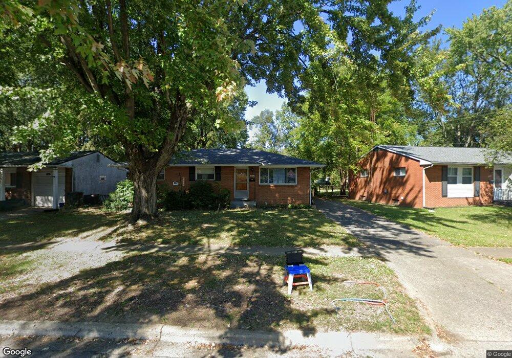
1703 Shady Lane Rd Columbus, OH 43227
Leawood NeighborhoodEstimated Value: $208,261 - $230,000
3
Beds
2
Baths
1,074
Sq Ft
$202/Sq Ft
Est. Value
About This Home
This home is located at 1703 Shady Lane Rd, Columbus, OH 43227 and is currently estimated at $216,815, approximately $201 per square foot. 1703 Shady Lane Rd is a home located in Franklin County with nearby schools including Shady Lane Elementary School, Sherwood Middle School, and Walnut Ridge High School.
Ownership History
Date
Name
Owned For
Owner Type
Purchase Details
Closed on
Jan 4, 2011
Sold by
Radke David
Bought by
Radke Investments Llc
Current Estimated Value
Purchase Details
Closed on
Aug 11, 2010
Sold by
Schreiner Mary E
Bought by
Radke David
Home Financials for this Owner
Home Financials are based on the most recent Mortgage that was taken out on this home.
Original Mortgage
$40,500
Interest Rate
4.63%
Mortgage Type
New Conventional
Purchase Details
Closed on
Oct 1, 1985
Bought by
Schreiner Mary E
Purchase Details
Closed on
May 6, 1981
Bought by
Schreiner Mary E
Purchase Details
Closed on
Sep 1, 1978
Create a Home Valuation Report for This Property
The Home Valuation Report is an in-depth analysis detailing your home's value as well as a comparison with similar homes in the area
Home Values in the Area
Average Home Value in this Area
Purchase History
| Date | Buyer | Sale Price | Title Company |
|---|---|---|---|
| Radke Investments Llc | -- | Hummel Titl | |
| Radke David | $54,000 | Hummel Titl | |
| Schreiner Mary E | -- | -- | |
| Schreiner Mary E | -- | -- | |
| -- | $45,000 | -- |
Source: Public Records
Mortgage History
| Date | Status | Borrower | Loan Amount |
|---|---|---|---|
| Previous Owner | Radke David | $40,500 |
Source: Public Records
Tax History Compared to Growth
Tax History
| Year | Tax Paid | Tax Assessment Tax Assessment Total Assessment is a certain percentage of the fair market value that is determined by local assessors to be the total taxable value of land and additions on the property. | Land | Improvement |
|---|---|---|---|---|
| 2024 | $2,297 | $50,120 | $15,820 | $34,300 |
| 2023 | $2,268 | $50,120 | $15,820 | $34,300 |
| 2022 | $1,514 | $28,490 | $6,860 | $21,630 |
| 2021 | $1,605 | $28,490 | $6,860 | $21,630 |
| 2020 | $1,519 | $28,490 | $6,860 | $21,630 |
| 2019 | $1,420 | $22,830 | $5,500 | $17,330 |
| 2018 | $1,293 | $22,830 | $5,500 | $17,330 |
| 2017 | $1,352 | $22,830 | $5,500 | $17,330 |
| 2016 | $1,284 | $18,900 | $7,210 | $11,690 |
| 2015 | $1,169 | $18,900 | $7,210 | $11,690 |
| 2014 | $1,172 | $18,900 | $7,210 | $11,690 |
| 2013 | $578 | $18,900 | $7,210 | $11,690 |
Source: Public Records
Map
Nearby Homes
- 1691 Shady Lane Rd
- 1607 Shady Lane Rd
- 4701 Janis Dr
- 4589 Belfast Dr
- 4571 Aragon Ave
- 1563 Genoa Place
- 1678 Huxley Dr
- 1571 Baxter Dr
- 4677 E Livingston Ave
- 4475 Ellery Dr
- 1693 Gaynor Rd
- 1787 Lattimer Dr
- 1618 S Hamilton Rd
- 1752 S Hamilton Rd
- 1543 S Hamilton Rd
- 4467 Grimsby Rd
- 4484 Grimsby Rd
- 4501 Amesbury Rd
- 4530 Amesbury Rd
- 4295 Colby Ave
- 1695 Shady Lane Rd
- 1715 Shady Lane Rd
- 1690 Simpson Dr
- 1680 Simpson Dr
- 1688 Simpson Dr
- 4611 Julian Dr
- 1672 Simpson Dr
- 1698 Shady Lane Rd
- 1720 Shady Lane Rd
- 1698 Simpson Dr
- 1729 Shady Lane Rd
- 1729 Shady Ln
- 4589 Dundee Ave
- 4590 Healy Dr
- 1704 Simpson Dr
- 4624 Julian Dr
- 4619 Julian Dr
- 1690 Shady Lane Rd
- 1735 Shady Lane Rd