Estimated Value: $259,562 - $279,000
3
Beds
1
Bath
1,980
Sq Ft
$136/Sq Ft
Est. Value
About This Home
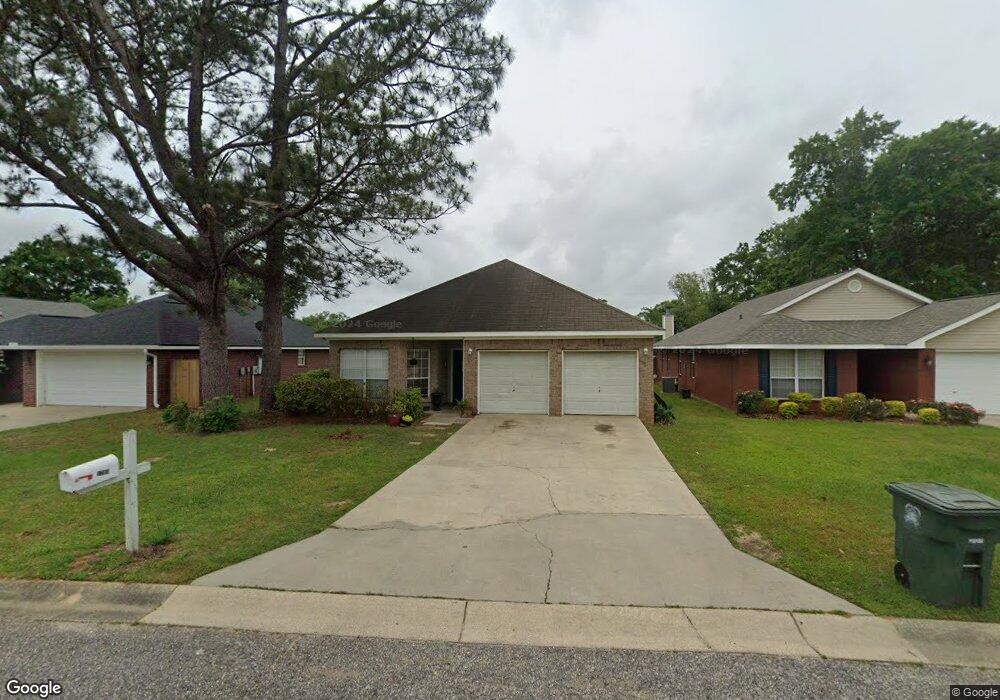
This home is located at 1703 Woodbridge Cir E, Foley, AL 36535 and is currently estimated at $268,641, approximately $135 per square foot. 1703 Woodbridge Cir E is a home located in Baldwin County with nearby schools including Foley Elementary School, Foley Middle School, and Foley High School.
Ownership History
Date
Name
Owned For
Owner Type
Purchase Details
Closed on
Jul 11, 2023
Sold by
Kao Ing Lan and Kao Ing
Bought by
Kao Chung K and Kao Ing Lan
Current Estimated Value
Purchase Details
Closed on
Dec 6, 2011
Sold by
Kao Chung E and Kao Ing Lan
Bought by
Kao Ing Lan
Purchase Details
Closed on
Sep 29, 2005
Sold by
Mitchell Roy A and Mitchell Clara L
Bought by
Kao Chung E and Kao Ing H
Home Financials for this Owner
Home Financials are based on the most recent Mortgage that was taken out on this home.
Original Mortgage
$119,250
Interest Rate
5.72%
Mortgage Type
New Conventional
Create a Home Valuation Report for This Property
The Home Valuation Report is an in-depth analysis detailing your home's value as well as a comparison with similar homes in the area
Home Values in the Area
Average Home Value in this Area
Purchase History
| Date | Buyer | Sale Price | Title Company |
|---|---|---|---|
| Kao Chung K | $30,500 | None Listed On Document | |
| Kao Ing Lan | -- | None Available | |
| Kao Chung E | -- | None Available |
Source: Public Records
Mortgage History
| Date | Status | Borrower | Loan Amount |
|---|---|---|---|
| Previous Owner | Kao Chung E | $119,250 |
Source: Public Records
Tax History Compared to Growth
Tax History
| Year | Tax Paid | Tax Assessment Tax Assessment Total Assessment is a certain percentage of the fair market value that is determined by local assessors to be the total taxable value of land and additions on the property. | Land | Improvement |
|---|---|---|---|---|
| 2024 | $1,479 | $44,820 | $5,960 | $38,860 |
| 2023 | $1,528 | $45,260 | $7,020 | $38,240 |
| 2022 | $1,242 | $37,640 | $0 | $0 |
| 2021 | $1,086 | $32,920 | $0 | $0 |
| 2020 | $1,001 | $30,320 | $0 | $0 |
| 2019 | $979 | $29,680 | $0 | $0 |
| 2018 | $915 | $27,740 | $0 | $0 |
| 2017 | $882 | $26,440 | $0 | $0 |
| 2016 | $859 | $25,660 | $0 | $0 |
| 2015 | $854 | $25,480 | $0 | $0 |
| 2014 | $810 | $24,140 | $0 | $0 |
| 2013 | -- | $23,120 | $0 | $0 |
Source: Public Records
Map
Nearby Homes
- 220 W Spruce Ave
- 1407 N Alston St
- 508 Carol Ann Ct
- 503 W Ariel Ave
- 302 Cluster St
- 1930 N Alston St
- 215 W Palm Ave
- 301 Cluster St
- 106 Oak Hollow Cir
- 141 Mark Twain Loop
- 509 W Amanda Ave
- 113 Natchez Trace
- 333 Cahaba St
- 522 W Amanda Ave
- 1468 Surrey Loop
- 1464 Surrey Loop
- 218 Hemingway Loop
- 213 Hemingway Loop
- 1835 Reese St
- 1853 Carly St
- 1707 Woodbridge Cir E
- 1701 Woodbridge Cir E
- 1629 Woodbridge Cir E
- 1711 Woodbridge Cir E
- 316 Woodbridge Ct
- 314 Woodbridge Ct
- 1628 Woodbridge Cir E
- 1627 Woodbridge Cir E
- 312 Woodbridge Ct
- 1702 Woodbridge Cir E
- 1704 Woodbridge Cir E
- 318 Woodbridge Ct
- 1700 Woodbridge Cir E
- 1630 Woodbridge Cir E
- 310 Woodbridge Ct
- 106 Pine Place Dr
- 108 Pine Place Dr
- 1621 Woodbridge Cir E
- 110 Pine Place Dr
- 319 Woodbridge Ct