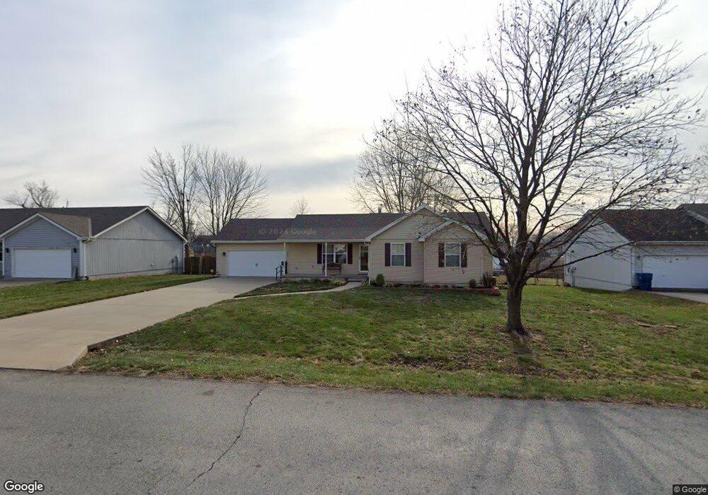
1703 Wornall Rd Excelsior Springs, MO 64024
Estimated Value: $250,000 - $282,000
3
Beds
2
Baths
1,346
Sq Ft
$202/Sq Ft
Est. Value
About This Home
This home is located at 1703 Wornall Rd, Excelsior Springs, MO 64024 and is currently estimated at $271,644, approximately $201 per square foot. 1703 Wornall Rd is a home located in Clay County with nearby schools including Excelsior Springs High School.
Ownership History
Date
Name
Owned For
Owner Type
Purchase Details
Closed on
Apr 4, 2011
Sold by
The Long Family Trust and Long Julie A
Bought by
Long Julie A
Current Estimated Value
Purchase Details
Closed on
Jan 3, 2005
Sold by
Long Lincoln T and Long Julie A
Bought by
Long Lincoln T and Long Julie A
Purchase Details
Closed on
Jul 9, 2003
Sold by
Braden Patsy C and Braden Fred
Bought by
Long Lincoln T and Long Julie A
Purchase Details
Closed on
Jun 28, 1999
Sold by
Heath Patsy C
Bought by
Heath Brandon Alan and Heath Jennifer Dawn
Purchase Details
Closed on
Jun 26, 1997
Sold by
Hill Mark and Hill Myra
Bought by
Heath Patsy C
Home Financials for this Owner
Home Financials are based on the most recent Mortgage that was taken out on this home.
Original Mortgage
$74,000
Interest Rate
7.5%
Create a Home Valuation Report for This Property
The Home Valuation Report is an in-depth analysis detailing your home's value as well as a comparison with similar homes in the area
Home Values in the Area
Average Home Value in this Area
Purchase History
| Date | Buyer | Sale Price | Title Company |
|---|---|---|---|
| Long Julie A | -- | None Available | |
| Long Lincoln T | -- | -- | |
| Long Lincoln T | -- | First American Title Ins Co | |
| Heath Brandon Alan | -- | -- | |
| Heath Patsy C | -- | -- |
Source: Public Records
Mortgage History
| Date | Status | Borrower | Loan Amount |
|---|---|---|---|
| Previous Owner | Heath Patsy C | $74,000 |
Source: Public Records
Tax History Compared to Growth
Tax History
| Year | Tax Paid | Tax Assessment Tax Assessment Total Assessment is a certain percentage of the fair market value that is determined by local assessors to be the total taxable value of land and additions on the property. | Land | Improvement |
|---|---|---|---|---|
| 2025 | $2,640 | $42,620 | -- | -- |
| 2024 | $2,640 | $37,640 | -- | -- |
| 2023 | $2,623 | $37,640 | $0 | $0 |
| 2022 | $2,213 | $31,240 | $0 | $0 |
| 2021 | $2,222 | $31,236 | $2,850 | $28,386 |
| 2020 | $2,067 | $28,250 | $0 | $0 |
| 2019 | $2,065 | $28,253 | $2,850 | $25,403 |
| 2018 | $1,859 | $25,350 | $0 | $0 |
| 2017 | $1,813 | $25,350 | $2,850 | $22,500 |
| 2016 | $1,813 | $25,350 | $2,850 | $22,500 |
| 2015 | $1,830 | $25,350 | $2,850 | $22,500 |
| 2014 | $1,846 | $25,350 | $2,850 | $22,500 |
Source: Public Records
Map
Nearby Homes
- 2017 Wornall Rd
- Lot 2 Wornall Rd
- 1904 Karlton Way
- 125 Crown Hill Rd
- 617 Lodwick Ln
- 1908 Lesa Place
- 609 Kimberly Dr
- 2017 Karlton Way
- 2081 Rock Bridge Pkwy
- 00000 NE 144th St
- 402 Leslie Ln
- 240 Rock Bridge Pkwy
- 1318 Kristie Cir
- 304 Waller Ave
- 2021 Riverstone Dr
- 332 Woods Ave
- 328 Virginia Rd
- 1101 Williams St
- 106 Helen St
- 402 Greenspire St
- 1701 Wornall Rd
- 1705 Wornall Rd
- 1707 Wornall Rd
- 420 Crown Hill Rd
- 1704 Briarwood Ln
- 1706 Briarwood Ln
- 1702 Briarwood Ln
- 1708 Briarwood Ln
- 0 Wornall Rd Unit 2115413
- 0 Wornall Rd Unit 1882351
- 0 Wornall Rd Unit 2054211
- 0 Wornall Rd Unit 2217939
- 0 Wornall Rd Unit 2138058
- 1700 Briarwood Ln
- 1704 Wornall Rd
- 1711 Wornall Rd
- 1710 Briarwood Ln
- Lot 1 Wornall Rd
- 1706 Wornall Rd
- 1712 Briarwood Ln