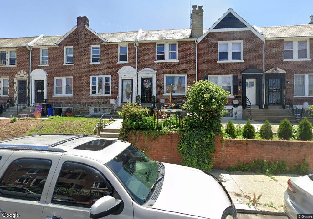
1704 E Mayland St Philadelphia, PA 19138
West Oak Lane NeighborhoodEstimated Value: $176,000 - $232,000
3
Beds
1
Bath
1,386
Sq Ft
$153/Sq Ft
Est. Value
About This Home
This home is located at 1704 E Mayland St, Philadelphia, PA 19138 and is currently estimated at $212,620, approximately $153 per square foot. 1704 E Mayland St is a home located in Philadelphia County with nearby schools including Pennypacker Samuel School, Martin Luther King High School, and West Oak Lane Charter School.
Ownership History
Date
Name
Owned For
Owner Type
Purchase Details
Closed on
Aug 20, 2009
Sold by
Rahmaan Najee F and Estate Of Zaheerah Jameelah Ra
Bought by
Lowrie Robert and Lowrie Regina
Current Estimated Value
Home Financials for this Owner
Home Financials are based on the most recent Mortgage that was taken out on this home.
Original Mortgage
$68,732
Outstanding Balance
$45,155
Interest Rate
5.36%
Mortgage Type
FHA
Estimated Equity
$167,465
Create a Home Valuation Report for This Property
The Home Valuation Report is an in-depth analysis detailing your home's value as well as a comparison with similar homes in the area
Home Values in the Area
Average Home Value in this Area
Purchase History
| Date | Buyer | Sale Price | Title Company |
|---|---|---|---|
| Lowrie Robert | $70,000 | None Available |
Source: Public Records
Mortgage History
| Date | Status | Borrower | Loan Amount |
|---|---|---|---|
| Open | Lowrie Robert | $68,732 |
Source: Public Records
Tax History Compared to Growth
Tax History
| Year | Tax Paid | Tax Assessment Tax Assessment Total Assessment is a certain percentage of the fair market value that is determined by local assessors to be the total taxable value of land and additions on the property. | Land | Improvement |
|---|---|---|---|---|
| 2025 | $2,410 | $209,600 | $41,920 | $167,680 |
| 2024 | $2,410 | $209,600 | $41,920 | $167,680 |
| 2023 | $2,410 | $172,200 | $34,440 | $137,760 |
| 2022 | $1,211 | $127,200 | $34,440 | $92,760 |
| 2021 | $1,841 | $0 | $0 | $0 |
| 2020 | $1,841 | $0 | $0 | $0 |
| 2019 | $1,922 | $0 | $0 | $0 |
| 2018 | $1,236 | $0 | $0 | $0 |
| 2017 | $1,656 | $0 | $0 | $0 |
| 2016 | $1,236 | $0 | $0 | $0 |
| 2015 | $1,183 | $0 | $0 | $0 |
| 2014 | -- | $118,300 | $9,792 | $108,508 |
| 2012 | -- | $16,320 | $2,261 | $14,059 |
Source: Public Records
Map
Nearby Homes
- 1762 Mohican St
- 1759 E Mayland St
- 1822 Nolan St
- 1821 E Tulpehocken St
- 1602 E Duval St
- 1544 E Tulpehocken St
- 1827 E Pastorius St
- 1559 E Pastorius St
- 1839 E Pastorius St
- 1859 E Washington Ln
- 1507 E Duval St
- 7349 E Walnut Ln
- 7277 E Walnut Ln
- 1544 Beverly Rd
- 1537 Beverly Rd
- 7243 Mansfield Ave
- 1413 E Washington Ln
- 1521 E Walnut Ln
- 1416-20 E Tulpehocken St
- 7258 Mansfield Ave
- 1702 E Mayland St
- 1706 E Mayland St
- 1708 E Mayland St
- 1700 E Mayland St
- 1710 E Mayland St
- 1712 E Mayland St
- 1714 E Mayland St
- 1703 Mohican St
- 1709 Mohican St
- 1707 Mohican St
- 1701 Mohican St
- 1711 Mohican St
- 1716 E Mayland St
- 1713 Mohican St
- 1718 E Mayland St
- 1715 Mohican St
- 1717 Mohican St
- 1720 E Mayland St
- 1705 E Mayland St
- 1703 E Mayland St