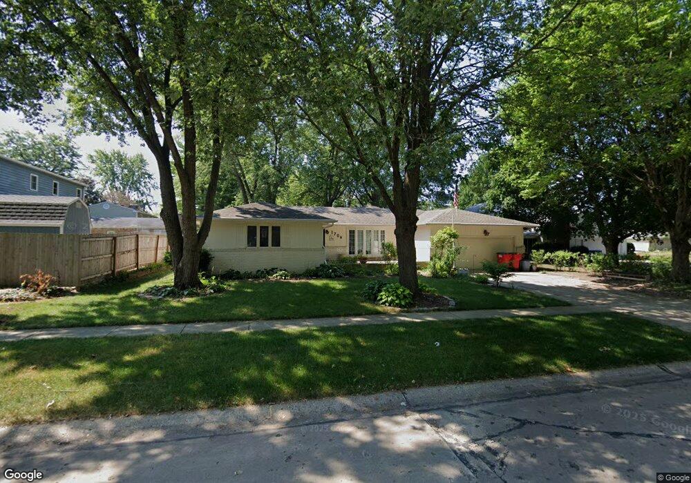
1704 Georgetown Dr Unit 1 Champaign, IL 61821
Bolten Field NeighborhoodEstimated Value: $312,000 - $373,000
3
Beds
3
Baths
2,649
Sq Ft
$129/Sq Ft
Est. Value
About This Home
This home is located at 1704 Georgetown Dr Unit 1, Champaign, IL 61821 and is currently estimated at $340,921, approximately $128 per square foot. 1704 Georgetown Dr Unit 1 is a home located in Champaign County with nearby schools including Central High School, Montessori Habitat School, and Next Generation School.
Ownership History
Date
Name
Owned For
Owner Type
Purchase Details
Closed on
Aug 21, 2012
Sold by
Fliege Roger W and Waldyke Kathryn M
Bought by
Taylor Bobby and Taylor Robin
Current Estimated Value
Home Financials for this Owner
Home Financials are based on the most recent Mortgage that was taken out on this home.
Original Mortgage
$155,039
Outstanding Balance
$105,877
Interest Rate
3.37%
Mortgage Type
FHA
Estimated Equity
$235,044
Create a Home Valuation Report for This Property
The Home Valuation Report is an in-depth analysis detailing your home's value as well as a comparison with similar homes in the area
Home Values in the Area
Average Home Value in this Area
Purchase History
| Date | Buyer | Sale Price | Title Company |
|---|---|---|---|
| Taylor Bobby | $158,000 | Atgf Inc |
Source: Public Records
Mortgage History
| Date | Status | Borrower | Loan Amount |
|---|---|---|---|
| Open | Taylor Bobby | $155,039 |
Source: Public Records
Tax History Compared to Growth
Tax History
| Year | Tax Paid | Tax Assessment Tax Assessment Total Assessment is a certain percentage of the fair market value that is determined by local assessors to be the total taxable value of land and additions on the property. | Land | Improvement |
|---|---|---|---|---|
| 2024 | $5,006 | $73,030 | $23,780 | $49,250 |
| 2023 | $5,006 | $66,510 | $21,660 | $44,850 |
| 2022 | $4,630 | $61,350 | $19,980 | $41,370 |
| 2021 | $4,499 | $60,150 | $19,590 | $40,560 |
| 2020 | $4,295 | $57,840 | $18,840 | $39,000 |
| 2019 | $4,136 | $56,650 | $18,450 | $38,200 |
| 2018 | $4,028 | $55,760 | $18,160 | $37,600 |
| 2017 | $3,850 | $53,610 | $17,460 | $36,150 |
| 2016 | $3,434 | $52,510 | $17,100 | $35,410 |
| 2015 | $3,867 | $51,580 | $16,800 | $34,780 |
| 2014 | $3,834 | $51,580 | $16,800 | $34,780 |
| 2013 | $3,800 | $51,580 | $16,800 | $34,780 |
Source: Public Records
Map
Nearby Homes
- 1318 Broadmoor Dr
- 1612 W Kirby Ave
- 1420 S Western Ave
- 1202 Foothill Dr
- 1205 Broadmoor Dr
- 1725 Lincoln Place
- 1901 Lakeside Dr Unit B
- 2002 O Donnell Dr
- 1106 W Kirby Ave
- 1410 S Mattis Ave
- 2001 S Mattis Ave Unit E
- 2003 W Kirby Ave
- 2144 Harbortown Cir Unit 2144
- 1908 Barberry Cir
- 7 McDonald Ct
- 2113 Sunview Dr
- 7 Greencroft Dr
- 1608 Sheridan Rd
- 32 Greencroft Dr
- 1928 Blackthorn Dr Unit 1
- 1704 Georgetown Dr
- 1701 Mayfair Rd
- 1708 Georgetown Dr
- 1703 Mayfair Rd
- 1703 Georgetown Dr Unit B
- 1703 Georgetown Dr
- 1705 Georgetown Dr
- 1712 Georgetown Dr
- 1705 Mayfair Rd
- 1701 Georgetown Dr
- 1707 Georgetown Dr Unit B
- 1713 Georgetown Dr
- 1715 Georgetown Dr
- 1711 Georgetown Dr
- 1709 Georgetown Dr
- 1714 Georgetown Dr
- 1707 Mayfair Rd
- 1411 Lincolnshire Dr
- 1515 Lincolnshire Dr
- 1611 Mayfair Rd