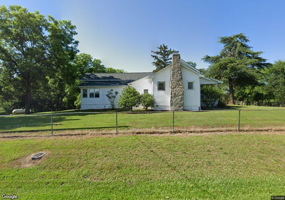
1704 Horton Rollins Rd Kershaw, SC 29067
Estimated Value: $286,089 - $350,000
--
Bed
3
Baths
3,193
Sq Ft
$102/Sq Ft
Est. Value
About This Home
This home is located at 1704 Horton Rollins Rd, Kershaw, SC 29067 and is currently estimated at $324,772, approximately $101 per square foot. 1704 Horton Rollins Rd is a home located in Lancaster County with nearby schools including Kershaw Elementary School, Andrew Jackson Middle School, and Andrew Jackson High School.
Ownership History
Date
Name
Owned For
Owner Type
Purchase Details
Closed on
Aug 7, 2009
Sold by
Bowling Glenwood Nelson and Bowling Janie Henson
Bought by
Bowling Nelson Keith and Bowling Leigh Anne
Current Estimated Value
Home Financials for this Owner
Home Financials are based on the most recent Mortgage that was taken out on this home.
Original Mortgage
$100,000
Interest Rate
3.75%
Mortgage Type
Purchase Money Mortgage
Create a Home Valuation Report for This Property
The Home Valuation Report is an in-depth analysis detailing your home's value as well as a comparison with similar homes in the area
Home Values in the Area
Average Home Value in this Area
Purchase History
| Date | Buyer | Sale Price | Title Company |
|---|---|---|---|
| Bowling Nelson Keith | $200,000 | -- |
Source: Public Records
Mortgage History
| Date | Status | Borrower | Loan Amount |
|---|---|---|---|
| Closed | Bowling Nelson Keith | $100,000 |
Source: Public Records
Tax History Compared to Growth
Tax History
| Year | Tax Paid | Tax Assessment Tax Assessment Total Assessment is a certain percentage of the fair market value that is determined by local assessors to be the total taxable value of land and additions on the property. | Land | Improvement |
|---|---|---|---|---|
| 2024 | $927 | $6,045 | $982 | $5,063 |
| 2023 | $923 | $6,045 | $982 | $5,063 |
| 2022 | $2,992 | $9,066 | $1,472 | $7,594 |
| 2021 | $2,865 | $8,821 | $1,512 | $7,309 |
| 2020 | $2,780 | $8,580 | $1,674 | $6,906 |
| 2019 | $2,594 | $7,669 | $1,496 | $6,173 |
| 2018 | $2,496 | $7,669 | $1,496 | $6,173 |
| 2017 | $2,305 | $0 | $0 | $0 |
| 2016 | $2,275 | $0 | $0 | $0 |
| 2015 | $1,791 | $0 | $0 | $0 |
| 2014 | $1,791 | $0 | $0 | $0 |
| 2013 | $1,791 | $0 | $0 | $0 |
Source: Public Records
Map
Nearby Homes
- 606 W Church St
- 00000 Ussery Rd
- 5474 Ussery Rd
- 510 & 516 & 520 N Ma N Matson St
- 207 W Richland St
- 6458 N Matson St
- 108 W Welsh St
- 215 S Matson St
- 6401 N Matson St
- 6963 Kershaw Camden Hwy
- 7630 Kershaw Camden Hwy
- 113 Jones St
- 301 E Church St
- 8846 Kershaw Camden Hwy
- 6504 Day St
- 309
- 202 N Ingram St
- 509 E Church St
- 511 E Church St
- 6820 Butterfly Ln
- 1675 Horton Rollins Rd
- 1662 Horton Rollins Rd
- 6253 Quail Rd
- 1755 Horton Rollins Rd
- 1534 Horton Rollins Rd
- 6201 Parker Dr
- 6274 Parker Dr
- 6243 Parker Dr
- 1488 Horton Rollins Rd
- 6502 Bowers Ln
- 75 Horton Rollins Rd
- 840 Scout Cabin Rd
- 934 Scout Cabin Rd
- 812 Scout Cabin Rd
- 800 Scout Cabin Rd
- 6554 Bowers Ln
- 792 Scout Cabin Rd
- 776 Scout Cabin Rd
- 760 Scout Cabin Rd
- 6570 Bowers Ln