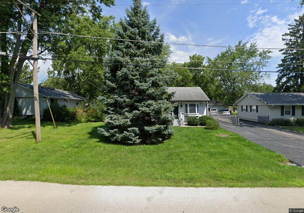
1704 Macarthur Dr Waukegan, IL 60087
Lake County Gardens NeighborhoodEstimated Value: $228,973 - $258,000
2
Beds
1
Bath
1,025
Sq Ft
$234/Sq Ft
Est. Value
About This Home
This home is located at 1704 Macarthur Dr, Waukegan, IL 60087 and is currently estimated at $239,743, approximately $233 per square foot. 1704 Macarthur Dr is a home located in Lake County with nearby schools including H R McCall Elementary School, Jack Benny Middle School, and Waukegan High School.
Ownership History
Date
Name
Owned For
Owner Type
Purchase Details
Closed on
Jun 25, 2015
Sold by
Mackey Scharlott L and Burak Frank S
Bought by
Mackey Scharlott L
Current Estimated Value
Purchase Details
Closed on
Jun 24, 1996
Sold by
Sedar Larry and Sedar Larry R
Bought by
Burak Frank S and Mackey Charlott L
Home Financials for this Owner
Home Financials are based on the most recent Mortgage that was taken out on this home.
Original Mortgage
$102,000
Outstanding Balance
$6,594
Interest Rate
8.13%
Mortgage Type
VA
Estimated Equity
$233,149
Purchase Details
Closed on
Sep 3, 1993
Sold by
Sedar Larry
Bought by
Sedar Larry R and Sedar Susan L
Home Financials for this Owner
Home Financials are based on the most recent Mortgage that was taken out on this home.
Original Mortgage
$55,000
Interest Rate
7.28%
Create a Home Valuation Report for This Property
The Home Valuation Report is an in-depth analysis detailing your home's value as well as a comparison with similar homes in the area
Home Values in the Area
Average Home Value in this Area
Purchase History
| Date | Buyer | Sale Price | Title Company |
|---|---|---|---|
| Mackey Scharlott L | -- | None Available | |
| Burak Frank S | $100,000 | Ticor Title Insurance Compan | |
| Sedar Larry R | -- | Chicago Title Insurance Co |
Source: Public Records
Mortgage History
| Date | Status | Borrower | Loan Amount |
|---|---|---|---|
| Open | Burak Frank S | $102,000 | |
| Previous Owner | Sedar Larry R | $55,000 |
Source: Public Records
Tax History Compared to Growth
Tax History
| Year | Tax Paid | Tax Assessment Tax Assessment Total Assessment is a certain percentage of the fair market value that is determined by local assessors to be the total taxable value of land and additions on the property. | Land | Improvement |
|---|---|---|---|---|
| 2024 | -- | $56,752 | $6,224 | $50,528 |
| 2023 | -- | $50,811 | $5,573 | $45,238 |
| 2022 | $0 | $46,712 | $4,880 | $41,832 |
| 2021 | $0 | $38,831 | $3,973 | $34,858 |
| 2020 | $0 | $36,175 | $3,701 | $32,474 |
| 2019 | $3 | $33,148 | $3,391 | $29,757 |
| 2018 | $3 | $37,891 | $4,798 | $33,093 |
| 2017 | $3 | $33,523 | $4,245 | $29,278 |
| 2016 | $3 | $29,130 | $3,689 | $25,441 |
| 2015 | $0 | $26,072 | $3,302 | $22,770 |
| 2014 | -- | $23,329 | $3,222 | $20,107 |
| 2012 | $2,538 | $25,274 | $3,490 | $21,784 |
Source: Public Records
Map
Nearby Homes
- 1636 Rice St
- 37966 N Cornell Rd
- 3211 Rugby Ct
- 1612 Whitney St
- 3411 N Lewis Ave
- 37905 N Loyola Ave
- 2613 N Lewis Ave
- 38127 N Shore Ave
- 38362 N Manor Ave
- 3101 Country Club Ln
- 2350 N Lewis Ave
- 1730 W Beach Rd
- 12312 W Audrey Ave
- 38697 N Cedar Ave
- 10241 W Bairstow Ave
- 2708 Dana Ave
- 2705 Dana Ave
- 2232 Walnut St
- 301 W Eagle Ct
- 0 Traditions Dr
- 1700 Macarthur Dr
- 3101 Cornell Rd
- 3111 Cornell Rd
- 1610 Macarthur Dr
- 3115 Cornell Rd
- 1619 Macarthur Dr
- 1617 Macarthur Dr
- 3117 Cornell Rd
- 1604 Macarthur Dr
- 3100 Cornell Rd
- 1711 Macarthur Dr
- 1600 Macarthur Dr
- 3112 Cornell Rd
- 1601 Macarthur Dr
- 3127 Cornell Rd
- 1533 Macarthur Dr
- 3116 Cornell Rd
- 3090 Cornell Rd
- 3124 N Cornell Rd
- 3124 Cornell Rd Unit E