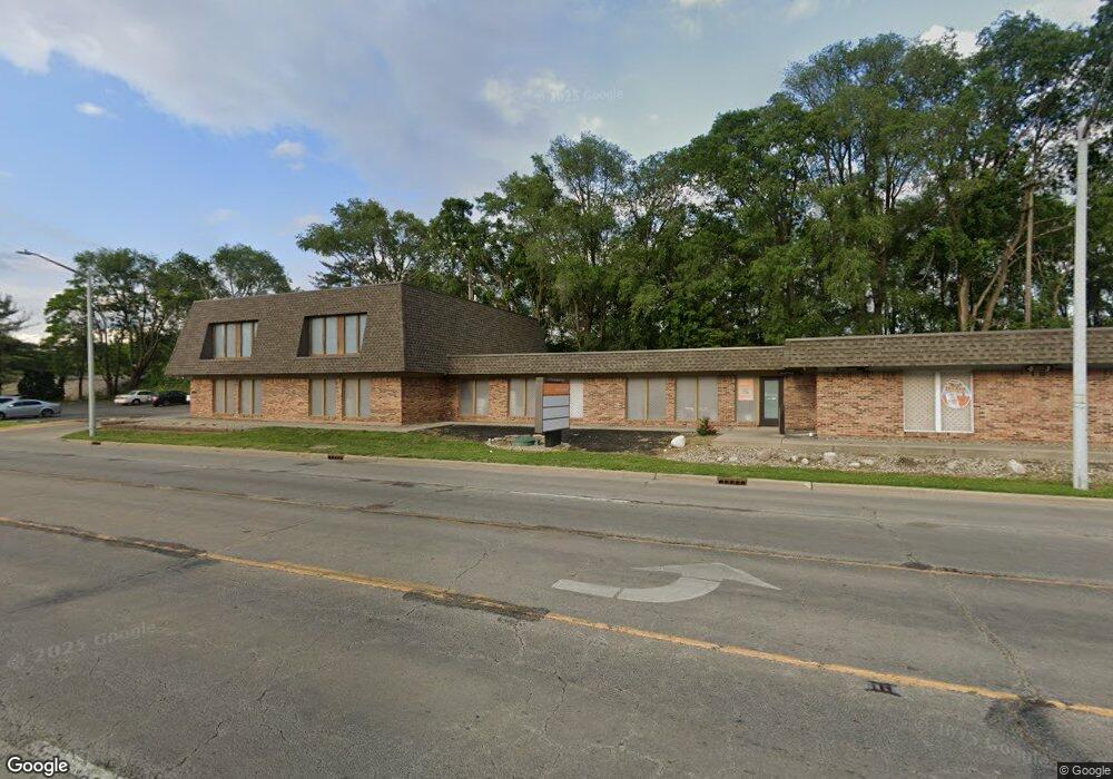
1704 S Neil St Unit D Champaign, IL 61820
Estimated Value: $1,423,278
--
Bed
--
Bath
--
Sq Ft
0.62
Acres
About This Home
This home is located at 1704 S Neil St Unit D, Champaign, IL 61820 and is currently estimated at $1,423,278. 1704 S Neil St Unit D is a home located in Champaign County with nearby schools including Central High School, Devonshire KinderCare, and Montessori Habitat School.
Ownership History
Date
Name
Owned For
Owner Type
Purchase Details
Closed on
Dec 4, 2019
Sold by
Cjcm Llc
Bought by
Chp Champaigan Llc
Current Estimated Value
Purchase Details
Closed on
Dec 15, 2017
Sold by
Champaign Village 2 Llc
Bought by
Des 2015 Llc
Purchase Details
Closed on
Dec 7, 2011
Sold by
1704 S Neil Llc
Bought by
Champaign Village 2 Llc Series 505
Home Financials for this Owner
Home Financials are based on the most recent Mortgage that was taken out on this home.
Original Mortgage
$2,100,000
Interest Rate
4.01%
Mortgage Type
Commercial
Purchase Details
Closed on
Jun 26, 2007
Sold by
First Busey Trust & Investment Co
Bought by
1704 S Neil Llc
Create a Home Valuation Report for This Property
The Home Valuation Report is an in-depth analysis detailing your home's value as well as a comparison with similar homes in the area
Home Values in the Area
Average Home Value in this Area
Purchase History
| Date | Buyer | Sale Price | Title Company |
|---|---|---|---|
| Chp Champaigan Llc | $950,000 | None Available | |
| Des 2015 Llc | -- | None Available | |
| Champaign Village 2 Llc Series 505 | $685,000 | None Available | |
| 1704 S Neil Llc | -- | None Available |
Source: Public Records
Mortgage History
| Date | Status | Borrower | Loan Amount |
|---|---|---|---|
| Previous Owner | Champaign Village 2 Llc Series 505 | $2,100,000 |
Source: Public Records
Tax History Compared to Growth
Tax History
| Year | Tax Paid | Tax Assessment Tax Assessment Total Assessment is a certain percentage of the fair market value that is determined by local assessors to be the total taxable value of land and additions on the property. | Land | Improvement |
|---|---|---|---|---|
| 2024 | $32,119 | $391,070 | $124,250 | $266,820 |
| 2023 | $32,119 | $356,170 | $113,160 | $243,010 |
| 2022 | $30,215 | $328,570 | $104,390 | $224,180 |
| 2021 | $27,820 | $303,890 | $96,550 | $207,340 |
| 2020 | $23,053 | $251,440 | $96,550 | $154,890 |
| 2019 | $22,312 | $246,260 | $94,560 | $151,700 |
| 2018 | $21,811 | $242,380 | $93,070 | $149,310 |
| 2017 | $21,901 | $242,380 | $93,070 | $149,310 |
| 2016 | $19,637 | $237,400 | $91,160 | $146,240 |
| 2015 | $19,787 | $233,200 | $89,550 | $143,650 |
| 2014 | $19,618 | $233,200 | $89,550 | $143,650 |
| 2013 | $19,441 | $233,200 | $89,550 | $143,650 |
Source: Public Records
Map
Nearby Homes
- 812 Dodds Dr
- 810 Breen Dr
- 508 Haines Blvd
- 904 S Elm Blvd
- 1007 S Locust St
- 811 Hamilton Dr
- 1919 Melrose Dr Unit 1919B
- 32 Greencroft Dr
- 2007 S Prospect Ave
- 21 Greencroft Dr
- 703 S Randolph St
- 207 W John St
- 7 Greencroft Dr
- 22 Colony Dr W
- 7 McDonald Ct
- 1106 W Kirby Ave
- 2006 Galen Dr
- 1202 Foothill Dr
- 1205 Broadmoor Dr
- 4 Stanford Place
- 1707 S Neil St Unit 1
- 1612 S Neil St
- 1710 S Neil St
- 1706 S State St
- 1711 S Neil St
- 100 Trade Centre Dr Unit 304
- 100 Trade Centre Dr Unit 102
- 100 Trade Centre Dr Unit 101
- 100 Trade Centre Dr
- 1804 S Neil St
- 1805 S Neil St
- 103 W Kirby Ave
- 1605 S State St
- 1605 S State St Unit 1
- 1605 S State St Unit 5
- 1605 S State St Unit 3
- 1713 S State St Unit 102
- 1713 S State St Unit 103
- 1713 S State St Unit 200
- 1713 S State St Unit 101