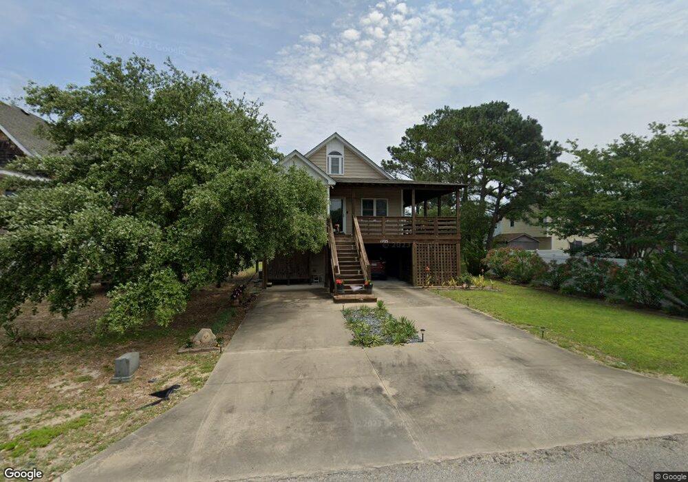
1705 Apache St Unit 11 Kill Devil Hills, NC 27948
Estimated Value: $534,000 - $668,000
4
Beds
3
Baths
1,853
Sq Ft
$314/Sq Ft
Est. Value
About This Home
This home is located at 1705 Apache St Unit 11, Kill Devil Hills, NC 27948 and is currently estimated at $581,620, approximately $313 per square foot. 1705 Apache St Unit 11 is a home located in Dare County with nearby schools including Nags Head Elementary School, First Flight Middle School, and First Flight High School.
Ownership History
Date
Name
Owned For
Owner Type
Purchase Details
Closed on
Feb 1, 2008
Sold by
Blue Rock Properties Llc
Bought by
Howe Susan Marie
Current Estimated Value
Home Financials for this Owner
Home Financials are based on the most recent Mortgage that was taken out on this home.
Original Mortgage
$260,000
Outstanding Balance
$164,203
Interest Rate
6.17%
Mortgage Type
Purchase Money Mortgage
Estimated Equity
$417,417
Purchase Details
Closed on
Apr 27, 2007
Sold by
Gunter Roger G and Gunter Patricia A
Bought by
Blue Rock Properties Llc
Create a Home Valuation Report for This Property
The Home Valuation Report is an in-depth analysis detailing your home's value as well as a comparison with similar homes in the area
Home Values in the Area
Average Home Value in this Area
Purchase History
| Date | Buyer | Sale Price | Title Company |
|---|---|---|---|
| Howe Susan Marie | $325,000 | None Available | |
| Blue Rock Properties Llc | $105,000 | None Available |
Source: Public Records
Mortgage History
| Date | Status | Borrower | Loan Amount |
|---|---|---|---|
| Open | Howe Susan Marie | $260,000 |
Source: Public Records
Tax History
| Year | Tax Paid | Tax Assessment Tax Assessment Total Assessment is a certain percentage of the fair market value that is determined by local assessors to be the total taxable value of land and additions on the property. | Land | Improvement |
|---|---|---|---|---|
| 2025 | $2,708 | $498,600 | $155,800 | $342,800 |
| 2024 | $2,418 | $320,100 | $84,000 | $236,100 |
| 2023 | $2,418 | $320,100 | $84,000 | $236,100 |
| 2022 | $2,306 | $320,100 | $84,000 | $236,100 |
| 2021 | $2,306 | $320,100 | $84,000 | $236,100 |
| 2020 | $2,306 | $320,100 | $84,000 | $236,100 |
| 2019 | $2,068 | $237,700 | $65,500 | $172,200 |
| 2018 | $2,018 | $237,200 | $65,500 | $171,700 |
| 2017 | $2,018 | $237,200 | $65,500 | $171,700 |
| 2016 | $1,923 | $237,200 | $65,500 | $171,700 |
| 2014 | $1,852 | $237,200 | $65,500 | $171,700 |
Source: Public Records
Map
Nearby Homes
- 1204 Indian Dr Unit Lot 29
- 1806 Creek St Unit Lot 13
- 330 Tern Ct Unit Lot 247
- 1106 Indian Dr Unit Lot 27
- 1817 Sioux St Unit Lot 7
- 1317 Devonshire Rd Unit 36
- 1208 W 4th St Unit 4
- 1207 W 4th St Unit Lot 45
- 700 Skipjack Ln Unit G7
- 700 W First St Unit J-11
- 700 W First St Unit E7
- 700 W First St Unit I-3
- 1515 Dogwood Ln Unit Lot 58
- 1100 W Durham St Unit lot 697
- 1208 W 5th St Unit 5
- 1711 Bobby Lee Trail
- 1624 N Virginia Dare Trail Unit Lot 7
- 516 Anika Way Unit Lot 34
- 512 Anika Way Unit Lot 36
- 524 Anika Way Unit Lot 30
- 1707 Apache St
- 1704 Wyandotte St
- 704 Indian Dr Unit 13
- 704 Indian Dr
- 1709 Apache St Unit 9
- 1709 Apache St
- 1706 Wyandotte St Unit 17
- 1706 Wyandotte St
- 706 Indian Dr Unit 12
- 706 Indian Dr Unit 12-13
- 706 Indian Dr
- 1702 Wyandotte St Unit 15
- 1702 Wyandotte St
- 1708 Wyandotte St
- 1700 Wyandotte St Unit 14
- 1700 Wyandotte St
- 1711 Apache St
- 0 Apache St Unit 70435
- 1710 Wyandotte St
- 1713 Apache St Unit Lot 7
Your Personal Tour Guide
Ask me questions while you tour the home.