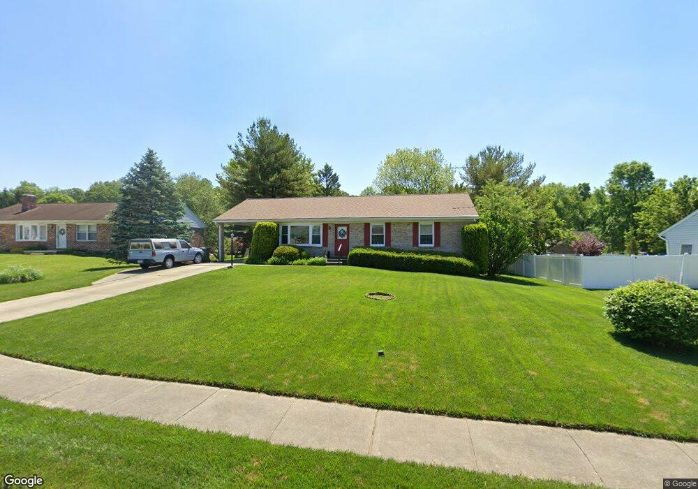
1705 Berdan Ct Bel Air, MD 21015
Estimated Value: $330,307 - $421,000
Studio
1
Bath
1,276
Sq Ft
$309/Sq Ft
Est. Value
About This Home
This home is located at 1705 Berdan Ct, Bel Air, MD 21015 and is currently estimated at $393,827, approximately $308 per square foot. 1705 Berdan Ct is a home located in Harford County with nearby schools including Fountain Green Elementary School, Southampton Middle School, and C. Milton Wright High School.
Ownership History
Date
Name
Owned For
Owner Type
Purchase Details
Closed on
Nov 8, 1985
Sold by
Greenridge Development Corporation
Bought by
Deshaw Neil G and Deshaw Carolyn L
Current Estimated Value
Home Financials for this Owner
Home Financials are based on the most recent Mortgage that was taken out on this home.
Original Mortgage
$55,000
Interest Rate
11.9%
Create a Home Valuation Report for This Property
The Home Valuation Report is an in-depth analysis detailing your home's value as well as a comparison with similar homes in the area
Home Values in the Area
Average Home Value in this Area
Purchase History
| Date | Buyer | Sale Price | Title Company |
|---|---|---|---|
| Deshaw Neil G | $75,400 | -- |
Source: Public Records
Mortgage History
| Date | Status | Borrower | Loan Amount |
|---|---|---|---|
| Closed | Deshaw Neil G | $55,000 |
Source: Public Records
Tax History
| Year | Tax Paid | Tax Assessment Tax Assessment Total Assessment is a certain percentage of the fair market value that is determined by local assessors to be the total taxable value of land and additions on the property. | Land | Improvement |
|---|---|---|---|---|
| 2025 | $2,524 | $296,000 | $97,700 | $198,300 |
| 2024 | $2,524 | $282,633 | $0 | $0 |
| 2023 | $2,404 | $269,267 | $0 | $0 |
| 2022 | $2,789 | $255,900 | $97,700 | $158,200 |
| 2021 | $2,815 | $249,933 | $0 | $0 |
| 2020 | $2,815 | $243,967 | $0 | $0 |
| 2019 | $2,747 | $238,000 | $112,600 | $125,400 |
| 2018 | $2,663 | $232,833 | $0 | $0 |
| 2017 | $2,604 | $238,000 | $0 | $0 |
| 2016 | -- | $222,500 | $0 | $0 |
| 2015 | $2,496 | $221,100 | $0 | $0 |
| 2014 | $2,496 | $219,700 | $0 | $0 |
Source: Public Records
Map
Nearby Homes
- 1622 Shady Tree Ct
- 718 Beretta Way
- 1619 Shady Tree Ct
- 1617 Shady Tree Ct
- 1613 Shady Tree Ct
- 1609 Shady Tree Ct
- 1612 Ruger Dr
- 1601 Redfield Rd
- 1479 Landis Cir
- 1522 Southview Rd
- 503 Mauser Dr
- 1335 Merry Hill Ct
- 804 Briergreen Ct
- 113 Crescent Dr
- 1723 E Churchville Rd
- 1837 E Churchville Rd
- 1224 Marston Ct
- 1406 Bonnett Place Unit 201
- 1402 Bonnett Place Unit 131
- 1603 Martha Ct Unit 101
- 1703 Berdan Ct
- 1707 Berdan Ct
- 816 Flintlock Dr
- 814 Flintlock Dr
- 818 Flintlock Dr
- 1709 Berdan Ct
- 727 Burnside Dr
- 1704 Berdan Ct
- 1702 Berdan Ct
- 729 Burnside Dr
- 1706 Berdan Ct
- 1708 Berdan Ct
- 725 Burnside Dr
- 820 Flintlock Dr
- 721 Huntington Way
- 719 Huntington Way
- 723 Burnside Dr
- 1709 Allen Ct
- 823 Flintlock Dr
- 821 Flintlock Dr
Your Personal Tour Guide
Ask me questions while you tour the home.