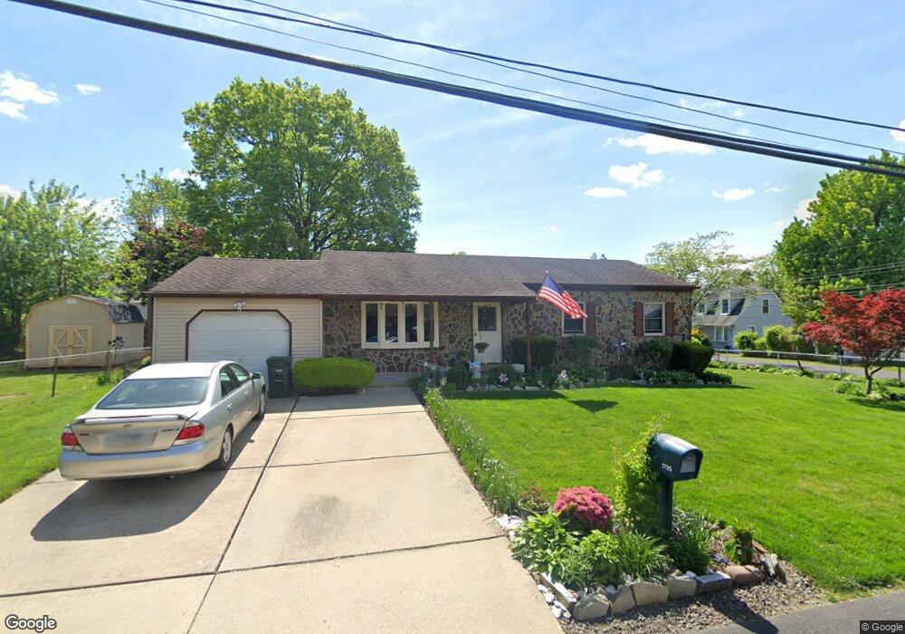
1705 Forrest Ave Feasterville Trevose, PA 19053
Estimated Value: $376,000 - $463,000
3
Beds
2
Baths
1,204
Sq Ft
$349/Sq Ft
Est. Value
About This Home
This home is located at 1705 Forrest Ave, Feasterville Trevose, PA 19053 and is currently estimated at $420,496, approximately $349 per square foot. 1705 Forrest Ave is a home located in Bucks County with nearby schools including Tawanka Elementary School, Poquessing Middle School, and Neshaminy High School.
Ownership History
Date
Name
Owned For
Owner Type
Purchase Details
Closed on
May 10, 2002
Sold by
White John P and White Joanne R
Bought by
Massaroni Christopher R and Kissell Kimberly A
Current Estimated Value
Home Financials for this Owner
Home Financials are based on the most recent Mortgage that was taken out on this home.
Original Mortgage
$137,400
Outstanding Balance
$57,896
Interest Rate
6.9%
Estimated Equity
$362,600
Purchase Details
Closed on
Mar 10, 1981
Bought by
White John P and White Joanne R
Create a Home Valuation Report for This Property
The Home Valuation Report is an in-depth analysis detailing your home's value as well as a comparison with similar homes in the area
Home Values in the Area
Average Home Value in this Area
Purchase History
| Date | Buyer | Sale Price | Title Company |
|---|---|---|---|
| Massaroni Christopher R | $178,000 | -- | |
| White John P | $15,000 | -- |
Source: Public Records
Mortgage History
| Date | Status | Borrower | Loan Amount |
|---|---|---|---|
| Open | Massaroni Christopher R | $137,400 |
Source: Public Records
Tax History Compared to Growth
Tax History
| Year | Tax Paid | Tax Assessment Tax Assessment Total Assessment is a certain percentage of the fair market value that is determined by local assessors to be the total taxable value of land and additions on the property. | Land | Improvement |
|---|---|---|---|---|
| 2025 | $4,936 | $23,200 | $3,280 | $19,920 |
| 2024 | $4,936 | $23,200 | $3,280 | $19,920 |
| 2023 | $4,890 | $23,200 | $3,280 | $19,920 |
| 2022 | $4,759 | $23,200 | $3,280 | $19,920 |
| 2021 | $4,759 | $23,200 | $3,280 | $19,920 |
| 2020 | $4,701 | $23,200 | $3,280 | $19,920 |
| 2019 | $4,594 | $23,200 | $3,280 | $19,920 |
| 2018 | $4,508 | $23,200 | $3,280 | $19,920 |
| 2017 | $4,391 | $23,200 | $3,280 | $19,920 |
| 2016 | $4,391 | $23,200 | $3,280 | $19,920 |
| 2015 | $3,320 | $23,200 | $3,280 | $19,920 |
| 2014 | $3,320 | $23,200 | $3,280 | $19,920 |
Source: Public Records
Map
Nearby Homes
- 510 Walnut Ave
- 611 Rosewood Ave
- 533 Avenue F
- 402 Larchwood Ave
- 387 Larchwood Ave
- 235 Andrews Rd
- 1544 Brownsville Rd
- 517 Somers Ave
- 24 Springmeadow Rd
- 1904 Acorn St
- 1515 N Meadowbrook Rd
- 3633 Brownsville Rd
- 4357 Brownsville Rd
- 4970 Central Ave
- 3866 Spruce Ave
- 111 E Endfield Rd
- 1215 W Pine St
- 836 E Bristol Rd
- 2053 Christina Ct
- 1700 Colonial Dr
- 512 E Myrtle Ave
- 505 Hazel Ave
- 511 Hazel Ave
- 1704 Forrest Ave
- 503 E Myrtle Ave
- 517 Hazel Ave
- 511 E Myrtle Ave
- 1708 Forrest Ave
- 550 E Myrtle Ave
- 526 E Myrtle Ave
- 523 E Myrtle Ave
- 475 E Myrtle Ave
- 475 Hazel Ave
- 514 Hazel Ave
- 470 E Myrtle Ave
- 504 Rosewood Ave
- 508 Rosewood Ave
- 1654 Forrest Ave
- 516 Hazel Ave
- 512 Rosewood Ave