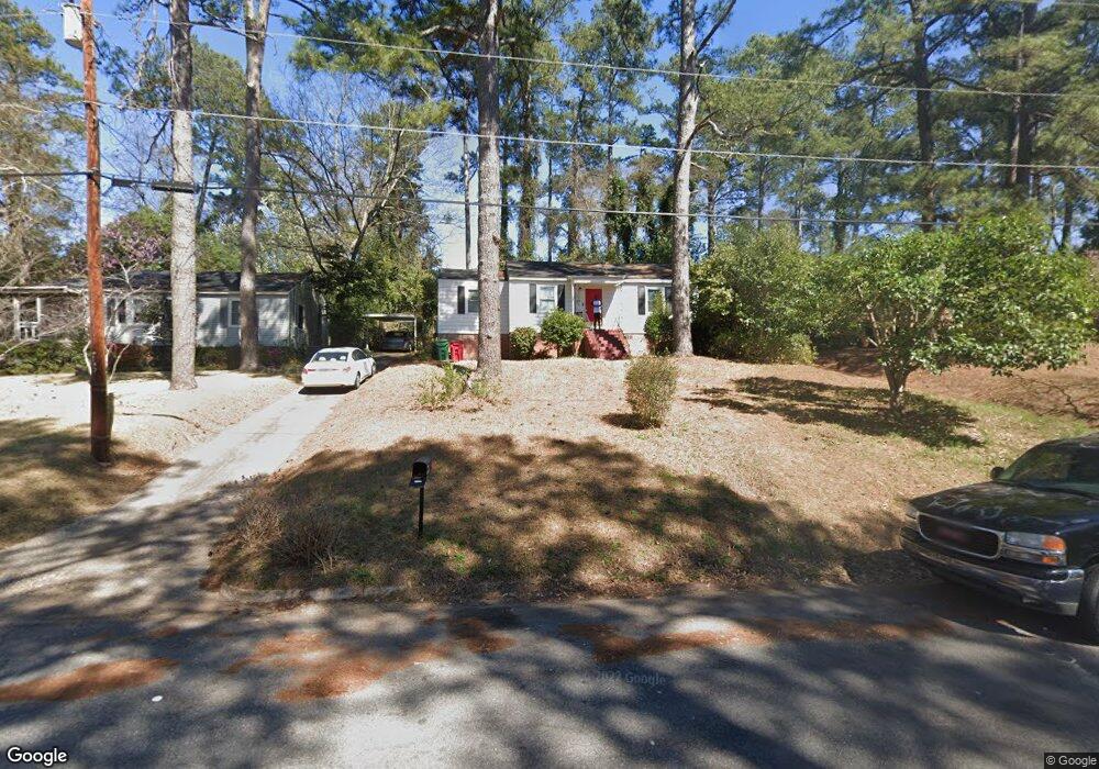
1705 Foster Pl (Multiple Parcels) Macon, GA 31211
Estimated Value: $128,000 - $160,000
3
Beds
2
Baths
1,512
Sq Ft
$99/Sq Ft
Est. Value
About This Home
This home is located at 1705 Foster Pl (Multiple Parcels), Macon, GA 31211 and is currently estimated at $149,000, approximately $98 per square foot. 1705 Foster Pl (Multiple Parcels) is a home located in Bibb County with nearby schools including Martin Luther King Jr. Elementary School, Appling Middle School, and Northeast High School.
Ownership History
Date
Name
Owned For
Owner Type
Purchase Details
Closed on
Sep 27, 2013
Sold by
Eadeh Michael
Bought by
Neptune Investment Group Llc
Current Estimated Value
Purchase Details
Closed on
Apr 12, 2013
Sold by
State Bank And Trust Company
Bought by
Eadeh Michael
Purchase Details
Closed on
Jun 5, 2012
Sold by
Jake'S Memory Llc
Bought by
State Bank And Trust Company
Purchase Details
Closed on
Jun 6, 2008
Sold by
Security Bank Of Jones Co
Bought by
Jake'S Memory Llc
Purchase Details
Closed on
Mar 4, 2008
Sold by
Levine Michael
Bought by
Security Bank Of Jones Co
Purchase Details
Closed on
Feb 3, 2006
Purchase Details
Closed on
Feb 11, 2005
Sold by
Gordon Forrest Thursley and Gordon Marie L
Bought by
Donald Properties Llc
Create a Home Valuation Report for This Property
The Home Valuation Report is an in-depth analysis detailing your home's value as well as a comparison with similar homes in the area
Home Values in the Area
Average Home Value in this Area
Purchase History
| Date | Buyer | Sale Price | Title Company |
|---|---|---|---|
| Neptune Investment Group Llc | -- | None Available | |
| Eadeh Michael | $5,500 | None Available | |
| State Bank And Trust Company | $214,800 | -- | |
| State Bank & Trust Company | $525,209 | None Available | |
| Jake'S Memory Llc | $493,600 | -- | |
| Security Bank Of Jones Co | $158,900 | -- | |
| -- | $216,000 | -- | |
| Donald Properties Llc | $30,000 | None Available |
Source: Public Records
Tax History Compared to Growth
Tax History
| Year | Tax Paid | Tax Assessment Tax Assessment Total Assessment is a certain percentage of the fair market value that is determined by local assessors to be the total taxable value of land and additions on the property. | Land | Improvement |
|---|---|---|---|---|
| 2025 | $891 | $36,260 | $3,770 | $32,490 |
| 2024 | $921 | $36,260 | $3,770 | $32,490 |
| 2023 | $814 | $32,060 | $3,770 | $28,290 |
| 2022 | $1,075 | $31,214 | $3,362 | $27,852 |
| 2021 | $789 | $20,759 | $3,002 | $17,757 |
| 2020 | $764 | $19,690 | $3,002 | $16,688 |
| 2019 | $771 | $19,690 | $3,002 | $16,688 |
| 2018 | $1,360 | $19,690 | $3,002 | $16,688 |
| 2017 | $738 | $19,690 | $3,002 | $16,688 |
| 2016 | $681 | $19,689 | $3,002 | $16,688 |
| 2015 | $964 | $19,689 | $3,002 | $16,688 |
| 2014 | $280 | $19,689 | $3,002 | $16,688 |
Source: Public Records
Map
Nearby Homes
- 1705 Foster Place
- 1695 Foster Place
- 1685 Foster Place
- 1725 Foster Place
- 1746 Upper River Rd Unit 100
- 1752 Upper River Rd
- 1740 Upper River Rd
- 1700 Foster Place
- 1675 Foster Place
- 1714 Foster Place
- 0 Foster Place
- 1758 Upper River Rd
- 1684 Foster Place
- 1730 Upper River Rd
- 1734 Foster Place
- 1764 Upper River Rd
- 1745 Foster Place
- 1674 Foster Place
- 1678 Engle Dr
- 1650 Maryland Dr