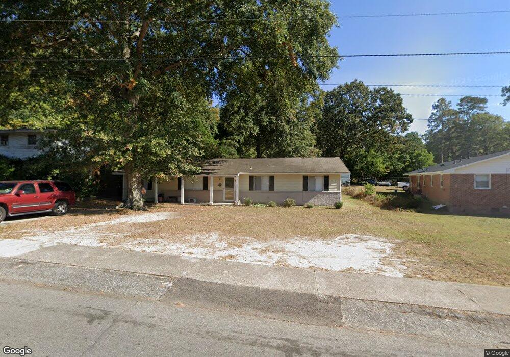
1705 Lowe St North Augusta, SC 29841
Estimated Value: $143,000 - $209,000
3
Beds
2
Baths
1,586
Sq Ft
$112/Sq Ft
Est. Value
About This Home
This home is located at 1705 Lowe St, North Augusta, SC 29841 and is currently estimated at $176,856, approximately $111 per square foot. 1705 Lowe St is a home located in Aiken County with nearby schools including Hammond Hill Elementary School, Paul Knox Middle School, and North Augusta High School.
Ownership History
Date
Name
Owned For
Owner Type
Purchase Details
Closed on
Jul 9, 2008
Sold by
Wachovia Mortgage Corp
Bought by
Hutt Sean C and Hutt Constance A
Current Estimated Value
Home Financials for this Owner
Home Financials are based on the most recent Mortgage that was taken out on this home.
Original Mortgage
$85,360
Outstanding Balance
$55,151
Interest Rate
6.27%
Mortgage Type
Purchase Money Mortgage
Estimated Equity
$121,705
Purchase Details
Closed on
Nov 10, 2004
Sold by
Hucks Howard
Bought by
Withrow Dawn M
Purchase Details
Closed on
Apr 15, 2004
Sold by
The Bank Of New York
Bought by
Hucks Howard
Purchase Details
Closed on
Dec 17, 2003
Sold by
Durden Elizabeth D and Durden Beth D
Bought by
The Bank Of New York
Create a Home Valuation Report for This Property
The Home Valuation Report is an in-depth analysis detailing your home's value as well as a comparison with similar homes in the area
Purchase History
| Date | Buyer | Sale Price | Title Company |
|---|---|---|---|
| Hutt Sean C | $88,000 | -- | |
| Withrow Dawn M | $77,900 | -- | |
| Hucks Howard | $42,600 | -- | |
| The Bank Of New York | $2,500 | -- |
Source: Public Records
Mortgage History
| Date | Status | Borrower | Loan Amount |
|---|---|---|---|
| Open | Hutt Sean C | $85,360 |
Source: Public Records
Tax History
| Year | Tax Paid | Tax Assessment Tax Assessment Total Assessment is a certain percentage of the fair market value that is determined by local assessors to be the total taxable value of land and additions on the property. | Land | Improvement |
|---|---|---|---|---|
| 2025 | $475 | $4,740 | -- | -- |
| 2023 | $476 | $4,740 | $869 | $107,030 |
| 2022 | $463 | $5,240 | $0 | $0 |
| 2021 | $464 | $5,240 | $0 | $0 |
| 2020 | $410 | $4,130 | $0 | $0 |
| 2019 | $410 | $4,130 | $0 | $0 |
| 2018 | $411 | $4,130 | $680 | $3,450 |
| 2017 | $390 | $0 | $0 | $0 |
| 2016 | $390 | $0 | $0 | $0 |
| 2015 | $393 | $0 | $0 | $0 |
| 2014 | $394 | $0 | $0 | $0 |
| 2013 | -- | $0 | $0 | $0 |
Source: Public Records
Map
Nearby Homes
- 2006 Bunting Dr
- 1962 Bunting Dr
- 2009 Wren Rd
- 19 Leigh Place Dr
- 518 Ridgecliff Ct
- 655 Bobbye Dr Unit Fb67
- 102 Briggs Ave Unit 4
- 1023 Scenic Ct
- 37 Hillwood Ct
- 2214 Vireo Dr
- 4037 Fieldcrest Dr
- 1519 Summerhill Rd
- 817 Bobbye Dr Unit Fb77
- 15 Summit Commons Ct
- 325 W Hugh St
- 1121 Bobbye Dr Unit 12b
- 379 Bobbye Dr Unit Fb94
- 1105 Bobbye Dr Unit 12a
- 1087 Bobbye Dr Unit 13b
- 1071 Bobbye Dr Unit 13a
- 1707 Lowe St
- 2002 Bunting Dr
- - Lowe St
- 2004 Bunting Dr
- 1706 Lowe St
- 222 Trimmier Place
- 224 Trimmier Place
- 1704 Lowe St
- 2005 Bunting Dr
- 220 Trimmier Place
- 2001 Arch Dr
- 218 Trimmier Place
- 2007 Bunting Dr
- 2008 Bunting Dr
- 2006 Arch Dr
- 1976 Bunting Dr
- 1910 Gordon St
- 216 Trimmier Place
- 2008 Arch Dr
- 1901 Gordon St
Your Personal Tour Guide
Ask me questions while you tour the home.