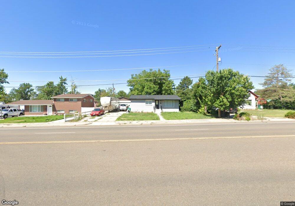
1705 N Hill Field Rd Layton, UT 84041
Estimated Value: $366,000 - $411,000
2
Beds
1
Bath
972
Sq Ft
$403/Sq Ft
Est. Value
About This Home
This home is located at 1705 N Hill Field Rd, Layton, UT 84041 and is currently estimated at $391,740, approximately $403 per square foot. 1705 N Hill Field Rd is a home located in Davis County with nearby schools including Lincoln Elementary School, North Layton Junior High School, and Northridge High School.
Ownership History
Date
Name
Owned For
Owner Type
Purchase Details
Closed on
Apr 9, 2014
Sold by
Jones Ralph Douglas
Bought by
Ralph Douglas Jones Utah Asse Proteciton and Jones Jarom Douglas
Current Estimated Value
Purchase Details
Closed on
Aug 10, 2010
Sold by
Jdj Property & Loan Llc
Bought by
Jones Ralph Douglas
Purchase Details
Closed on
Sep 25, 2006
Sold by
Jones Ralph Douglas and Jones Jarom D
Bought by
Jdj Property & Loan Llc
Purchase Details
Closed on
Mar 1, 2005
Sold by
Wall Norma Anderson
Bought by
Jones Ralph Douglas and Jones Jarom D
Home Financials for this Owner
Home Financials are based on the most recent Mortgage that was taken out on this home.
Original Mortgage
$104,000
Interest Rate
5.66%
Mortgage Type
New Conventional
Purchase Details
Closed on
Sep 5, 2000
Sold by
Wall Norma Anderson and Wall Norma A
Bought by
Wall Norma Anderson
Create a Home Valuation Report for This Property
The Home Valuation Report is an in-depth analysis detailing your home's value as well as a comparison with similar homes in the area
Home Values in the Area
Average Home Value in this Area
Purchase History
| Date | Buyer | Sale Price | Title Company |
|---|---|---|---|
| Ralph Douglas Jones Utah Asse Proteciton | -- | None Available | |
| Jones Ralph Douglas | -- | Accommodation | |
| Jdj Property & Loan Llc | -- | Accommodation | |
| Jones Ralph Douglas | -- | None Available | |
| Wall Norma Anderson | -- | -- |
Source: Public Records
Mortgage History
| Date | Status | Borrower | Loan Amount |
|---|---|---|---|
| Previous Owner | Jones Ralph Douglas | $104,000 |
Source: Public Records
Tax History Compared to Growth
Tax History
| Year | Tax Paid | Tax Assessment Tax Assessment Total Assessment is a certain percentage of the fair market value that is determined by local assessors to be the total taxable value of land and additions on the property. | Land | Improvement |
|---|---|---|---|---|
| 2025 | $1,776 | $186,450 | $111,181 | $75,269 |
| 2024 | $1,737 | $183,699 | $128,974 | $54,725 |
| 2023 | $1,663 | $170,500 | $81,464 | $89,035 |
| 2022 | $1,663 | $306,000 | $145,193 | $160,807 |
| 2021 | $1,537 | $232,000 | $116,216 | $115,784 |
| 2020 | $1,402 | $203,000 | $96,004 | $106,996 |
| 2019 | $1,452 | $206,000 | $89,586 | $116,414 |
| 2018 | $1,285 | $183,000 | $89,586 | $93,414 |
| 2016 | $1,085 | $79,695 | $29,768 | $49,927 |
| 2015 | $1,031 | $71,885 | $29,768 | $42,117 |
| 2014 | $974 | $69,460 | $29,768 | $39,692 |
| 2013 | -- | $79,454 | $24,816 | $54,638 |
Source: Public Records
Map
Nearby Homes
- 398 Paul Ave
- 1715 N Alder St
- 1837 N 440 W
- 1490 N 175 W
- 1908 N 200 W
- 1583 N 25 E
- 2053 Evans Cove Loop Unit 39
- 2044 Evans Cove Loop
- 2048 Evans Cove Loop
- 103 W 1275 N
- 506 W 2200 N
- 2211 N 525 W
- 2248 N 500 W
- 1096 N 300 W
- 1553 N 250 E
- 9 W 2150 N
- 1500 N Angel St Unit 12
- 23 E 2150 N
- 1180 N 100 E
- 1094 N Angel St W
- 1691 N Hill Field Rd
- 1721 N Hill Field Rd
- 1698 Alder St
- 1684 N Alder St
- 1684 Alder St
- 1675 N Hill Field Rd
- 1708 Alder St
- 401 Paul Ave
- 411 Paul Ave
- 1670 Alder St
- 419 Paul Ave
- 1656 N Hill Field Rd
- 1656 N Hill Field Rd
- 388 Forbes St
- 1718 Alder St
- 410 W Forbes St
- 410 Forbes St
- 1701 Alder St
- 1701 N Alder St
- 1673 Alder St