
Seller's Agent in 2025
Brittanie Woodward
Trish Rowe Realty, LLC
(717) 357-1125
83 Total Sales
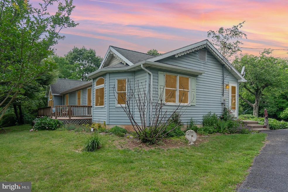
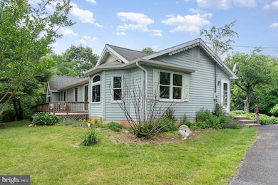
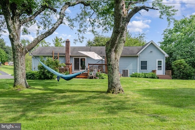
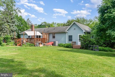
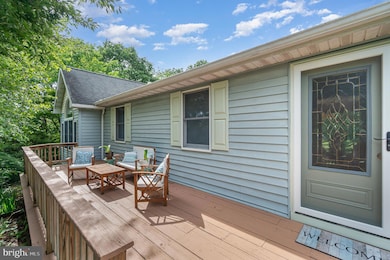
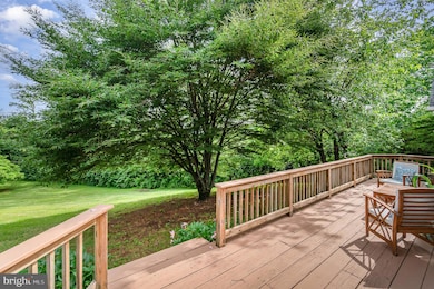
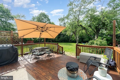
3 Bedroom Rancher on 1.10 acres with the views & seclusion you've been looking for! Kitchen/Dining Area was remodeled in 2018- featuring Kraftmaid cabinets, stainless steel appliances, beautiful waterproof floors, and glass tile backsplash. New HVAC system in 2020, new washer/dryer in 2024, new water heater 2025. Bathroom was remodeled in 2021 with gorgeous tile shower. Half bath has plenty of room to add a shower or tub to make it a full bath. Original hardwood floors in living room & hallway. Stunning real wood doors & trim throughout! Large master bedroom with attached dressing room- you'll feel like you're sleeping among the trees- no need for curtains with views & seclusion like this! Office could also be a 4th bedroom if needed. Full unfinished basement offers endless possibilities for storage, hobbies, or more living space! Large front & back porches have been freshly stained and are perfect for relaxing or entertaining.
Last Agent to Sell the Property
(717) 357-1125 bwrealtor@yahoo.com Trish Rowe Realty, LLC License #AB068096 Listed on: 06/02/2025
Last Buyer's Agent
(717) 253-4178 trishrowerealty@yahoo.com Trish Rowe Realty, LLC License #RM421488
| Date | Type | Sale Price | Title Company |
|---|---|---|---|
| Deed | $331,900 | Mason Dixon Settlements | |
| Deed | $331,900 | Mason Dixon Settlements | |
| Deed | $220,000 | -- | |
| Deed | $209,000 | -- |
| Date | Status | Loan Amount | Loan Type |
|---|---|---|---|
| Open | $298,710 | New Conventional | |
| Closed | $298,710 | New Conventional | |
| Previous Owner | $60,000 | New Conventional | |
| Previous Owner | $44,000 | Stand Alone Second | |
| Previous Owner | $176,000 | New Conventional | |
| Previous Owner | $167,200 | Adjustable Rate Mortgage/ARM | |
| Previous Owner | $41,800 | Stand Alone Second |
| Date | Event | Price | Change | Sq Ft Price |
|---|---|---|---|---|
| 08/04/2025 08/04/25 | Sold | $331,900 | +0.6% | $223 / Sq Ft |
| 06/06/2025 06/06/25 | Pending | -- | -- | -- |
| 06/02/2025 06/02/25 | For Sale | $329,900 | -- | $221 / Sq Ft |
| Year | Tax Paid | Tax Assessment Tax Assessment Total Assessment is a certain percentage of the fair market value that is determined by local assessors to be the total taxable value of land and additions on the property. | Land | Improvement |
|---|---|---|---|---|
| 2025 | $4,059 | $212,300 | $45,500 | $166,800 |
| 2024 | $3,769 | $212,300 | $45,500 | $166,800 |
| 2023 | $3,621 | $212,300 | $45,500 | $166,800 |
| 2022 | $3,621 | $212,300 | $45,500 | $166,800 |
| 2021 | $3,520 | $212,300 | $45,500 | $166,800 |
| 2020 | $3,485 | $212,300 | $45,500 | $166,800 |
| 2019 | $3,425 | $212,300 | $45,500 | $166,800 |
| 2018 | $3,387 | $212,300 | $45,500 | $166,800 |
| 2017 | $3,211 | $212,300 | $45,500 | $166,800 |
| 2016 | -- | $212,300 | $45,500 | $166,800 |
| 2015 | -- | $212,300 | $45,500 | $166,800 |
| 2014 | -- | $212,300 | $45,500 | $166,800 |
Seller's Agent in 2025
Brittanie Woodward
Trish Rowe Realty, LLC
(717) 357-1125
83 Total Sales
Buyer's Agent in 2025
Trish Rowe
Trish Rowe Realty, LLC
(717) 253-4178
60 Total Sales
Source: Bright MLS
MLS Number: PAAD2018112
APN: 18-C12-0117-000
Disclaimer: Certain information contained herein is derived from information provided by parties other than Homes.com. All information provided is deemed reliable, but is not guaranteed to be accurate and should be independently verified.
![]() The data relating to real estate for sale on this website appears in part through the BRIGHT Internet Data Exchange program, a voluntary cooperative exchange of property listing data between licensed real estate brokerage firms, and is provided by BRIGHT through a licensing agreement.
The data relating to real estate for sale on this website appears in part through the BRIGHT Internet Data Exchange program, a voluntary cooperative exchange of property listing data between licensed real estate brokerage firms, and is provided by BRIGHT through a licensing agreement.
Listing information is from various brokers who participate in the Bright MLS IDX program and not all listings may be visible on the site.
The property information being provided on or through the website is for the personal, non-commercial use of consumers and such information may not be used for any purpose other than to identify prospective properties consumers may be interested in purchasing.
Some properties which appear for sale on the website may no longer be available because they are for instance, under contract, sold or are no longer being offered for sale.
Property information displayed is deemed reliable but is not guaranteed.
Copyright 2025 Bright MLS, Inc.