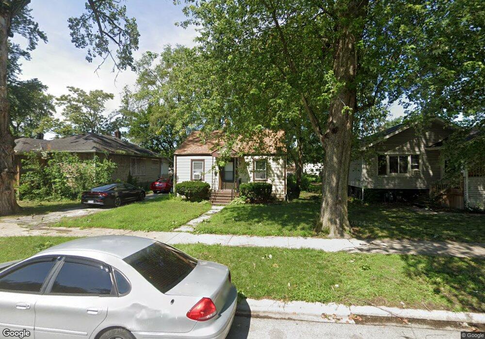
17054 Winchester Ave Hazel Crest, IL 60429
Hazel Crest Proper NeighborhoodEstimated Value: $103,000 - $131,000
3
Beds
1
Bath
910
Sq Ft
$133/Sq Ft
Est. Value
About This Home
This home is located at 17054 Winchester Ave, Hazel Crest, IL 60429 and is currently estimated at $121,020, approximately $132 per square foot. 17054 Winchester Ave is a home located in Cook County with nearby schools including Thornwood High School.
Ownership History
Date
Name
Owned For
Owner Type
Purchase Details
Closed on
Apr 18, 2006
Sold by
Washington Mutual Bank Fa
Bought by
Lewis Lenard
Current Estimated Value
Home Financials for this Owner
Home Financials are based on the most recent Mortgage that was taken out on this home.
Original Mortgage
$49,400
Interest Rate
6.72%
Mortgage Type
Unknown
Purchase Details
Closed on
Aug 4, 2005
Sold by
Frederick
Bought by
Washington Mutual Bank Fa and Home Savings Of America
Create a Home Valuation Report for This Property
The Home Valuation Report is an in-depth analysis detailing your home's value as well as a comparison with similar homes in the area
Home Values in the Area
Average Home Value in this Area
Purchase History
| Date | Buyer | Sale Price | Title Company |
|---|---|---|---|
| Lewis Lenard | $54,900 | Service Link | |
| Washington Mutual Bank Fa | -- | -- |
Source: Public Records
Mortgage History
| Date | Status | Borrower | Loan Amount |
|---|---|---|---|
| Previous Owner | Lewis Lenard | $49,400 |
Source: Public Records
Tax History
| Year | Tax Paid | Tax Assessment Tax Assessment Total Assessment is a certain percentage of the fair market value that is determined by local assessors to be the total taxable value of land and additions on the property. | Land | Improvement |
|---|---|---|---|---|
| 2025 | $3,203 | $5,000 | $1,085 | $3,915 |
| 2024 | $3,203 | $5,000 | $1,085 | $3,915 |
| 2023 | $2,532 | $5,000 | $1,085 | $3,915 |
| 2022 | $2,532 | $2,925 | $930 | $1,995 |
| 2021 | $1,060 | $2,925 | $930 | $1,995 |
| 2020 | $1,448 | $2,925 | $930 | $1,995 |
| 2019 | $1,490 | $3,620 | $852 | $2,768 |
| 2018 | $1,448 | $3,620 | $852 | $2,768 |
| 2017 | $1,423 | $3,620 | $852 | $2,768 |
| 2016 | $1,589 | $3,600 | $775 | $2,825 |
| 2015 | $1,501 | $3,600 | $775 | $2,825 |
| 2014 | $1,499 | $3,600 | $775 | $2,825 |
| 2013 | $1,449 | $3,768 | $775 | $2,993 |
Source: Public Records
Map
Nearby Homes
- 17046 Winchester Ave
- 17092 Lincoln St
- 1913 170th St
- 17092 Jodave Ave
- 16963 Winchester Ave
- 16930 Winchester Ave
- 2030 170th St
- 17026 Bulger Ave
- 17031 Trapet Ave
- 17212 Hawthorne Dr
- 2159 171st St
- 2131 170th St
- 16919 Wood St
- 17308 Forestway Dr
- 16840 Bulger Ave
- 17322 Forestway Dr
- 16735 Dixie Hwy
- 16802 Bulger Ave
- 16927 Crane Ave
- 16876 Head Ave
- 17054 Winchester Ave
- 17056 Winchester Ave
- 17064 Winchester Ave
- 17038 Winchester Ave
- 17076 Winchester Ave
- 17053 Winchester Ave
- 17051 Winchester Ave
- 17065 Dixie Hwy Unit 33
- 17065 Dixie Hwy
- 17026 Winchester Ave
- 17071 Winchester Ave
- 17084 Winchester Ave
- 17041 Winchester Ave
- 17065 Dixie Hwy Unit 33
- 17065 Dixie Hwy Unit 28
- 17035 Winchester Ave
- 17077 Winchester Ave
- 17093 Winchester Ave
- 17093 Winchester Ave
Your Personal Tour Guide
Ask me questions while you tour the home.