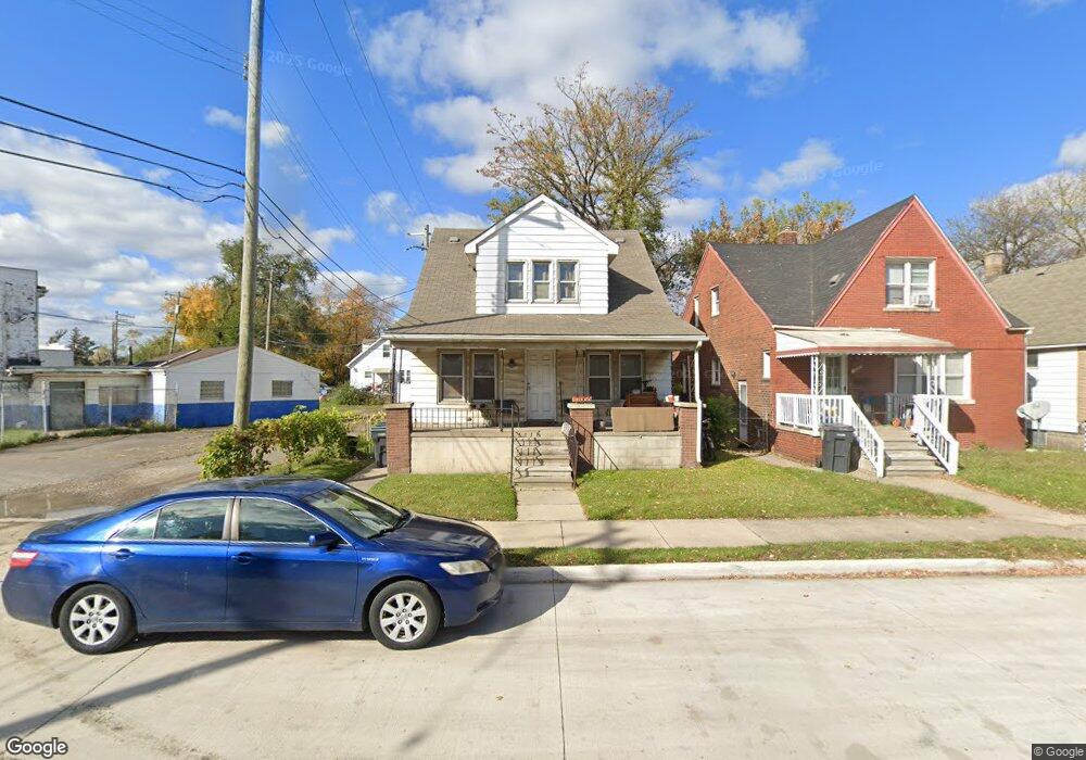
17055 Flora St Melvindale, MI 48122
Estimated Value: $120,000 - $192,000
--
Bed
1
Bath
1,152
Sq Ft
$126/Sq Ft
Est. Value
About This Home
This home is located at 17055 Flora St, Melvindale, MI 48122 and is currently estimated at $145,086, approximately $125 per square foot. 17055 Flora St is a home located in Wayne County with nearby schools including Rogers Early Elementary School, Allendale Elementary School, and Julian O. Strong Middle School.
Ownership History
Date
Name
Owned For
Owner Type
Purchase Details
Closed on
Nov 13, 2008
Sold by
Deutsche Bank National Trust Company
Bought by
Passmore Linda
Current Estimated Value
Purchase Details
Closed on
Oct 10, 2007
Sold by
Delong Timothy G
Bought by
Wells Fargo Bank Na
Purchase Details
Closed on
May 13, 2005
Sold by
Delong Gene
Bought by
Delong Timothy G
Home Financials for this Owner
Home Financials are based on the most recent Mortgage that was taken out on this home.
Original Mortgage
$70,000
Interest Rate
7.87%
Mortgage Type
Stand Alone First
Purchase Details
Closed on
Oct 26, 1990
Sold by
Delong Juanita and Delong Clifford S
Bought by
Delong Juanita
Create a Home Valuation Report for This Property
The Home Valuation Report is an in-depth analysis detailing your home's value as well as a comparison with similar homes in the area
Home Values in the Area
Average Home Value in this Area
Purchase History
| Date | Buyer | Sale Price | Title Company |
|---|---|---|---|
| Passmore Linda | $7,000 | Attorneys Title Agency Llc | |
| Deutsche Bank National Trust Company | -- | Attorneys Title Agency Llc | |
| Wells Fargo Bank Na | $78,778 | None Available | |
| Delong Timothy G | $70,000 | Lawyers Title Ins | |
| Delong Juanita | -- | None Available |
Source: Public Records
Mortgage History
| Date | Status | Borrower | Loan Amount |
|---|---|---|---|
| Previous Owner | Delong Timothy G | $70,000 |
Source: Public Records
Tax History Compared to Growth
Tax History
| Year | Tax Paid | Tax Assessment Tax Assessment Total Assessment is a certain percentage of the fair market value that is determined by local assessors to be the total taxable value of land and additions on the property. | Land | Improvement |
|---|---|---|---|---|
| 2025 | $962 | $61,500 | $0 | $0 |
| 2024 | $962 | $52,700 | $0 | $0 |
| 2023 | $917 | $43,800 | $0 | $0 |
| 2022 | $1,951 | $38,700 | $0 | $0 |
| 2021 | $1,727 | $33,200 | $0 | $0 |
| 2020 | $1,721 | $29,500 | $0 | $0 |
| 2019 | $1,595 | $27,800 | $0 | $0 |
| 2018 | $954 | $28,100 | $0 | $0 |
| 2017 | $1,184 | $25,600 | $0 | $0 |
| 2016 | $1,512 | $24,400 | $0 | $0 |
| 2015 | $2,195 | $22,100 | $0 | $0 |
| 2013 | $2,140 | $22,400 | $0 | $0 |
| 2012 | $1,465 | $21,900 | $2,000 | $19,900 |
Source: Public Records
Map
Nearby Homes
- 17083 Dora St
- 17150 Flora St
- 17206 Flora St
- 17172 Eddon St
- 17579 Park St
- 3589 Caryn St
- 2326 Fisher St
- 3595 Elizabeth St
- 2527 Corbin St
- 0002 Prospect St
- 0001 Prospect St
- 17182 Henry St
- 530 S Colonial St
- 17951 Prospect St
- 1415 S Liddesdale St
- 1409 S Liddesdale St
- 17632 Henry St
- 12836 Conway St
- 1483 S Annabelle St
- 17450 Wood St