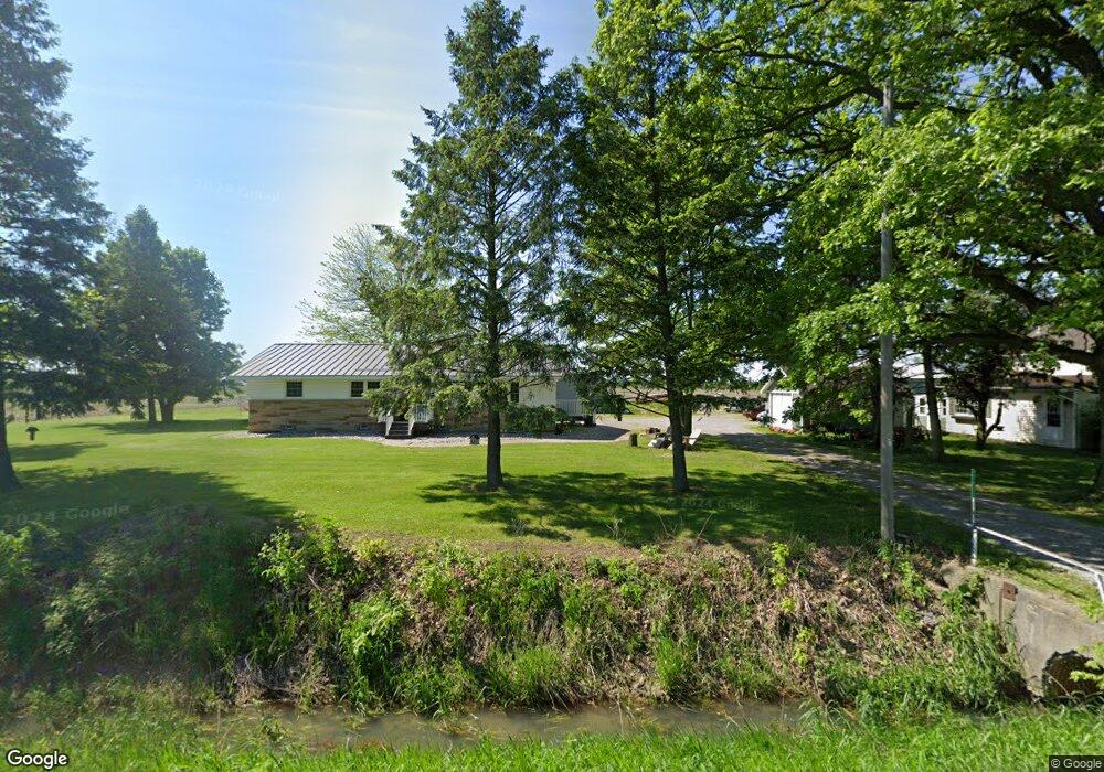
17055 Robinson Rd Bowling Green, OH 43402
Estimated Value: $282,000 - $412,000
3
Beds
1
Bath
1,664
Sq Ft
$199/Sq Ft
Est. Value
About This Home
This home is located at 17055 Robinson Rd, Bowling Green, OH 43402 and is currently estimated at $331,696, approximately $199 per square foot. 17055 Robinson Rd is a home located in Wood County with nearby schools including Otsego Elementary School, Otsego Junior High School, and Otsego High School.
Ownership History
Date
Name
Owned For
Owner Type
Purchase Details
Closed on
Apr 4, 2023
Sold by
Greene Stacey C and Greene Joyce M
Bought by
Greene Family Trust
Current Estimated Value
Purchase Details
Closed on
May 22, 2019
Sold by
Grimm Anna Marie
Bought by
Greene Stacey C and Greene Joyce M
Purchase Details
Closed on
Feb 7, 2019
Sold by
Grimm Donald A and Grimm Terri L
Bought by
Grimm Anna Marie
Purchase Details
Closed on
Sep 18, 2000
Sold by
Grimm Robert L and Grimm Anna Marie
Bought by
Grimm Robert L and Grimm Anna Marie
Purchase Details
Closed on
Jan 1, 1990
Bought by
Grimm Robert L
Create a Home Valuation Report for This Property
The Home Valuation Report is an in-depth analysis detailing your home's value as well as a comparison with similar homes in the area
Home Values in the Area
Average Home Value in this Area
Purchase History
| Date | Buyer | Sale Price | Title Company |
|---|---|---|---|
| Greene Family Trust | -- | None Listed On Document | |
| Greene Stacey C | $151,600 | None Available | |
| Grimm Anna Marie | -- | None Available | |
| Grimm Robert L | -- | -- | |
| Grimm Robert L | -- | -- |
Source: Public Records
Tax History Compared to Growth
Tax History
| Year | Tax Paid | Tax Assessment Tax Assessment Total Assessment is a certain percentage of the fair market value that is determined by local assessors to be the total taxable value of land and additions on the property. | Land | Improvement |
|---|---|---|---|---|
| 2024 | $2,605 | $77,770 | $36,155 | $41,615 |
| 2023 | $2,605 | $75,330 | $36,160 | $39,170 |
| 2022 | $2,235 | $60,200 | $30,940 | $29,260 |
| 2021 | $2,208 | $60,200 | $30,940 | $29,260 |
| 2020 | $2,166 | $60,200 | $30,940 | $29,260 |
| 2019 | $1,871 | $55,510 | $27,580 | $27,930 |
| 2018 | $1,875 | $55,510 | $27,580 | $27,930 |
| 2017 | $1,815 | $55,510 | $27,580 | $27,930 |
| 2016 | $2,123 | $45,720 | $22,370 | $23,350 |
| 2015 | $2,123 | $45,720 | $22,370 | $23,350 |
| 2014 | $1,685 | $45,720 | $22,370 | $23,350 |
| 2013 | $750 | $43,410 | $20,060 | $23,350 |
Source: Public Records
Map
Nearby Homes
- 19537 Liberty Hi Rd
- 109 High St
- 104 E Main St
- 18555 Crom St
- 16890 W River Rd
- 18735 Main St
- 0 Wall St
- 0 River Rd W
- 18142 Tontogany Rd
- 0 Scott Rd
- 0 W River Rd Unit 10000155
- 335 S River Rd
- 0 Kellogg Rd Unit 6125521
- 35 S River Rd
- 21 Pennsylvania Ave
- 320 Ridgepoint Cir
- 0 Noward Rd
- 1248 Applegate St
- 16920 Long Judson Rd
- 16896 Long Judson Rd
- 17071 Robinson Rd
- 17210 Robinson Rd
- 16984 Robinson Rd
- 0 Robinson Rd
- 16637 Robinson Rd
- 17234 Robinson Rd
- 17281 Robinson Rd
- 20425 Green Rd
- 20363 Green Rd
- 20311 Green Rd
- 20398 Green Rd
- 20398 Green Rd
- 20218 Tontogany Rd
- 20640 Green Rd
- 20710 Green Rd
- 17480 Robinson Rd
- 20760 Tontogany Rd
- 20748 Green Rd
- 17064 Bobel Rd
- 20655 Tontogany Rd