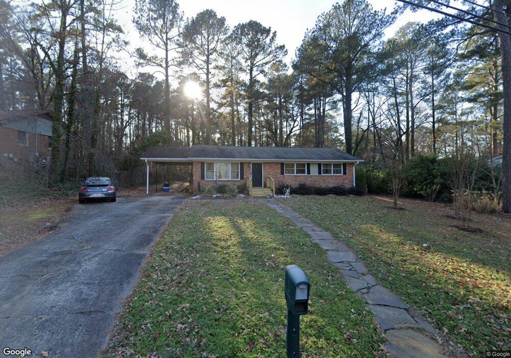
1706 Euclid Rd Durham, NC 27713
Estimated Value: $374,000 - $416,000
3
Beds
2
Baths
1,719
Sq Ft
$229/Sq Ft
Est. Value
About This Home
This home is located at 1706 Euclid Rd, Durham, NC 27713 and is currently estimated at $393,484, approximately $228 per square foot. 1706 Euclid Rd is a home located in Durham County with nearby schools including Parkwood Elementary, Lowe's Grove Middle, and Hillside High School.
Ownership History
Date
Name
Owned For
Owner Type
Purchase Details
Closed on
Feb 14, 2014
Sold by
Covil Elizabeth B
Bought by
Taylor Richard A and Samuels Robin J
Current Estimated Value
Home Financials for this Owner
Home Financials are based on the most recent Mortgage that was taken out on this home.
Original Mortgage
$152,000
Outstanding Balance
$115,571
Interest Rate
4.5%
Mortgage Type
New Conventional
Estimated Equity
$277,913
Create a Home Valuation Report for This Property
The Home Valuation Report is an in-depth analysis detailing your home's value as well as a comparison with similar homes in the area
Home Values in the Area
Average Home Value in this Area
Purchase History
| Date | Buyer | Sale Price | Title Company |
|---|---|---|---|
| Taylor Richard A | $152,000 | None Available |
Source: Public Records
Mortgage History
| Date | Status | Borrower | Loan Amount |
|---|---|---|---|
| Open | Taylor Richard A | $152,000 |
Source: Public Records
Tax History Compared to Growth
Tax History
| Year | Tax Paid | Tax Assessment Tax Assessment Total Assessment is a certain percentage of the fair market value that is determined by local assessors to be the total taxable value of land and additions on the property. | Land | Improvement |
|---|---|---|---|---|
| 2025 | $3,652 | $368,449 | $133,000 | $235,449 |
| 2024 | $3,127 | $224,185 | $40,020 | $184,165 |
| 2023 | $2,937 | $224,185 | $40,020 | $184,165 |
| 2022 | $2,869 | $224,185 | $40,020 | $184,165 |
| 2021 | $2,856 | $224,185 | $40,020 | $184,165 |
| 2020 | $2,789 | $224,185 | $40,020 | $184,165 |
| 2019 | $2,789 | $243,319 | $40,020 | $203,299 |
| 2018 | $2,344 | $172,780 | $36,685 | $136,095 |
| 2017 | $2,326 | $172,780 | $36,685 | $136,095 |
| 2016 | $2,248 | $172,780 | $36,685 | $136,095 |
| 2015 | $1,889 | $136,472 | $30,446 | $106,026 |
| 2014 | $1,889 | $136,472 | $30,446 | $106,026 |
Source: Public Records
Map
Nearby Homes
- 115 Lattimore Ln
- 105 Jennings Ln
- 1621 Clermont Rd
- 1215 Lotus Lilly Dr
- 1304 Seaton Rd Unit 1
- 1203 Lotus Lilly Dr
- 1227 Seaton Rd Unit 54
- 27 Sunflower Ct
- 1039 Laceflower Dr
- 1038 Laceflower Dr
- 1049 Laceflower Dr
- 1107 Rocketcress Dr
- 124 White Crane Ct
- 1003 Canary Pepper Dr
- 5320 Newhall Rd
- 6500 Amber Springs Dr
- 109 Settlers Mill Ln
- 4517 Grandale Dr
- 1445 Sedwick Rd
- 1509 Crimson Creek Dr
- 1710 Euclid Rd
- 1702 Euclid Rd
- 4705 Brentwood Rd
- 1712 Euclid Rd
- 4707 Brentwood Rd
- 1714 Euclid Rd
- 1711 Euclid Rd
- 4709 Brentwood Rd
- 1 Custer Cir
- 4702 Brentwood Rd
- 7 Custer Cir
- 3 Custer Cir
- 1713 Euclid Rd
- 4803 Brentwood Rd
- 1716 Euclid Rd
- 102 Lattimore Ln
- 5 Custer Cir
- 1715 Euclid Rd
- 105 Bradley Cir
- 1718 Euclid Rd