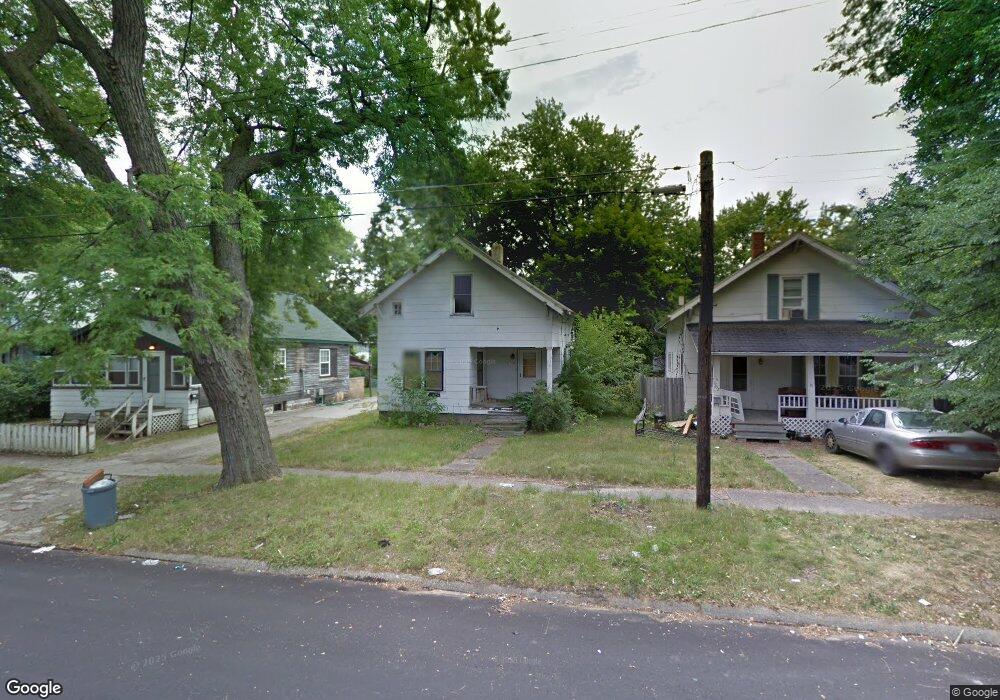
1706 Indiana Ave Flint, MI 48506
Eastside NeighborhoodEstimated Value: $18,990 - $152,000
2
Beds
1
Bath
816
Sq Ft
$85/Sq Ft
Est. Value
About This Home
This home is located at 1706 Indiana Ave, Flint, MI 48506 and is currently estimated at $68,997, approximately $84 per square foot. 1706 Indiana Ave is a home located in Genesee County with nearby schools including Doyle/Ryder School, Flint Cultural Center Academy, and WAY Academy of Flint.
Ownership History
Date
Name
Owned For
Owner Type
Purchase Details
Closed on
Dec 20, 2012
Sold by
Cherry Deborah L and Genesee County Treasurer
Bought by
Genesee County Land Bank
Current Estimated Value
Purchase Details
Closed on
Feb 16, 2010
Sold by
Cook Shannon T
Bought by
Williams Derek C
Purchase Details
Closed on
Nov 20, 2009
Sold by
Kildee Daniel T
Bought by
Cook Shannon
Purchase Details
Closed on
Apr 19, 2006
Sold by
Chera Jatinder and Castro Dunican Jessica
Bought by
Elemenop Investments Unlimited Llc
Purchase Details
Closed on
Apr 11, 2006
Sold by
Isaac Imad and Isaac Patrice
Bought by
Chera Jatinder and Castro Dunican Jessica
Create a Home Valuation Report for This Property
The Home Valuation Report is an in-depth analysis detailing your home's value as well as a comparison with similar homes in the area
Home Values in the Area
Average Home Value in this Area
Purchase History
| Date | Buyer | Sale Price | Title Company |
|---|---|---|---|
| Genesee County Land Bank | -- | None Available | |
| Williams Derek C | $350 | None Available | |
| Cook Shannon | -- | None Available | |
| Elemenop Investments Unlimited Llc | $8,000 | None Available | |
| Chera Jatinder | $6,500 | Metropolitan Title Company | |
| Isaac Imad | -- | Metropolitan Title Company |
Source: Public Records
Tax History
| Year | Tax Paid | Tax Assessment Tax Assessment Total Assessment is a certain percentage of the fair market value that is determined by local assessors to be the total taxable value of land and additions on the property. | Land | Improvement |
|---|---|---|---|---|
| 2025 | -- | $0 | $0 | $0 |
| 2024 | -- | $0 | $0 | $0 |
| 2023 | -- | $0 | $0 | $0 |
| 2022 | $0 | $0 | $0 | $0 |
| 2021 | $0 | $0 | $0 | $0 |
| 2020 | $0 | $0 | $0 | $0 |
| 2019 | $0 | $0 | $0 | $0 |
| 2018 | $0 | $0 | $0 | $0 |
| 2017 | $0 | $0 | $0 | $0 |
| 2016 | $0 | $0 | $0 | $0 |
| 2015 | -- | $0 | $0 | $0 |
| 2014 | -- | $0 | $0 | $0 |
| 2012 | -- | $2,500 | $0 | $0 |
Source: Public Records
Map
Nearby Homes
- 1724 Ohio Ave
- 1609 Ohio Ave
- 1540 Illinois Ave
- 1318 Cronk Ave
- 1622 Arlington Ave
- 1501 Arlington Ave
- 1216 Minnesota Ave
- 1529 Broadway Blvd
- 1805 Bennett Ave
- 2301 Missouri Ave
- 2302 Missouri Ave
- 2218 Kentucky Ave
- 2426 Broadway Blvd
- 1379 Washington Ave
- 2433 Pennsylvania Ave
- 1721 New York Ave
- 2601 Illinois Ave
- 1629 New York Ave
- 2506 Arlington Ave
- 2321 Levern St
- 1702 Indiana Ave
- 1708 Minnesota Ave
- 1718 Indiana Ave
- 1714 Indiana Ave
- 1701 Illinois Ave
- 1658 Indiana Ave
- 1713 Illinois Ave
- 1705 Illinois Ave
- 1709 Illinois Ave
- 1722 Indiana Ave
- 1705 Indiana Ave
- 1701 Indiana Ave
- 1717 Illinois Ave
- 1654 Indiana Ave
- 1657 Illinois Ave
- 1713 Indiana Ave
- 1721 Illinois Ave
- 1726 Indiana Ave
- 1719 Indiana Ave
- 1653 Illinois Ave
Your Personal Tour Guide
Ask me questions while you tour the home.