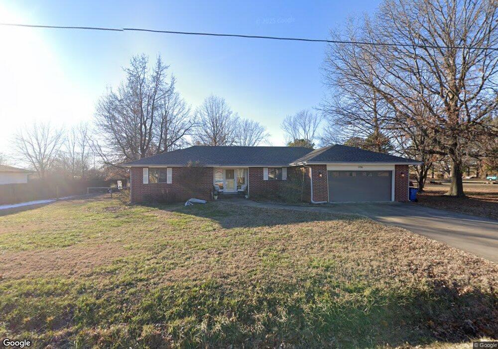
1706 Mayflower Rd Bentonville, AR 72712
Estimated Value: $406,586 - $472,000
3
Beds
3
Baths
1,724
Sq Ft
$256/Sq Ft
Est. Value
About This Home
This home is located at 1706 Mayflower Rd, Bentonville, AR 72712 and is currently estimated at $441,897, approximately $256 per square foot. 1706 Mayflower Rd is a home located in Benton County with nearby schools including Mary Mae Jones Elementary School, Ruth Barker Middle School, and Fulbright Junior High School.
Ownership History
Date
Name
Owned For
Owner Type
Purchase Details
Closed on
Nov 21, 2008
Sold by
Clark Robert W and Clark Margie P
Bought by
Porter Jaron Michael and Porter Jamie Marie
Current Estimated Value
Home Financials for this Owner
Home Financials are based on the most recent Mortgage that was taken out on this home.
Original Mortgage
$164,505
Outstanding Balance
$107,504
Interest Rate
5.99%
Estimated Equity
$334,393
Purchase Details
Closed on
Mar 10, 1998
Bought by
Clark Tr
Purchase Details
Closed on
Jul 31, 1987
Bought by
Clark
Purchase Details
Closed on
Jul 12, 1982
Bought by
Norris
Create a Home Valuation Report for This Property
The Home Valuation Report is an in-depth analysis detailing your home's value as well as a comparison with similar homes in the area
Home Values in the Area
Average Home Value in this Area
Purchase History
| Date | Buyer | Sale Price | Title Company |
|---|---|---|---|
| Porter Jaron Michael | $3,000 | Pinnacle Title Llc | |
| Clark Tr | -- | -- | |
| Clark | $16,000 | -- | |
| Norris | -- | -- |
Source: Public Records
Mortgage History
| Date | Status | Borrower | Loan Amount |
|---|---|---|---|
| Open | Porter Jaron Michael | $164,505 |
Source: Public Records
Tax History Compared to Growth
Tax History
| Year | Tax Paid | Tax Assessment Tax Assessment Total Assessment is a certain percentage of the fair market value that is determined by local assessors to be the total taxable value of land and additions on the property. | Land | Improvement |
|---|---|---|---|---|
| 2025 | $2,354 | $65,328 | $15,300 | $50,028 |
| 2024 | $2,257 | $65,328 | $15,300 | $50,028 |
| 2023 | $2,149 | $42,010 | $9,590 | $32,420 |
| 2022 | $1,731 | $42,010 | $9,590 | $32,420 |
| 2021 | $1,629 | $42,010 | $9,590 | $32,420 |
| 2020 | $1,552 | $30,250 | $5,710 | $24,540 |
| 2019 | $1,552 | $30,250 | $5,710 | $24,540 |
| 2018 | $1,499 | $30,250 | $5,710 | $24,540 |
| 2017 | $1,289 | $30,250 | $5,710 | $24,540 |
| 2016 | $1,289 | $30,250 | $5,710 | $24,540 |
| 2015 | $1,524 | $24,660 | $4,900 | $19,760 |
| 2014 | $1,174 | $24,660 | $4,900 | $19,760 |
Source: Public Records
Map
Nearby Homes
- 1500 Mayflower Rd
- 1711 Mayflower Rd
- 1903 SW Birch St
- 1904 Mayflower Rd
- 1800 SW Sequoia St
- 1902 SW Sequoia St
- 2500 SW Moorland St
- 2503 SW Moorland St
- 2302 SW 15th St
- 2101 SW 20th St
- 1203 SW I St
- 2400 SW I St
- 1900 SW Aspen St
- 1201 & 1203 SW I St
- 2310 SW 17th St
- 1900 SW Aspeen St
- 0 SW I St Unit 1317853
- 2402 SW 17th St
- 1901 SW Columbus Rd
- 42 Cheryl Cir
- 1708 Mayflower Rd
- 1606 Mayflower Rd
- 1707 Mayflower Rd
- 1710 Mayflower Rd
- 1709 Mayflower Rd
- 1701 Mayflower Rd
- 1605 Mayflower Rd
- 1607 Mayflower Rd
- 1802 Mayflower Rd
- 1506 Mayflower Rd
- 1803 Mayflower Rd
- 1804 Mayflower Rd
- 1507 Mayflower Rd
- 1805 Mayflower Rd
- 1807 Mayflower Rd
- 1412 Mayflower Rd
- 1501 Mayflower Rd
- 1808 Mayflower Rd
- 1413 Mayflower Rd
- 1410 Mayflower Rd