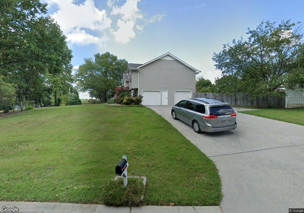
1706 Sutton Dr Dalton, GA 30721
Estimated Value: $283,000 - $316,000
Studio
3
Baths
1,642
Sq Ft
$182/Sq Ft
Est. Value
About This Home
This home is located at 1706 Sutton Dr, Dalton, GA 30721 and is currently estimated at $298,023, approximately $181 per square foot. 1706 Sutton Dr is a home located in Whitfield County with nearby schools including New Hope Elementary School, New Hope Middle School, and Northwest Whitfield County High School.
Ownership History
Date
Name
Owned For
Owner Type
Purchase Details
Closed on
Jun 27, 2003
Sold by
Castillo Isabel and Castillo Hector
Bought by
Mittal Sudeep and Mittal Seema
Current Estimated Value
Purchase Details
Closed on
May 20, 2002
Sold by
Carter Carter M and Carter Beth W
Bought by
Corporate Transfer Service Inc
Purchase Details
Closed on
Oct 1, 1995
Bought by
Carter Carter M and Carter Beth W
Create a Home Valuation Report for This Property
The Home Valuation Report is an in-depth analysis detailing your home's value as well as a comparison with similar homes in the area
Purchase History
| Date | Buyer | Sale Price | Title Company |
|---|---|---|---|
| Mittal Sudeep | $145,000 | -- | |
| Corporate Transfer Service Inc | $141,000 | -- | |
| Castillo Isabel | $141,000 | -- | |
| Carter Carter M | $120,900 | -- |
Source: Public Records
Tax History Compared to Growth
Tax History
| Year | Tax Paid | Tax Assessment Tax Assessment Total Assessment is a certain percentage of the fair market value that is determined by local assessors to be the total taxable value of land and additions on the property. | Land | Improvement |
|---|---|---|---|---|
| 2024 | $2,362 | $114,988 | $16,560 | $98,428 |
| 2023 | $2,004 | $73,891 | $13,320 | $60,571 |
| 2022 | $1,531 | $60,456 | $11,880 | $48,576 |
| 2021 | $1,531 | $60,456 | $11,880 | $48,576 |
| 2020 | $1,502 | $58,164 | $11,880 | $46,284 |
| 2019 | $1,521 | $58,164 | $11,880 | $46,284 |
| 2018 | $1,540 | $58,164 | $11,880 | $46,284 |
| 2017 | $1,522 | $57,585 | $8,730 | $48,855 |
| 2016 | $1,414 | $55,503 | $8,730 | $46,773 |
| 2014 | $1,230 | $53,073 | $6,300 | $46,773 |
| 2013 | -- | $53,072 | $6,300 | $46,772 |
Source: Public Records
Map
Nearby Homes
- 1626 Lagenia Ct
- 1015 S Ridge Dr
- 0 West R W Ridge Dr
- 466 Scarlet Dr
- 126 Andros Dr
- 2256 Waring Rd NW
- 2215 Kerr Rd NW
- 303 Cherokee Trail NW
- 1247 Reed Rd
- 486 Haig Mill Rd
- 213 Grassdale Rd
- 3025 Cleveland Hwy
- 0 Silhouette Way
- 2002 Broadacre Dr NW
- 3201 Maple Grove Dr NW
- 3147 Cleveland Hwy
- 112 Albertson Dr
- 00 Waring Rd NW
- 106 Albertson Dr
- 3450 Misty Meadows Dr NW
- 1710 Sutton Dr
- 1705 Sutton Dr
- 1603 Lagenia Ct
- 0 Sutton Dr Unit 1338510
- 0 Sutton Dr Unit 1381451
- 0 Sutton Dr Unit 48 1381451
- 0 Sutton Dr Unit 48 1338510
- 1712 Sutton Dr
- 1629 Sutton Dr Unit 43
- 1628 Sutton Dr Unit 42
- 1707 Sutton Dr Unit 48
- 1605 Lagenia Ct
- 1709 Sutton Dr
- 42 Lagenia Ct
- 43 Lagenia Ct
- 1612 Lagenia Ct Unit 34
- 35 Lagenia Ct
- 0 Lagenia Ct Unit 118289
- 0 Lagenia Ct Unit RTC2328173
- 0 Lagenia Ct Unit RTC2328172