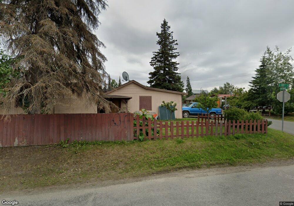
1706 W 32nd Ave Anchorage, AK 99517
Spenard NeighborhoodEstimated Value: $164,000 - $384,000
4
Beds
2
Baths
704
Sq Ft
$413/Sq Ft
Est. Value
About This Home
This home is located at 1706 W 32nd Ave, Anchorage, AK 99517 and is currently estimated at $290,425, approximately $412 per square foot. 1706 W 32nd Ave is a home located in Anchorage Municipality with nearby schools including Northwood Elementary School, Romig Middle School, and West High School.
Ownership History
Date
Name
Owned For
Owner Type
Purchase Details
Closed on
Nov 14, 2011
Sold by
Montanye Bobbie Jo
Bought by
Montanye Michael P
Current Estimated Value
Purchase Details
Closed on
Aug 28, 1987
Sold by
Federal National Mortgage Assn
Bought by
Montanye Michael P
Home Financials for this Owner
Home Financials are based on the most recent Mortgage that was taken out on this home.
Original Mortgage
$48,500
Interest Rate
10.34%
Mortgage Type
Seller Take Back
Create a Home Valuation Report for This Property
The Home Valuation Report is an in-depth analysis detailing your home's value as well as a comparison with similar homes in the area
Home Values in the Area
Average Home Value in this Area
Purchase History
| Date | Buyer | Sale Price | Title Company |
|---|---|---|---|
| Montanye Michael P | -- | None Available | |
| Montanye Michael P | -- | -- | |
| Montanye Michael P | -- | -- |
Source: Public Records
Mortgage History
| Date | Status | Borrower | Loan Amount |
|---|---|---|---|
| Closed | Montanye Michael P | $48,500 |
Source: Public Records
Tax History Compared to Growth
Tax History
| Year | Tax Paid | Tax Assessment Tax Assessment Total Assessment is a certain percentage of the fair market value that is determined by local assessors to be the total taxable value of land and additions on the property. | Land | Improvement |
|---|---|---|---|---|
| 2025 | $2,959 | $269,100 | $84,900 | $184,200 |
| 2024 | $2,959 | $258,300 | $84,900 | $173,400 |
| 2023 | $4,138 | $243,000 | $84,900 | $158,100 |
| 2022 | $3,166 | $235,000 | $84,800 | $150,200 |
| 2021 | $3,667 | $203,500 | $84,800 | $118,700 |
| 2020 | $2,811 | $207,000 | $84,800 | $122,200 |
| 2019 | $2,716 | $207,500 | $84,800 | $122,700 |
| 2018 | $2,662 | $202,900 | $76,900 | $126,000 |
| 2017 | $2,988 | $210,800 | $76,900 | $133,900 |
| 2016 | $2,316 | $195,400 | $72,600 | $122,800 |
| 2015 | $2,316 | $196,900 | $72,600 | $124,300 |
| 2014 | $2,316 | $184,000 | $72,600 | $111,400 |
Source: Public Records
Map
Nearby Homes
- 1508 W 31st Ave
- 3311 Greenland Dr Unit B
- 000 Anchorage
- 3406 Wyoming Dr
- 1407 W 33rd Ave
- 3409 Oregon Dr
- 3507 Greenland Dr
- 3605 Oregon Dr Unit 7
- 3605 Oregon Dr Unit 4
- 2155 W 29th Ave Unit 2
- 3201 Spenard Rd
- 1100 W 32nd Ave Unit 23
- Tr A W Northern Lights Blvd
- 1102 W 29th Ave
- 3731 Mccain Loop
- 1441 W 26th Ave Unit B3
- 1471 W 26th Ave
- 1806 Cleveland Ave
- 1808 Cleveland Ave
- 1010 W 29th Place
- 3203 Wyoming Dr
- L13 B4 W 32nd Ave
- L13 B5 W 32nd Ave
- 3205 Wyoming Dr
- 1800 W 32nd Ave
- 1901 Oregon
- 3204 Greenland Dr
- 3202 Wyoming Dr
- 3200 Greenland Dr
- 3200 Greenland Dr
- 3204 Wyoming Dr
- 3209 Wyoming Dr
- 3209 Wyoming Dr
- 3206 Greenland Dr
- 3206 Wyoming Dr
- 3208 Greenland Dr
- 3208 Wyoming Dr
- 3213 Wyoming Dr
- 3210 Greenland Dr
- 3210 Wyoming Dr