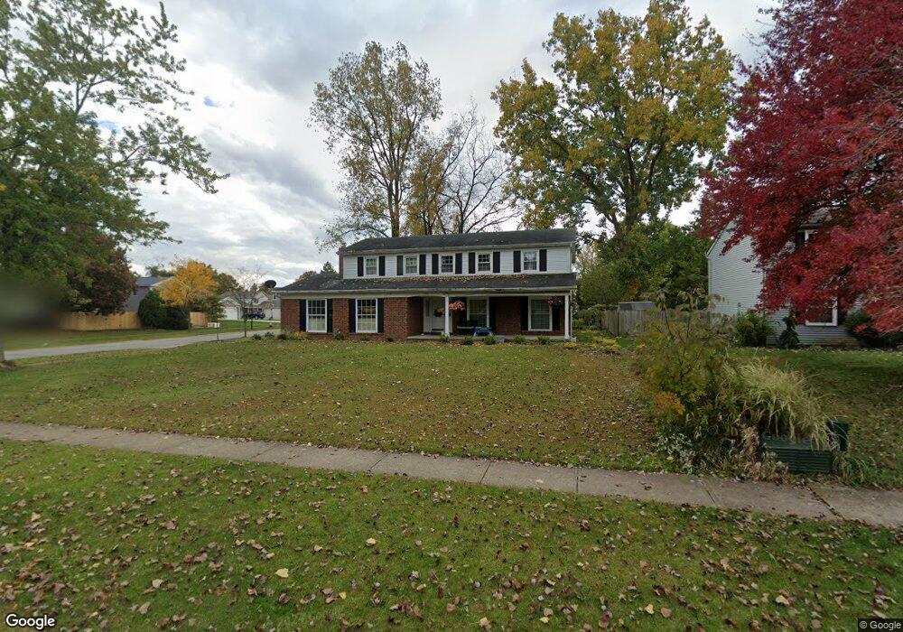
17061 Hunting Meadows Dr Strongsville, OH 44136
Estimated Value: $339,307 - $387,000
4
Beds
3
Baths
2,220
Sq Ft
$164/Sq Ft
Est. Value
About This Home
This home is located at 17061 Hunting Meadows Dr, Strongsville, OH 44136 and is currently estimated at $364,327, approximately $164 per square foot. 17061 Hunting Meadows Dr is a home located in Cuyahoga County with nearby schools including Strongsville High School and Sts Joseph & John Interparochial School.
Ownership History
Date
Name
Owned For
Owner Type
Purchase Details
Closed on
Oct 19, 2001
Sold by
Kaszei Richard A
Bought by
Ly Heng H
Current Estimated Value
Purchase Details
Closed on
Jan 30, 1995
Sold by
Kishel William E
Bought by
Kaszei Richard A
Home Financials for this Owner
Home Financials are based on the most recent Mortgage that was taken out on this home.
Original Mortgage
$114,000
Interest Rate
9.99%
Mortgage Type
New Conventional
Purchase Details
Closed on
Jan 5, 1987
Sold by
Jumshyd Ali
Bought by
Kishel William E
Purchase Details
Closed on
Jun 27, 1978
Bought by
Jumshyd Ali
Purchase Details
Closed on
Jan 1, 1975
Bought by
Parkview Corp
Create a Home Valuation Report for This Property
The Home Valuation Report is an in-depth analysis detailing your home's value as well as a comparison with similar homes in the area
Home Values in the Area
Average Home Value in this Area
Purchase History
| Date | Buyer | Sale Price | Title Company |
|---|---|---|---|
| Ly Heng H | $162,000 | -- | |
| Kaszei Richard A | $150,000 | -- | |
| Kishel William E | $92,000 | -- | |
| Jumshyd Ali | $89,900 | -- | |
| Parkview Corp | -- | -- |
Source: Public Records
Mortgage History
| Date | Status | Borrower | Loan Amount |
|---|---|---|---|
| Previous Owner | Kaszei Richard A | $114,000 |
Source: Public Records
Tax History Compared to Growth
Tax History
| Year | Tax Paid | Tax Assessment Tax Assessment Total Assessment is a certain percentage of the fair market value that is determined by local assessors to be the total taxable value of land and additions on the property. | Land | Improvement |
|---|---|---|---|---|
| 2024 | $4,892 | $104,195 | $22,680 | $81,515 |
| 2023 | $4,804 | $76,730 | $19,220 | $57,510 |
| 2022 | $4,770 | $76,720 | $19,220 | $57,510 |
| 2021 | $4,732 | $76,720 | $19,220 | $57,510 |
| 2020 | $4,385 | $62,900 | $15,750 | $47,150 |
| 2019 | $4,256 | $179,700 | $45,000 | $134,700 |
| 2018 | $3,755 | $62,900 | $15,750 | $47,150 |
| 2017 | $3,716 | $56,010 | $12,710 | $43,300 |
| 2016 | $3,685 | $56,010 | $12,710 | $43,300 |
| 2015 | $3,738 | $56,010 | $12,710 | $43,300 |
| 2014 | $3,738 | $56,010 | $12,710 | $43,300 |
Source: Public Records
Map
Nearby Homes
- 18162 Fawn Cir
- 16650 Lanier Ave
- 17024 Bear Creek Ln
- 18630 Shurmer Rd
- 17159 Turkey Meadow Ln
- 17682 Drake Rd
- 15639 Indianhead Ln
- 16450 Howe Rd
- 18294 Drake Rd
- 19311 Bradford Ct
- 17934 Cambridge Oval
- 14826 Lenox Dr
- 14703 Lenox Dr Unit 103
- 19297 Lauren Way
- 17259 Woodshire Dr
- 16486 S Red Rock Dr
- 19513 Lunn Rd
- 18411 Yorktown Oval
- 17130 Golden Star Dr
- 19160 Wheelers Ln
- 17065 Hunting Meadows Dr
- 17037 Deer Path Dr
- 17051 Hunting Meadows Dr
- 17069 Hunting Meadows Dr
- 17019 Partridge Dr
- 17033 Deer Path Dr
- 17060 Hunting Meadows Dr
- 17064 Hunting Meadows Dr
- 17038 Deer Path Dr
- 17049 Hunting Meadows Dr
- 17023 Partridge Dr
- 17050 Hunting Meadows Dr
- 17068 Hunting Meadows Dr
- 17034 Deer Path Dr
- 17027 Deer Path Dr
- 17070 Hunting Meadows Dr
- 17048 Hunting Meadows Dr
- 17045 Hunting Meadows Dr
- 17026 Deer Path Dr
- 17029 Partridge Dr