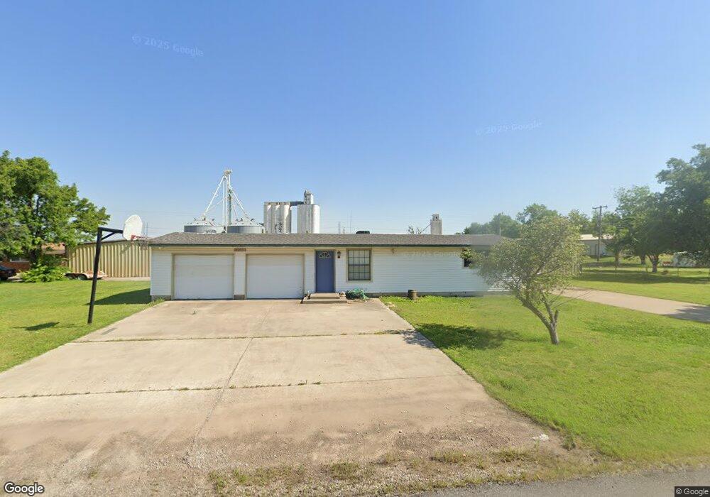
17067 Darren Ave El Reno, OK 73036
Estimated Value: $110,000 - $273,000
1
Bed
1
Bath
5,664
Sq Ft
$31/Sq Ft
Est. Value
About This Home
This home is located at 17067 Darren Ave, El Reno, OK 73036 and is currently estimated at $174,842, approximately $30 per square foot. 17067 Darren Ave is a home with nearby schools including Banner School.
Ownership History
Date
Name
Owned For
Owner Type
Purchase Details
Closed on
Oct 14, 2021
Sold by
Dobos Arthur P and Dobos Patricia A
Bought by
Dobos Patricia A
Current Estimated Value
Purchase Details
Closed on
Feb 2, 2012
Sold by
Dobos Arthur and Dobos Patricia A
Bought by
Dobos Arthur P and Dobos Patricia A
Purchase Details
Closed on
Sep 3, 1999
Sold by
Heinrich Phil and Heinrich Glenda K
Purchase Details
Closed on
Feb 20, 1998
Sold by
Lair,Sylvan G Trustee
Purchase Details
Closed on
Sep 20, 1995
Sold by
Lair Samuel Lee
Purchase Details
Closed on
Apr 20, 1993
Sold by
Lair,Sylvan G Revoc Trust
Purchase Details
Closed on
Dec 23, 1992
Sold by
Lair Sylvan G
Create a Home Valuation Report for This Property
The Home Valuation Report is an in-depth analysis detailing your home's value as well as a comparison with similar homes in the area
Home Values in the Area
Average Home Value in this Area
Purchase History
| Date | Buyer | Sale Price | Title Company |
|---|---|---|---|
| Dobos Patricia A | -- | None Available | |
| Dobos Arthur P | -- | None Available | |
| -- | $86,000 | -- | |
| -- | $80,000 | -- | |
| -- | -- | -- | |
| -- | -- | -- | |
| -- | -- | -- |
Source: Public Records
Tax History Compared to Growth
Tax History
| Year | Tax Paid | Tax Assessment Tax Assessment Total Assessment is a certain percentage of the fair market value that is determined by local assessors to be the total taxable value of land and additions on the property. | Land | Improvement |
|---|---|---|---|---|
| 2024 | $1,146 | $15,769 | $600 | $15,169 |
| 2023 | $1,146 | $15,018 | $2,655 | $12,363 |
| 2022 | $1,101 | $14,303 | $2,655 | $11,648 |
| 2021 | $1,054 | $13,622 | $2,655 | $10,967 |
| 2020 | $991 | $12,974 | $2,655 | $10,319 |
| 2019 | $949 | $12,356 | $2,655 | $9,701 |
| 2018 | $975 | $12,506 | $2,655 | $9,851 |
| 2017 | $990 | $12,603 | $2,509 | $10,094 |
| 2016 | $925 | $12,603 | $2,509 | $10,094 |
| 2015 | -- | $11,431 | $664 | $10,767 |
| 2014 | -- | $11,431 | $664 | $10,767 |
Source: Public Records
Map
Nearby Homes
- 11020 N Banner Rd
- 3501 Manning Farms Blvd
- 4160 N Gregory Rd
- 8592 Beth Ln
- 8652 Beth Ln
- 4115 S Manning Rd
- 8384 Rip Way
- 8664 Rip Way
- 8634 Rip Way
- 8604 Rip Way
- 8454 Rip Way
- 8574 Rip Way
- 7145 S Manning Rd
- 3550 N Manning Rd
- 4747 Dutton Cir
- 8626 Kayce St
- 8545 Kayce St
- 8625 Kayce St
- 8655 Kayce St
- 8595 Kayce St
- 17103 Darren Ave
- 17064 Darren Ave
- 17048 White St
- 17088 Darren Ave
- 17043 Darren Ave
- 17127 Darren Ave
- 17032 Darren Ave
- 17021 Darren Ave
- 4065 N Banner Rd
- 17143 Darren Ave
- 17051 White St
- 17164 Darren Ave
- 3905 N Banner Rd
- 3905 N Banner Rd
- 4115 N Banner Rd
- 3855 N Banner Rd
- 17183 Darren Ave
- 4123 N Banner Rd
- 3805 N Banner Rd
- 9225 Us Highway 66 E