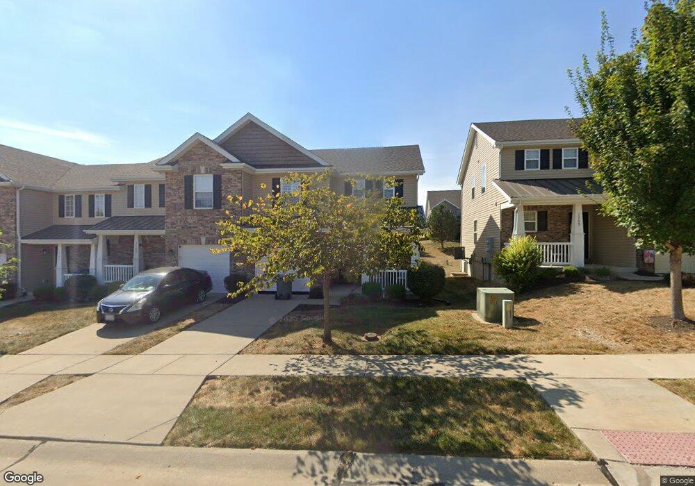
1707 Bromfield Ct O Fallon, MO 63366
Estimated Value: $263,000 - $267,000
About This Home
This home is located at 1707 Bromfield Ct, O Fallon, MO 63366 and is currently estimated at $264,665, approximately $189 per square foot. 1707 Bromfield Ct is a home located in St. Charles County with nearby schools including Mount Hope Elementary School, Fort Zumwalt North Middle School, and Fort Zumwalt North High School.
Ownership History
We collect this data history from publicly available records. To have your information removed, we recommend requesting removal directly through your county’s website.
Purchase Details
Purchase Details
Home Financials for this Owner
Home Financials are based on the most recent Mortgage that was taken out on this home.Home Values in the Area
Average Home Value in this Area
Purchase History
We collect this data history from publicly available records. To have your information removed, we recommend requesting removal directly through your county’s website.
| Date | Buyer | Sale Price | Title Company |
|---|---|---|---|
| -- | None Available | ||
| -- | Benchmark Title Llc |
Mortgage History
We collect this data history from publicly available records. To have your information removed, we recommend requesting removal directly through your county’s website.
| Date | Status | Borrower | Loan Amount |
|---|---|---|---|
| Open | $55,000 |
Tax History
We collect this data history from publicly available records. To have your information removed, we recommend requesting removal directly through your county’s website.
| Year | Tax Paid | Tax Assessment Tax Assessment Total Assessment is a certain percentage of the fair market value that is determined by local assessors to be the total taxable value of land and additions on the property. | Land | Improvement |
|---|---|---|---|---|
| 2025 | $2,679 | $42,897 | -- | -- |
| 2024 | $2,679 | $40,290 | -- | -- |
| 2023 | $2,680 | $40,290 | -- | -- |
| 2022 | $2,249 | $31,390 | $0 | $0 |
| 2021 | $2,251 | $31,390 | $0 | $0 |
| 2020 | $2,423 | $32,836 | $0 | $0 |
| 2019 | $2,428 | $32,836 | $0 | $0 |
| 2018 | $2,137 | $27,550 | $0 | $0 |
| 2017 | $2,103 | $27,550 | $0 | $0 |
| 2016 | $2,111 | $27,550 | $0 | $0 |
| 2015 | $1,197 | $1,900 | $0 | $0 |
| 2014 | $137 | $1,900 | $0 | $0 |
Map
- 207 Bluestem Ln
- 941 Crestwood Ln
- 1358 Woodgrove Park Dr
- 509 Gaslite Dr
- 915 Crestwood Ln
- 58 Fawn Oaks Dr
- 11 Fawn View Ln
- 33 Royal Oaks Dr
- 3.59 Acres Matteson Blvd
- 7.19 Acres Matteson Blvd
- 3.6 Acres Matteson Blvd
- 185 Roxbury Dr
- 208 Lorene Dr
- 703 Wayland Dr
- 992 Tilestone Dr
- 218 Park Ridge Dr Unit 60A
- 2 Doe Valley Ct
- 1628 Thurston Ct
- 710 Longfellow Cir
- 2011 Alana Ln
- 1300 New Charter Ln
- 1300 New Charter Ln Unit 52D
- 1302 New Charter Ln
- 1302 New Charter Ln Unit 53D
- 1304 New Charter Ln
- 1304 New Charter Ln Unit 54D
- 1306 New Charter Ln
- 1310 New Charter Ln
- 1703 Bromfield Ct
- 1705 Bromfield Ct
- 1705 Bromfield Ct Unit 44D
- 1701 Bromfield Ct
- 1701 Bromfield Ct Unit 42D
- 1707 Bromfield Ct Unit 45D
- 1312 New Charter Ln
- 1312 New Charter Ln Unit 57D
- 1278 Woodgrove Park Dr
- 1278 Woodgrove Park Dr Unit 40D
- 1276 Woodgrove Park Dr Unit 39D
- 1276 Woodgrove Park Dr
Ask me questions while you tour the home.