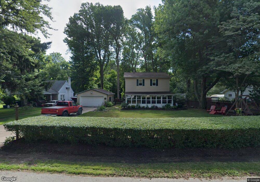
1707 Brookside Dr Erie, PA 16505
Millcreek NeighborhoodEstimated Value: $196,348 - $256,000
3
Beds
2
Baths
1,388
Sq Ft
$158/Sq Ft
Est. Value
About This Home
This home is located at 1707 Brookside Dr, Erie, PA 16505 and is currently estimated at $219,587, approximately $158 per square foot. 1707 Brookside Dr is a home located in Erie County with nearby schools including Westlake Middle School, McDowell High School, and Tracy Elementary School.
Ownership History
Date
Name
Owned For
Owner Type
Purchase Details
Closed on
May 29, 2009
Sold by
Colvin Stephen C and Colvin Beth
Bought by
Colvin Stephen C
Current Estimated Value
Home Financials for this Owner
Home Financials are based on the most recent Mortgage that was taken out on this home.
Original Mortgage
$105,000
Outstanding Balance
$66,519
Interest Rate
4.82%
Mortgage Type
New Conventional
Estimated Equity
$153,068
Purchase Details
Closed on
Nov 4, 2002
Sold by
Chambers Jeffrey A and Chambers Cherie L
Bought by
Colvin Stephen C and Colvin Beth
Create a Home Valuation Report for This Property
The Home Valuation Report is an in-depth analysis detailing your home's value as well as a comparison with similar homes in the area
Home Values in the Area
Average Home Value in this Area
Purchase History
| Date | Buyer | Sale Price | Title Company |
|---|---|---|---|
| Colvin Stephen C | -- | None Available | |
| Colvin Stephen C | $89,900 | -- |
Source: Public Records
Mortgage History
| Date | Status | Borrower | Loan Amount |
|---|---|---|---|
| Open | Colvin Stephen C | $105,000 |
Source: Public Records
Tax History Compared to Growth
Tax History
| Year | Tax Paid | Tax Assessment Tax Assessment Total Assessment is a certain percentage of the fair market value that is determined by local assessors to be the total taxable value of land and additions on the property. | Land | Improvement |
|---|---|---|---|---|
| 2025 | $2,831 | $103,010 | $24,200 | $78,810 |
| 2024 | $2,757 | $103,010 | $24,200 | $78,810 |
| 2023 | $2,603 | $103,010 | $24,200 | $78,810 |
| 2022 | $2,501 | $103,010 | $24,200 | $78,810 |
| 2021 | $2,474 | $103,010 | $24,200 | $78,810 |
| 2020 | $2,448 | $103,010 | $24,200 | $78,810 |
| 2019 | $2,407 | $103,010 | $24,200 | $78,810 |
| 2018 | $2,348 | $103,010 | $24,200 | $78,810 |
| 2017 | $2,343 | $103,010 | $24,200 | $78,810 |
| 2016 | $2,731 | $103,010 | $24,200 | $78,810 |
| 2015 | $2,705 | $103,010 | $24,200 | $78,810 |
| 2014 | $874 | $103,010 | $24,200 | $78,810 |
Source: Public Records
Map
Nearby Homes
- 0 W Lake Rd Unit 187118
- 0 W Lake Rd Unit 157295
- 4845 W Lake Rd
- 2954 Old West Lake Rd
- 5064 Wolf Run Dr
- 5110 Wolf Run Dr
- 4825 W 23 St
- 5031 Wolf Rd
- 1715 Millfair Rd
- 5520 Fulda Dr
- 4028 W Lake Rd
- 2721 W Park Ln
- 1027 Kerry Ln
- 5552 W Ridge Rd
- 2718 E Park Ln
- 5075 Saybrook Place
- 2713 Ganzer Ln
- 5080 Saybrook Place
- 4512 S Park Ln Unit 4512
- 5360 Wolf Rd
- 1643 Brookside Dr
- 1651 Brookside Dr
- 1719 Brookside Dr
- 0 Brookside Dr
- 1637 Brookside Dr
- 1629 Brookside Dr
- 1728 Brookside Dr
- 1737 Brookside Dr
- 1704 Brookside Dr
- 1722 Brookside Dr
- 1702 Brookside Dr
- 1725 Brookside Dr
- 1734 Brookside Dr
- 1638 Brookside Dr
- 1633 Brookside Dr
- 1617 Brookside Dr
- 1740 Brookside Dr
- 1719 Westwood Dr
- 1701 Westwood Dr
- 1734 Woodside Dr