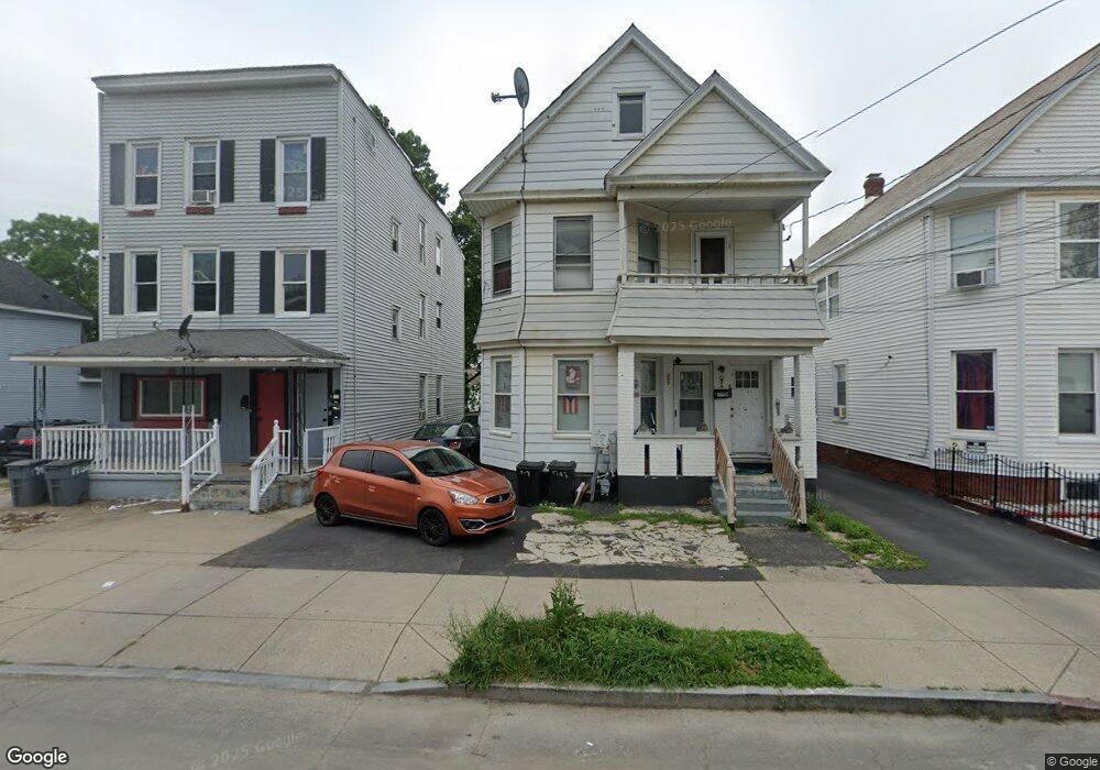
1707 Carrie St Schenectady, NY 12308
Estimated Value: $192,848 - $273,000
4
Beds
2
Baths
2,000
Sq Ft
$120/Sq Ft
Est. Value
About This Home
This home is located at 1707 Carrie St, Schenectady, NY 12308 and is currently estimated at $239,212, approximately $119 per square foot. 1707 Carrie St is a home located in Schenectady County with nearby schools including Jessie T Zoller School, Oneida Middle School, and Schenectady High School.
Ownership History
Date
Name
Owned For
Owner Type
Purchase Details
Closed on
Jul 28, 2006
Sold by
Balkissoon Ram
Bought by
Permal Lenny
Current Estimated Value
Home Financials for this Owner
Home Financials are based on the most recent Mortgage that was taken out on this home.
Original Mortgage
$7,900
Outstanding Balance
$4,704
Interest Rate
6.8%
Mortgage Type
Unknown
Estimated Equity
$234,508
Purchase Details
Closed on
Nov 9, 2000
Sold by
Defilippo
Bought by
Dicaprio Amalia L and Dicaprio E
Create a Home Valuation Report for This Property
The Home Valuation Report is an in-depth analysis detailing your home's value as well as a comparison with similar homes in the area
Purchase History
| Date | Buyer | Sale Price | Title Company |
|---|---|---|---|
| Permal Lenny | $79,000 | Katherine Grifferty | |
| Dicaprio Amalia L | -- | -- |
Source: Public Records
Mortgage History
| Date | Status | Borrower | Loan Amount |
|---|---|---|---|
| Open | Permal Lenny | $7,900 | |
| Open | Permal Lenny | $71,100 |
Source: Public Records
Tax History
| Year | Tax Paid | Tax Assessment Tax Assessment Total Assessment is a certain percentage of the fair market value that is determined by local assessors to be the total taxable value of land and additions on the property. | Land | Improvement |
|---|---|---|---|---|
| 2024 | $4,827 | $74,800 | $11,200 | $63,600 |
| 2023 | $47 | $74,800 | $11,200 | $63,600 |
| 2022 | $4,506 | $74,800 | $11,200 | $63,600 |
| 2021 | $4,468 | $74,800 | $11,200 | $63,600 |
| 2020 | $4,382 | $74,800 | $11,200 | $63,600 |
| 2019 | $4,419 | $74,800 | $11,200 | $63,600 |
| 2018 | $4,419 | $74,800 | $11,200 | $63,600 |
| 2017 | $4,431 | $74,800 | $11,200 | $63,600 |
Source: Public Records
Map
Nearby Homes
- 1712 Foster Ave
- 1732 Carrie St
- 1725 van Vranken Ave
- 1616 Foster Ave
- 1606 Foster Ave
- 1602 Foster Ave
- 531 Hattie St
- 1857 Foster Ave
- 431 Clarendon St
- 506 Hattie St
- 1584 Avenue A
- 905 Mason St
- 435 Manhattan St
- 603 Nott St
- L1 Lenox Rd
- 1593 Randolph Rd
- 2004 Foster Ave
- 1818 Lenox Rd
- L3 Maxon Rd
- 910 Gerling St
- 1701 Carrie St Unit 3
- 1701 Carrie St
- 1711 Carrie St
- 1703 Carrie St
- 1693 Carrie St
- 1701 Carrie St
- 1677 Carrie St
- 1685 Carrie St
- 1719 Carrie St
- 1698 Foster Ave
- 1694 Foster Ave
- 1702 Foster Ave
- 1702 Carrie St
- 1665 Carrie St
- 1708 Foster Ave
- 1686 Foster Ave
- 1671 Carrie St
- 1688 Carrie St
- 1706 Carrie St
- 1710 Carrie St
Your Personal Tour Guide
Ask me questions while you tour the home.