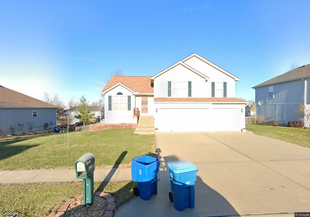
1707 Debrah Dr Kearney, MO 64060
Estimated Value: $320,000 - $365,000
3
Beds
2
Baths
1,524
Sq Ft
$224/Sq Ft
Est. Value
About This Home
This home is located at 1707 Debrah Dr, Kearney, MO 64060 and is currently estimated at $341,646, approximately $224 per square foot. 1707 Debrah Dr is a home located in Clay County with nearby schools including Kearney Junior High School and Kearney High School.
Ownership History
Date
Name
Owned For
Owner Type
Purchase Details
Closed on
Jul 1, 2024
Sold by
Wilcox Timothy and Wilcox Lori
Bought by
Timothy And Lori Wilcox Living Trust and Wilcox
Current Estimated Value
Purchase Details
Closed on
Jun 8, 2009
Sold by
Wilcox Timothy and Wilcox Lori
Bought by
Wilcox Timothy and Wilcox Lori
Purchase Details
Closed on
May 20, 2005
Sold by
Lappe Patrick C and Lappe Leann M
Bought by
Wilcox Timothy
Home Financials for this Owner
Home Financials are based on the most recent Mortgage that was taken out on this home.
Original Mortgage
$142,400
Interest Rate
5.87%
Mortgage Type
Fannie Mae Freddie Mac
Purchase Details
Closed on
Aug 19, 2002
Sold by
Our 3 Sons Llc
Bought by
Lappe Patrick C and Lappe Leann M
Home Financials for this Owner
Home Financials are based on the most recent Mortgage that was taken out on this home.
Original Mortgage
$152,950
Interest Rate
6.6%
Create a Home Valuation Report for This Property
The Home Valuation Report is an in-depth analysis detailing your home's value as well as a comparison with similar homes in the area
Home Values in the Area
Average Home Value in this Area
Purchase History
| Date | Buyer | Sale Price | Title Company |
|---|---|---|---|
| Timothy And Lori Wilcox Living Trust | -- | None Listed On Document | |
| Wilcox Timothy | -- | None Available | |
| Wilcox Timothy | -- | Advantage Title Llc | |
| Lappe Patrick C | -- | Thomson Title Corp |
Source: Public Records
Mortgage History
| Date | Status | Borrower | Loan Amount |
|---|---|---|---|
| Previous Owner | Wilcox Timothy | $142,400 | |
| Previous Owner | Lappe Patrick C | $152,950 |
Source: Public Records
Tax History
| Year | Tax Paid | Tax Assessment Tax Assessment Total Assessment is a certain percentage of the fair market value that is determined by local assessors to be the total taxable value of land and additions on the property. | Land | Improvement |
|---|---|---|---|---|
| 2025 | $3,067 | $49,890 | -- | -- |
| 2024 | $3,067 | $44,760 | -- | -- |
| 2023 | $3,057 | $44,760 | $0 | $0 |
| 2022 | $2,708 | $38,340 | $0 | $0 |
| 2021 | $2,654 | $38,342 | $6,650 | $31,692 |
| 2020 | $2,705 | $35,530 | $0 | $0 |
| 2019 | $2,690 | $35,530 | $0 | $0 |
Source: Public Records
Map
Nearby Homes
- 1102 Melody Ct
- 1207 E 15th St
- 1818 Lauren Ln
- 801 Southbrook Pkwy
- 1300 Melissa Ct
- 21421 Jesse James Farm Rd
- 709 Feldspar St
- 1710 Rockwater Ln
- 1307 Stonecrest Dr
- 1505 Emerald Cir
- 623 E 13th St
- 1209 Noah's Ln
- 1204 Noah's Ln
- 1300 Robin Cir
- 1202 Noah Ln
- 2305 Larkspur Ln
- 2118 Glenside Rd
- 919 E 8th Cir
- 905 Susan St
- 2318 Larkspur Ln
- 1705 Debrah Dr
- 1709 Debrah Dr
- 1708 Clear Creek Dr
- 1704 Clear Creek Dr
- 1000 Erica Ct
- 1711 Debrah Dr
- 1703 Debrah Dr
- 1702 Clear Creek Dr
- 1704 Debrah Dr
- 1712 Debrah Dr
- 1713 Debrah Dr
- 1002 Erica Ct
- 1712 Clear Creek Dr
- 1701 Debrah Dr
- 1702 Debrah Dr
- 1705 Clear Creek Dr
- 1703 Clear Creek Dr
- 1700 Clear Creek Dr
- 1800 Debrah Dr
- 1004 Erica Ct
Your Personal Tour Guide
Ask me questions while you tour the home.