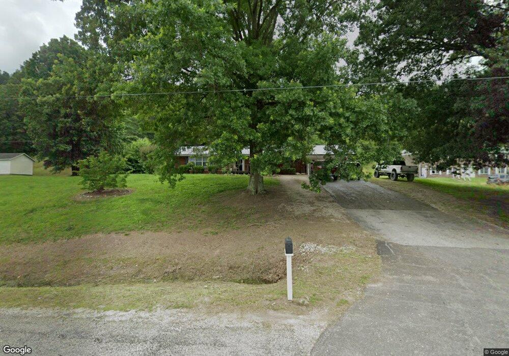
1707 E Us Highway 60 Grayson, KY 41143
Estimated Value: $144,000 - $299,000
3
Beds
2
Baths
1,992
Sq Ft
$109/Sq Ft
Est. Value
About This Home
This home is located at 1707 E Us Highway 60, Grayson, KY 41143 and is currently estimated at $217,472, approximately $109 per square foot. 1707 E Us Highway 60 is a home located in Carter County with nearby schools including Prichard Elementary School, East Carter Middle School, and East Carter County High School.
Ownership History
Date
Name
Owned For
Owner Type
Purchase Details
Closed on
Jun 9, 2023
Sold by
Dirt Slingers Excavation Llc
Bought by
Boheim Christopher M
Current Estimated Value
Purchase Details
Closed on
Jul 1, 2022
Sold by
Jane Hall Sally and Jane Ralph D
Bought by
Dirt Slingers Excavation Llc
Purchase Details
Closed on
Aug 26, 2019
Sold by
Criswell Roger and Criswell Connie
Bought by
Morgan May Jessica and Morgan May
Purchase Details
Closed on
Jun 17, 2019
Sold by
Wilburn Donna and Wilburn Wade
Bought by
Morgan May Jessica and Morgan May
Create a Home Valuation Report for This Property
The Home Valuation Report is an in-depth analysis detailing your home's value as well as a comparison with similar homes in the area
Home Values in the Area
Average Home Value in this Area
Purchase History
| Date | Buyer | Sale Price | Title Company |
|---|---|---|---|
| Boheim Christopher M | $80,000 | None Listed On Document | |
| Dirt Slingers Excavation Llc | $280,000 | W Jeffrey Scott Psc | |
| Morgan May Jessica | $30,000 | None Available | |
| Morgan May Jessica | -- | None Available |
Source: Public Records
Tax History
| Year | Tax Paid | Tax Assessment Tax Assessment Total Assessment is a certain percentage of the fair market value that is determined by local assessors to be the total taxable value of land and additions on the property. | Land | Improvement |
|---|---|---|---|---|
| 2025 | $746 | $87,500 | $0 | $0 |
| 2024 | $751 | $87,500 | $0 | $0 |
| 2023 | $754 | $87,500 | $0 | $0 |
| 2022 | $757 | $87,500 | $0 | $0 |
| 2021 | $772 | $87,500 | $0 | $0 |
| 2020 | $774 | $87,500 | $5,000 | $82,500 |
| 2019 | $425 | $87,500 | $5,000 | $82,500 |
| 2018 | $440 | $87,500 | $5,000 | $82,500 |
| 2017 | $420 | $87,500 | $5,000 | $82,500 |
| 2016 | $425 | $87,500 | $5,000 | $82,500 |
| 2015 | $415 | $87,500 | $5,000 | $82,500 |
| 2014 | $422 | $87,500 | $0 | $0 |
| 2011 | $431 | $87,500 | $0 | $0 |
Source: Public Records
Map
Nearby Homes
- 102 Wildcat Dr
- 0 Upper Stinson Rd
- 1671 E Midland Trail
- 1113 Kristy Dr
- 1180 E Maple St
- Lot #2 Greenbrier Plantations Phase 1
- Lot #10 Greenbrier Plantations Phase 1
- 3.95 acres Plantation Dr
- Lot #7 Greenbrier Plantations Phase 1
- Lot #15 Greenbrier Plantations Phase 1
- Lot #11 Greenbrier Plantations Phase 1
- Lot #13 Greenbrier Plantations Phase 1
- 100 Driftwood Ln
- 64 Tara Ct
- 76 Cutter Dr
- 2659 E US Highway 60
- 817 Cherrywood Ln
- 218 Fox Run Rd
- 710 Elm St
- 711 Circle Dr
- 1711 E Us Highway 60
- 1711 U S 60
- 1717 Carroll Cir
- 1725 Carroll Cir
- 1619 Carroll Cir
- 1731 Carroll Cir
- 165 Wildcat Dr
- 155 Wildcat Dr
- 145 Wildcat Dr
- 135 Wildcat Dr
- 154 Wildcat Dr
- 127 Wildcat Dr
- 1600 E Us Highway 60
- 144 Wildcat Dr
- 121 Wildcat Dr
- 134 Wildcat Dr
- 0 Wildcat Dr
- 201 Stone St
- 126 Wildcat Dr
- 205 Stone St
Your Personal Tour Guide
Ask me questions while you tour the home.