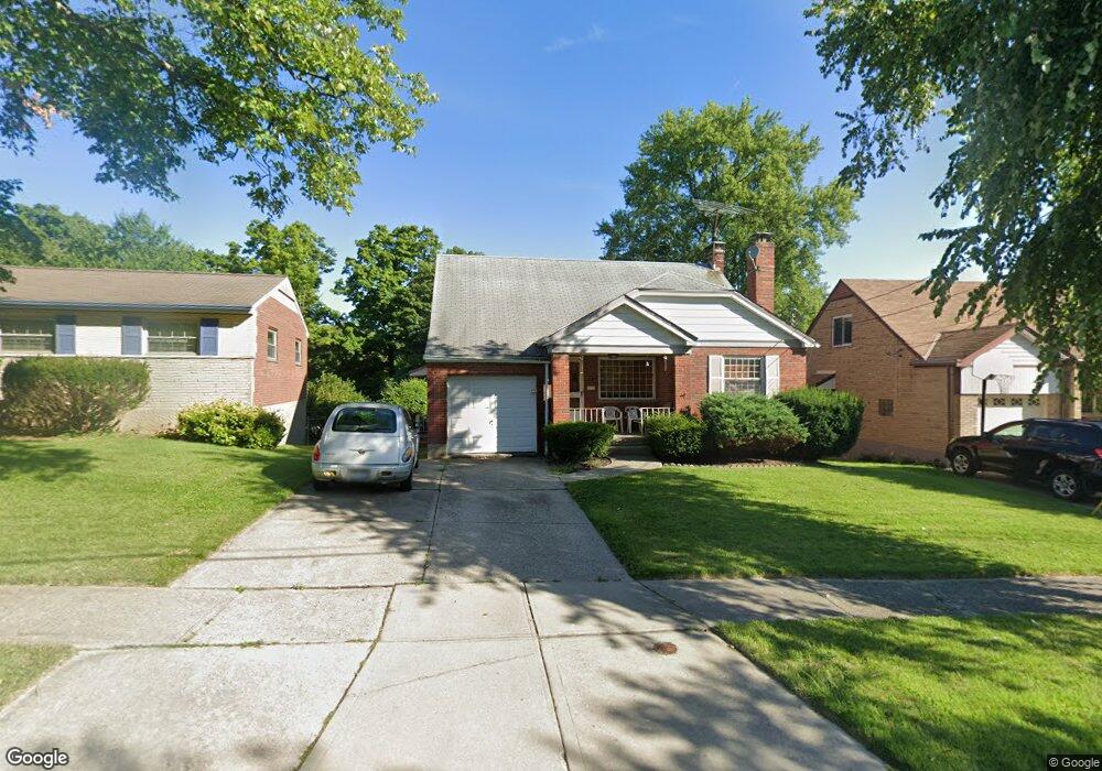
1707 Tuxworth Ave Cincinnati, OH 45238
West Price Hill NeighborhoodEstimated Value: $137,000 - $215,000
3
Beds
2
Baths
1,430
Sq Ft
$131/Sq Ft
Est. Value
About This Home
This home is located at 1707 Tuxworth Ave, Cincinnati, OH 45238 and is currently estimated at $187,982, approximately $131 per square foot. 1707 Tuxworth Ave is a home located in Hamilton County with nearby schools including Carson School, Gilbert A. Dater High School, and Western Hills High School.
Ownership History
Date
Name
Owned For
Owner Type
Purchase Details
Closed on
Feb 2, 2009
Sold by
Hsbc Bank Usa National Association
Bought by
Miken Enterprises Llc
Current Estimated Value
Purchase Details
Closed on
Jul 16, 2008
Sold by
Freeland Lisa M
Bought by
Hsbc Bank Usa National Association
Purchase Details
Closed on
Sep 12, 2005
Sold by
Wischer Richard J
Bought by
Freeland Lisa M
Home Financials for this Owner
Home Financials are based on the most recent Mortgage that was taken out on this home.
Original Mortgage
$102,150
Interest Rate
8.75%
Mortgage Type
Fannie Mae Freddie Mac
Create a Home Valuation Report for This Property
The Home Valuation Report is an in-depth analysis detailing your home's value as well as a comparison with similar homes in the area
Home Values in the Area
Average Home Value in this Area
Purchase History
We collect this data history from publicly available records. To have your information removed, we recommend requesting removal directly through your county’s website.
| Date | Buyer | Sale Price | Title Company |
|---|---|---|---|
| Miken Enterprises Llc | $55,000 | Federated Land Title Agency | |
| Hsbc Bank Usa National Association | $76,000 | None Available | |
| Freeland Lisa M | $113,500 | Priority Land Title Agency |
Source: Public Records
Mortgage History
We collect this data history from publicly available records. To have your information removed, we recommend requesting removal directly through your county’s website.
| Date | Status | Borrower | Loan Amount |
|---|---|---|---|
| Previous Owner | Freeland Lisa M | $102,150 |
Source: Public Records
Tax History
| Year | Tax Paid | Tax Assessment Tax Assessment Total Assessment is a certain percentage of the fair market value that is determined by local assessors to be the total taxable value of land and additions on the property. | Land | Improvement |
|---|---|---|---|---|
| 2025 | $3,229 | $50,789 | $5,922 | $44,867 |
| 2023 | $3,231 | $50,789 | $5,922 | $44,867 |
| 2022 | $2,195 | $30,965 | $5,887 | $25,078 |
| 2021 | $2,154 | $30,965 | $5,887 | $25,078 |
| 2020 | $2,160 | $30,965 | $5,887 | $25,078 |
| 2019 | $2,157 | $28,151 | $5,352 | $22,799 |
| 2018 | $2,158 | $28,151 | $5,352 | $22,799 |
| 2017 | $2,078 | $28,151 | $5,352 | $22,799 |
| 2016 | $1,286 | $16,940 | $5,726 | $11,214 |
| 2015 | $1,150 | $16,940 | $5,726 | $11,214 |
| 2014 | $1,156 | $16,940 | $5,726 | $11,214 |
| 2013 | $1,335 | $19,251 | $6,507 | $12,744 |
Source: Public Records
Map
Nearby Homes
- 1735 Ashbrook Dr
- 4730 Prosperity Place
- 1778 Ashbrook Dr
- 4760 Clevesdale Dr
- 4817 Prosperity Place
- 1893 Ashbrook Dr
- 4827 Prosperity Place
- 1772 Tuxworth Ave
- 1923 Ashbrook Dr
- 1866 Ashbrook Dr
- 1914 Ashbrook Dr
- 4849 Prosperity Place
- 1724 Hillfred Ln
- 4808 Guerley Rd
- 4965 Glenway Ave
- 4709 Guerley Rd
- 4925 Ralph Ave
- 4816 Glenway Ave
- 4952 Western Hills Ave
- 4925 Shirley Place
- 1734 Ashbrook Dr
- 1738 Ashbrook Dr
- 1730 Ashbrook Dr
- 1742 Ashbrook Dr
- 1726 Ashbrook Dr
- 1703 Tuxworth Ave
- 1746 Ashbrook Dr
- 1731 Ashbrook Dr
- 1699 Tuxworth Ave
- 1722 Ashbrook Dr
- 1711 Tuxworth Ave
- 4515 Western Hills Ave
- 1727 Ashbrook Dr
- 1743 Ashbrook Dr
- 1750 Ashbrook Dr
- 1715 Tuxworth Ave
- 1723 Ashbrook Dr
- 1695 Tuxworth Ave
- 1718 Ashbrook Dr
- 4745 Prosperity Place
Your Personal Tour Guide
Ask me questions while you tour the home.