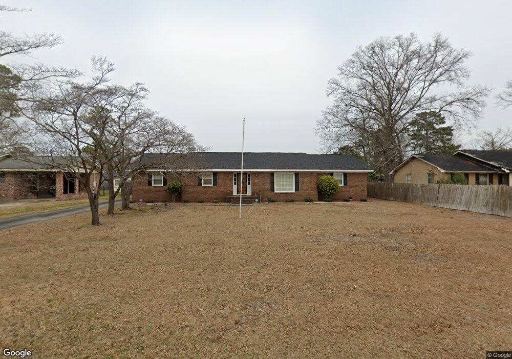
1707 Winthrop Dr Florence, SC 29501
Estimated Value: $209,380 - $227,000
3
Beds
2
Baths
1,702
Sq Ft
$127/Sq Ft
Est. Value
About This Home
This home is located at 1707 Winthrop Dr, Florence, SC 29501 and is currently estimated at $215,845, approximately $126 per square foot. 1707 Winthrop Dr is a home located in Florence County with nearby schools including Briggs Elementary School, Henry L. Sneed Middle School, and John W. Moore Middle School.
Ownership History
Date
Name
Owned For
Owner Type
Purchase Details
Closed on
Aug 26, 2005
Sold by
Garland Thomas K and Garland Cathryn B
Bought by
Touchberry Willie E and Touchberry Dianne G
Current Estimated Value
Home Financials for this Owner
Home Financials are based on the most recent Mortgage that was taken out on this home.
Original Mortgage
$100,000
Interest Rate
5.71%
Mortgage Type
New Conventional
Create a Home Valuation Report for This Property
The Home Valuation Report is an in-depth analysis detailing your home's value as well as a comparison with similar homes in the area
Purchase History
| Date | Buyer | Sale Price | Title Company |
|---|---|---|---|
| Touchberry Willie E | $125,000 | -- |
Source: Public Records
Mortgage History
| Date | Status | Borrower | Loan Amount |
|---|---|---|---|
| Closed | Touchberry Willie E | $100,000 | |
| Closed | Touchberry Willie E | $18,750 |
Source: Public Records
Tax History
| Year | Tax Paid | Tax Assessment Tax Assessment Total Assessment is a certain percentage of the fair market value that is determined by local assessors to be the total taxable value of land and additions on the property. | Land | Improvement |
|---|---|---|---|---|
| 2024 | $478 | $7,353 | $880 | $6,473 |
| 2023 | $355 | $5,330 | $880 | $4,450 |
| 2022 | $425 | $5,330 | $0 | $0 |
| 2021 | $436 | $5,330 | $0 | $0 |
| 2020 | $413 | $5,330 | $0 | $0 |
| 2019 | $386 | $5,330 | $880 | $4,450 |
| 2018 | $290 | $4,650 | $0 | $0 |
| 2017 | $275 | $4,650 | $0 | $0 |
| 2016 | $242 | $4,650 | $0 | $0 |
| 2015 | $252 | $4,650 | $0 | $0 |
| 2014 | $218 | $4,648 | $880 | $3,768 |
Source: Public Records
Map
Nearby Homes
- 1779 S Saint Anthony Ave
- 1804 Woods Dr
- 1770 Woods Dr
- 1811 Meadow Green Place
- 1510 Rosedale St
- 1816 Meadow Green Place
- 1815 Hampton Dr
- 1849 Sloane Ln
- 1905 Marsh Ave
- 1830 Marsh Ave
- 2109 Eaton Cir
- 1521 2nd Loop Rd
- 1768 Marsh Ave
- 1807 Nottingham Dr
- 2200 Eaton Cir
- 2303 W McCown Dr
- 0 State Road S-21-869
- 1420 Fairfax Rd
- 1335 S Lazar Place
- 2051 2nd Loop Rd
- 1711 Winthrop Dr
- 1701 Winthrop Dr
- 1700 Furman Dr
- 1708 Furman Dr
- 1901 Bellevue Dr
- 1713 Winthrop Dr
- 1708 Winthrop Dr
- 1712 Furman Dr
- 1712 Winthrop Dr
- 1905 Bellevue Dr
- 1715 Winthrop Dr
- 1808 Bellevue Dr
- 1900 Bellevue Dr
- 1716 Winthrop Dr
- 1716 Furman Dr
- 1705 Furman Dr
- 1701 Furman Dr
- 1906 Bellevue Dr
- 1711 Furman Dr
- 1917 Bellevue Dr
Your Personal Tour Guide
Ask me questions while you tour the home.