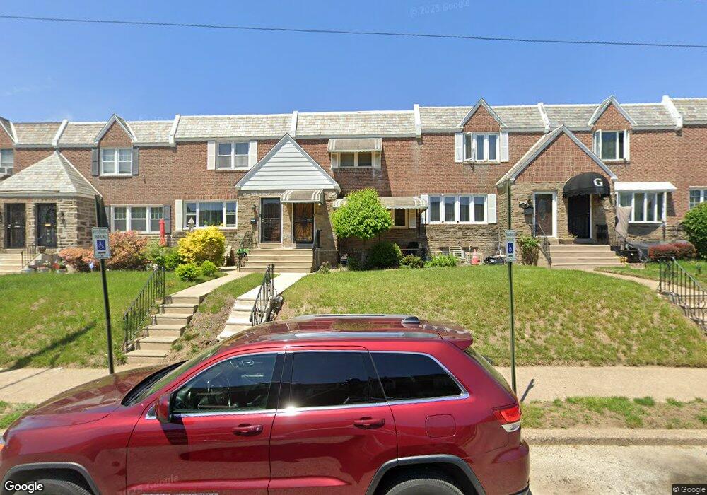
1707 Wynsam St Philadelphia, PA 19138
West Oak Lane NeighborhoodEstimated Value: $234,000 - $290,000
3
Beds
3
Baths
1,416
Sq Ft
$184/Sq Ft
Est. Value
About This Home
This home is located at 1707 Wynsam St, Philadelphia, PA 19138 and is currently estimated at $259,923, approximately $183 per square foot. 1707 Wynsam St is a home located in Philadelphia County with nearby schools including Pennypacker Samuel School, Martin Luther King High School, and West Oak Lane Charter School.
Ownership History
Date
Name
Owned For
Owner Type
Purchase Details
Closed on
Mar 18, 2024
Sold by
Wilson Davitta D
Bought by
Wilson Davitta
Current Estimated Value
Purchase Details
Closed on
Oct 21, 2021
Sold by
James Johnson
Bought by
Johnson James and Wilson Davitta
Home Financials for this Owner
Home Financials are based on the most recent Mortgage that was taken out on this home.
Original Mortgage
$188,000
Interest Rate
2.88%
Mortgage Type
VA
Purchase Details
Closed on
May 25, 2017
Sold by
Kinrad Donna and Estate Of Donald James Wells
Bought by
Johnson James
Home Financials for this Owner
Home Financials are based on the most recent Mortgage that was taken out on this home.
Original Mortgage
$140,000
Interest Rate
4.02%
Mortgage Type
VA
Purchase Details
Closed on
Jun 10, 1999
Sold by
Wells Donald James
Bought by
Wells Donald James and Wells Elaine
Create a Home Valuation Report for This Property
The Home Valuation Report is an in-depth analysis detailing your home's value as well as a comparison with similar homes in the area
Home Values in the Area
Average Home Value in this Area
Purchase History
| Date | Buyer | Sale Price | Title Company |
|---|---|---|---|
| Wilson Davitta | -- | None Listed On Document | |
| Johnson James | -- | Bc Law Firm Pa | |
| Johnson James | $140,000 | None Available | |
| Wells Donald James | -- | -- |
Source: Public Records
Mortgage History
| Date | Status | Borrower | Loan Amount |
|---|---|---|---|
| Previous Owner | Johnson James | $188,000 | |
| Previous Owner | Johnson James | $140,000 |
Source: Public Records
Tax History Compared to Growth
Tax History
| Year | Tax Paid | Tax Assessment Tax Assessment Total Assessment is a certain percentage of the fair market value that is determined by local assessors to be the total taxable value of land and additions on the property. | Land | Improvement |
|---|---|---|---|---|
| 2025 | $2,632 | $231,400 | $46,280 | $185,120 |
| 2024 | $2,632 | $231,400 | $46,280 | $185,120 |
| 2023 | $2,632 | $188,000 | $37,600 | $150,400 |
| 2022 | $1,953 | $188,000 | $37,600 | $150,400 |
| 2021 | $1,953 | $0 | $0 | $0 |
| 2020 | $1,953 | $0 | $0 | $0 |
| 2019 | $2,038 | $0 | $0 | $0 |
| 2018 | $1,828 | $0 | $0 | $0 |
| 2017 | $1,828 | $0 | $0 | $0 |
| 2016 | $1,408 | $0 | $0 | $0 |
| 2015 | $1,348 | $0 | $0 | $0 |
| 2014 | -- | $130,600 | $12,830 | $117,770 |
| 2012 | -- | $18,368 | $2,452 | $15,916 |
Source: Public Records
Map
Nearby Homes
- 1559 E Pastorius St
- 1762 Mohican St
- 7349 E Walnut Ln
- 7277 E Walnut Ln
- 1821 E Tulpehocken St
- 1827 E Pastorius St
- 1544 E Tulpehocken St
- 1822 Nolan St
- 1544 Beverly Rd
- 1839 E Pastorius St
- 1759 E Mayland St
- 1537 Beverly Rd
- 1521 E Walnut Ln
- 7243 Mansfield Ave
- 1602 E Duval St
- 6635 Hollis St
- 1505 Beverly Rd
- 7206 Forrest Ave
- 7258 Mansfield Ave
- 1416-20 E Tulpehocken St
- 1709 Wynsam St
- 1705 Wynsam St
- 1711 Wynsam St
- 1703 Wynsam St
- 1713 Wynsam St
- 1701 Wynsam St
- 1715 Wynsam St
- 1706 E Tulpehocken St
- 1708 E Tulpehocken St
- 1717 Wynsam St
- 1710 E Tulpehocken St
- 1704 E Tulpehocken St
- 1712 E Tulpehocken St
- 1714 E Tulpehocken St
- 1702 E Tulpehocken St
- 1700 E Tulpehocken St
- 1716 E Tulpehocken St
- 1719 Wynsam St
- 1718 E Tulpehocken St
- 1720 E Tulpehocken St