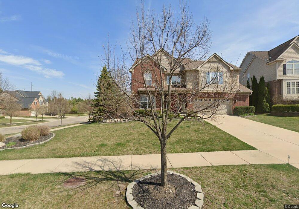
17078 Boulder Dr Unit 202 Northville, MI 48168
Estimated Value: $690,632 - $808,000
4
Beds
4
Baths
2,995
Sq Ft
$246/Sq Ft
Est. Value
About This Home
This home is located at 17078 Boulder Dr Unit 202, Northville, MI 48168 and is currently estimated at $738,158, approximately $246 per square foot. 17078 Boulder Dr Unit 202 is a home located in Wayne County with nearby schools including Ridge Wood Elementary School, Hillside Middle School, and Northville High School.
Ownership History
Date
Name
Owned For
Owner Type
Purchase Details
Closed on
Dec 31, 2014
Sold by
Ingram Lori
Bought by
Ingram Lori and Lori A Ingram Revocable Living
Current Estimated Value
Purchase Details
Closed on
Dec 7, 2007
Sold by
Northville Ridge Land Co Llc
Bought by
Ingram Lori
Purchase Details
Closed on
Dec 19, 2005
Sold by
Northville Ridge Development Corp
Bought by
Northville Ridge Land Co Llc
Purchase Details
Closed on
Jul 29, 2005
Sold by
Hometowne Building Co Llc
Bought by
Northville Ridge Land Co Llc
Home Financials for this Owner
Home Financials are based on the most recent Mortgage that was taken out on this home.
Original Mortgage
$4,500,000
Interest Rate
6.46%
Mortgage Type
Construction
Create a Home Valuation Report for This Property
The Home Valuation Report is an in-depth analysis detailing your home's value as well as a comparison with similar homes in the area
Home Values in the Area
Average Home Value in this Area
Purchase History
| Date | Buyer | Sale Price | Title Company |
|---|---|---|---|
| Ingram Lori | -- | None Available | |
| Ingram Lori | $100,000 | Greco | |
| Northville Ridge Land Co Llc | $2,455,687 | Greco | |
| Northville Ridge Land Co Llc | -- | Metropolitan |
Source: Public Records
Mortgage History
| Date | Status | Borrower | Loan Amount |
|---|---|---|---|
| Previous Owner | Northville Ridge Land Co Llc | $4,500,000 |
Source: Public Records
Tax History Compared to Growth
Tax History
| Year | Tax Paid | Tax Assessment Tax Assessment Total Assessment is a certain percentage of the fair market value that is determined by local assessors to be the total taxable value of land and additions on the property. | Land | Improvement |
|---|---|---|---|---|
| 2025 | $4,445 | $319,600 | $0 | $0 |
| 2024 | $4,445 | $306,600 | $0 | $0 |
| 2023 | $4,241 | $268,600 | $0 | $0 |
| 2022 | $4,039 | $238,600 | $0 | $0 |
| 2021 | $6,612 | $236,000 | $0 | $0 |
| 2020 | $6,600 | $241,700 | $0 | $0 |
| 2019 | $6,478 | $236,000 | $0 | $0 |
| 2018 | $3,681 | $229,600 | $0 | $0 |
| 2017 | $5,033 | $230,700 | $0 | $0 |
| 2016 | $6,017 | $234,600 | $0 | $0 |
| 2015 | $16,651 | $218,200 | $0 | $0 |
| 2013 | $16,131 | $181,000 | $0 | $0 |
| 2012 | $5,111 | $166,700 | $38,100 | $128,600 |
Source: Public Records
Map
Nearby Homes
- 49487 Coldwater Ridge Dr
- 19085 Chaumont Way
- 17170 Garden Ridge Ln Unit 72
- 17486 Crestbrook Dr
- 16707 Carriage Way Unit 53
- 16702 Dover Dr Unit 73
- 49401 N Glacier Unit 57
- 16701 Carriage Way Unit 56
- 16897 Carriage Way Unit 2
- 16706 Dover Dr Unit 71
- 16865 Carriage Way Unit 10
- 50437 Tamarack Trail
- 16550 Mulberry Way Unit 17
- 50306 Cressnut Ct Unit 111
- 50070 Venice Ct Unit 36
- 16413 Mulberry Way Unit 137
- 15943 Morningside Unit 179
- 41628 Six Mile Rd
- 15970 Morningside Unit 207
- 17464 Williamsburg Ct
- 17066 Boulder Dr
- 17079 Carriage Way Unit 142
- 17058 Boulder Dr
- 17058 Boulder Dr
- 17067 Carriage Way Unit 143
- 49912 Parkside Dr Unit 205
- 49895 Parkside Dr
- 49904 Parkside Dr Unit 206
- 49920 Parkside Dr
- 17059 Carriage Way Unit 144
- 17048 Boulder Dr
- 17065 Boulder Dr Unit 177
- 49896 Parkside Dr Unit Bldg-Unit
- 49896 Parkside Dr Unit 207
- 49928 Parkside Dr Unit 203
- 17049 Carriage Way Unit 145
- 49879 Parkside Dr Unit 175
- 49888 Parkside Dr Unit 208
- 17047 Boulder Dr Unit 178
- 17039 Carriage Way Unit 146