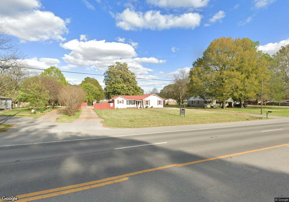
1708 Highway 367 N Newport, AR 72112
Estimated Value: $89,103 - $154,000
--
Bed
1
Bath
1,116
Sq Ft
$103/Sq Ft
Est. Value
About This Home
This home is located at 1708 Highway 367 N, Newport, AR 72112 and is currently estimated at $115,276, approximately $103 per square foot. 1708 Highway 367 N is a home located in Jackson County with nearby schools including Newport Elementary School and Newport High School.
Ownership History
Date
Name
Owned For
Owner Type
Purchase Details
Closed on
Oct 28, 2021
Sold by
Honey Sandy and Honey William M
Bought by
Honey Living Trust and Honey
Current Estimated Value
Purchase Details
Closed on
Jan 26, 2015
Bought by
Honey Sandy
Purchase Details
Closed on
Jun 27, 2007
Bought by
Fortenberry Billy M and Fortenberry Claudia F
Purchase Details
Closed on
Feb 26, 1998
Bought by
Coe Shane and Coe Laura
Purchase Details
Closed on
Oct 1, 1995
Bought by
Pulliam Shelly and Pulliam Bobbie
Create a Home Valuation Report for This Property
The Home Valuation Report is an in-depth analysis detailing your home's value as well as a comparison with similar homes in the area
Home Values in the Area
Average Home Value in this Area
Purchase History
| Date | Buyer | Sale Price | Title Company |
|---|---|---|---|
| Honey Living Trust | -- | None Listed On Document | |
| Honey Sandy | -- | -- | |
| Fortenberry Billy M | $54,000 | -- | |
| Coe Shane | $45,000 | -- | |
| Pulliam Shelly | $38,000 | -- |
Source: Public Records
Tax History Compared to Growth
Tax History
| Year | Tax Paid | Tax Assessment Tax Assessment Total Assessment is a certain percentage of the fair market value that is determined by local assessors to be the total taxable value of land and additions on the property. | Land | Improvement |
|---|---|---|---|---|
| 2024 | $659 | $15,100 | $1,950 | $13,150 |
| 2023 | $599 | $11,520 | $1,800 | $9,720 |
| 2022 | $618 | $11,520 | $1,800 | $9,720 |
| 2021 | $606 | $11,520 | $1,800 | $9,720 |
| 2020 | $606 | $11,520 | $1,800 | $9,720 |
| 2019 | $606 | $11,520 | $1,800 | $9,720 |
| 2018 | $601 | $11,790 | $1,800 | $9,990 |
| 2017 | $601 | $11,790 | $1,800 | $9,990 |
| 2015 | -- | $10,260 | $1,800 | $8,460 |
| 2014 | -- | $10,260 | $1,800 | $8,460 |
| 2013 | -- | $11,170 | $1,500 | $9,670 |
| 2012 | -- | $11,170 | $1,500 | $9,670 |
Source: Public Records
Map
Nearby Homes
- 2208 John Cir
- 1212 Graceland Dr
- 1217 Cherokee Dr
- 0 Robinson Rd
- 2412 Linwood St
- 2708 Robinson St
- 2600 Hollywood St
- 1303 Cindy Ln
- 1620 Brookfield Cir
- 2001 S Main St
- 1319 Cindy Ln
- 2701 S Main St
- 1714 Dill St
- 203 Alice Ct
- 1407 Dill St
- 1311 Dill St
- 900 Josephine St
- 1801 Hines St
- 1900 Hines St
- 3101 Lax St
- 1704 Highway 367 N
- 1800 Highway 367 N
- 2507 Virginia Ave
- 2500 Normandy Dr
- 2508 Normandy Dr
- 2601 Virginia Ave
- 1608 Highway 367 N
- 2504 Virginia Ave
- 2508 Virginia Ave
- 1701 Linden Cir
- 2600 Normandy Dr
- 2600 Virginia Ave
- 1705 Linden Cir
- 1604 Highway 367 N
- 1900 Highway 367 N
- 2505 Brandenburg Ln
- 1915 Highway 367 N
- 2604 Virginia Ave
- 2509 Brandenburg Ln
- 2601 Brandenburg Ln