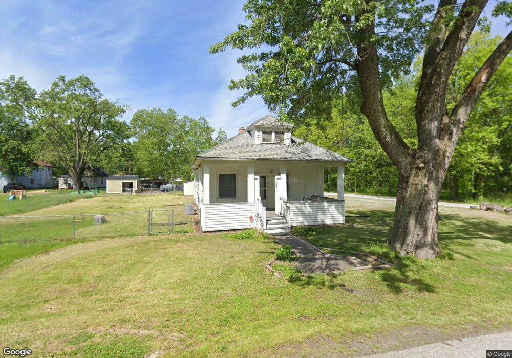
1708 Tower St Chesterton, IN 46304
Estimated Value: $181,781 - $242,000
2
Beds
1
Bath
988
Sq Ft
$216/Sq Ft
Est. Value
About This Home
This home is located at 1708 Tower St, Chesterton, IN 46304 and is currently estimated at $213,445, approximately $216 per square foot. 1708 Tower St is a home located in Porter County with nearby schools including Liberty Elementary School, Liberty Intermediate School, and Chesterton Middle School.
Ownership History
Date
Name
Owned For
Owner Type
Purchase Details
Closed on
Sep 9, 2022
Sold by
Akb Rental Properties Llc
Bought by
Akb Rental Properties Llc
Current Estimated Value
Purchase Details
Closed on
Jul 28, 2015
Sold by
Bratcher Lance and Bratcher Amy
Bought by
A K B Rental Properties Llc
Purchase Details
Closed on
Jul 18, 2014
Sold by
Zimmerman Bonnie L and Estate Of Clara Hogan
Bought by
Bratcher Lance and Bratcher Amy
Create a Home Valuation Report for This Property
The Home Valuation Report is an in-depth analysis detailing your home's value as well as a comparison with similar homes in the area
Home Values in the Area
Average Home Value in this Area
Purchase History
| Date | Buyer | Sale Price | Title Company |
|---|---|---|---|
| Akb Rental Properties Llc | -- | -- | |
| A K B Rental Properties Llc | -- | None Available | |
| Bratcher Lance | -- | None Available |
Source: Public Records
Tax History
| Year | Tax Paid | Tax Assessment Tax Assessment Total Assessment is a certain percentage of the fair market value that is determined by local assessors to be the total taxable value of land and additions on the property. | Land | Improvement |
|---|---|---|---|---|
| 2025 | $2,314 | $116,200 | $19,700 | $96,500 |
| 2024 | $2,314 | $106,900 | $19,700 | $87,200 |
| 2023 | $2,204 | $104,300 | $18,900 | $85,400 |
| 2022 | $2,593 | $116,800 | $27,900 | $88,900 |
| 2021 | $2,204 | $98,400 | $27,900 | $70,500 |
| 2020 | $2,014 | $89,800 | $25,500 | $64,300 |
| 2019 | $1,911 | $85,200 | $25,500 | $59,700 |
| 2018 | $1,845 | $82,200 | $25,500 | $56,700 |
| 2017 | $1,916 | $84,400 | $25,500 | $58,900 |
| 2016 | $2,040 | $91,000 | $33,200 | $57,800 |
| 2014 | $1,030 | $101,900 | $31,100 | $70,800 |
| 2013 | -- | $98,400 | $31,800 | $66,600 |
Source: Public Records
Map
Nearby Homes
- 1717 Crocker St
- 1765 Tower St
- 2131 Pepperbush Ave
- 4221 Westwood Ln S
- 7401 Belplane Ct
- 0 St Rd 149 Unit NRA824925
- TBD Lenburg Rd
- 0-TBD Lenburg Rd
- 513 Sienna Ave
- V/L U S 20
- 283 Melton Rd
- 1440 Duffer Dr
- 1151 Burns Blvd
- 1 Burns Blvd
- 2375 Arrow St
- 7040 Elaine Ave
- 1181 Harbor Way
- 1178 Harbor Way
- 3431 Drivers Way
- 1178 Putman Place
- 1714 Tower St
- 1707 Tower St
- 1724 Tower St
- 1707 Crocker St
- 1711 Crocker St
- 1725 Crocker St
- 1734 Tower St
- 1733 Crocker St
- 1733 Tower St
- 1714 Crocker St
- 1734 Crocker St
- 1710 Crocker St
- 1718 Crocker St
- 1749 Tower St
- 1749 Crocker St
- 1758 Tower St
- 1734 Church St
- 1750 Crocker St
- 5567 Joliet Ave
- 1758 Crocker St
Your Personal Tour Guide
Ask me questions while you tour the home.