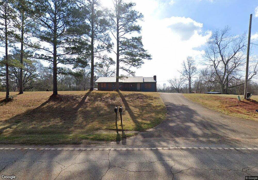
17086 Ga Highway 27 Richland, GA 31825
Estimated Value: $224,000 - $336,000
3
Beds
2
Baths
1,394
Sq Ft
$200/Sq Ft
Est. Value
About This Home
This home is located at 17086 Ga Highway 27, Richland, GA 31825 and is currently estimated at $278,722, approximately $199 per square foot. 17086 Ga Highway 27 is a home located in Stewart County with nearby schools including Stewart County Elementary School, Stewart County Middle School, and Stewart County High School.
Ownership History
Date
Name
Owned For
Owner Type
Purchase Details
Closed on
Jun 2, 2022
Sold by
Bass Kimberly A
Bought by
Williams Mindy and Williams Kenneth Michael
Current Estimated Value
Home Financials for this Owner
Home Financials are based on the most recent Mortgage that was taken out on this home.
Original Mortgage
$306,900
Outstanding Balance
$292,017
Interest Rate
5.27%
Mortgage Type
VA
Estimated Equity
-$13,295
Purchase Details
Closed on
Mar 23, 2013
Sold by
Bass James Larry
Bought by
Bass Kimberly A
Create a Home Valuation Report for This Property
The Home Valuation Report is an in-depth analysis detailing your home's value as well as a comparison with similar homes in the area
Home Values in the Area
Average Home Value in this Area
Purchase History
| Date | Buyer | Sale Price | Title Company |
|---|---|---|---|
| Williams Mindy | $300,000 | -- | |
| Bass Kimberly A | -- | -- |
Source: Public Records
Mortgage History
| Date | Status | Borrower | Loan Amount |
|---|---|---|---|
| Open | Williams Mindy | $306,900 |
Source: Public Records
Tax History Compared to Growth
Tax History
| Year | Tax Paid | Tax Assessment Tax Assessment Total Assessment is a certain percentage of the fair market value that is determined by local assessors to be the total taxable value of land and additions on the property. | Land | Improvement |
|---|---|---|---|---|
| 2024 | -- | $70,140 | $32,560 | $37,580 |
| 2023 | $1,230 | $70,140 | $32,560 | $37,580 |
| 2022 | $949 | $54,540 | $25,440 | $29,100 |
| 2021 | $944 | $54,540 | $25,440 | $29,100 |
| 2020 | $938 | $54,540 | $25,440 | $29,100 |
| 2019 | $1,453 | $54,540 | $25,440 | $29,100 |
| 2018 | $926 | $54,540 | $25,440 | $29,100 |
| 2017 | $825 | $50,980 | $25,440 | $25,540 |
| 2016 | $819 | $50,980 | $25,440 | $25,540 |
| 2015 | -- | $48,200 | $25,440 | $22,760 |
| 2013 | -- | $48,000 | $25,440 | $22,560 |
Source: Public Records
Map
Nearby Homes
- 13990 Ga Highway 27
- 0 Liberty St Unit 10517245
- 0 Liberty St Unit 10517236
- 0 Valley Rd
- 0 Broad St Unit 10460253
- 0 Louise Bell Rd
- 0 Louise Bell Rd Unit 10536398
- 0 Rd
- James Lane Loop
- James Lane Loop
- James Lane Loop
- 8 Old Chestnut St
- 213 Broad St
- 1469 Wall St
- 0 Humber Ave
- 0 House Ave
- Lumpkin Bypass Us Highway 27
- 000 Broad St
- 10200 U S Highway 280
- 0 U S Highway 280
- 17086 Georgia 27
- 17052 Ga Highway 27
- 17330 Ga Highway 27
- 17354 Ga Highway 27
- 17497 Ga Highway 27 Unit A
- 16932 Ga Highway 27
- 220 Waterloo Cir
- 16836 Ga Highway 27
- 17636 Ga Highway 27
- 17679 Ga Highway 27
- 16363 Georgia 27
- 16363 Ga Hwy 0027
- 16363 Ga Highway 27
- 17743 Ga Highway 27
- 0 Georgia 27 Unit 11317817
- 0 Georgia 27 Unit 11268319
- 0 Georgia 27
- 17863 Ga Highway 27
- 1969 Dairy Rd
- 2687 Valley Rd