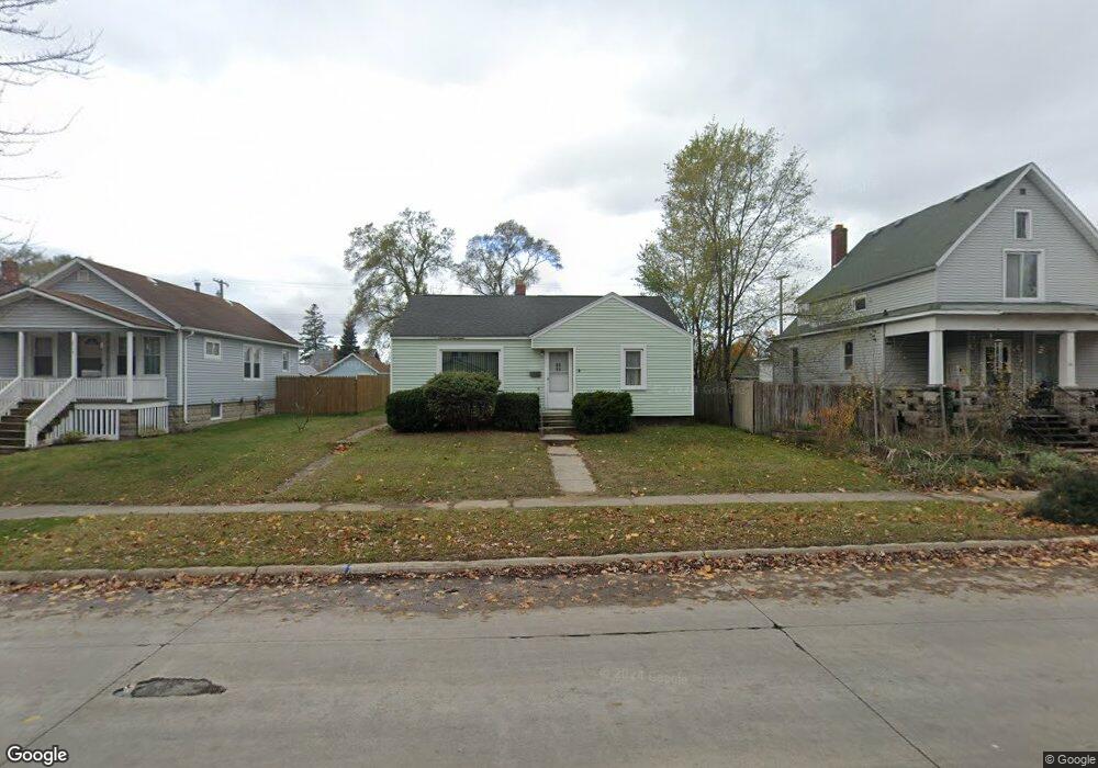
1709 16th St Port Huron, MI 48060
Estimated Value: $78,394 - $113,000
2
Beds
1
Bath
830
Sq Ft
$112/Sq Ft
Est. Value
About This Home
This home is located at 1709 16th St, Port Huron, MI 48060 and is currently estimated at $93,099, approximately $112 per square foot. 1709 16th St is a home located in St. Clair County with nearby schools including Michigamme Elementary School, Central Middle School, and Port Huron High School.
Ownership History
Date
Name
Owned For
Owner Type
Purchase Details
Closed on
Nov 27, 2024
Sold by
Simpson David
Bought by
Simpson David and Simpson Sarah
Current Estimated Value
Purchase Details
Closed on
Nov 26, 2024
Sold by
Mclain Linsay Rosine and Miller Christopher Anthony
Bought by
Simpson David
Purchase Details
Closed on
May 15, 2021
Sold by
Mclain Linsay Rosine and Estate Of Patricia Joan Miller
Bought by
Mclain Linsay Rosine and Miller Christopher Anthony
Purchase Details
Closed on
Jun 30, 2020
Sold by
Miller Patricia Joan
Bought by
Miller Patricia Joan and Miller Christopher Anthony
Create a Home Valuation Report for This Property
The Home Valuation Report is an in-depth analysis detailing your home's value as well as a comparison with similar homes in the area
Home Values in the Area
Average Home Value in this Area
Purchase History
| Date | Buyer | Sale Price | Title Company |
|---|---|---|---|
| Simpson David | -- | None Listed On Document | |
| Simpson David | -- | None Listed On Document | |
| Simpson David | $60,000 | None Listed On Document | |
| Simpson David | $60,000 | None Listed On Document | |
| Mclain Linsay Rosine | -- | None Available | |
| Miller Patricia Joan | -- | None Available |
Source: Public Records
Tax History Compared to Growth
Tax History
| Year | Tax Paid | Tax Assessment Tax Assessment Total Assessment is a certain percentage of the fair market value that is determined by local assessors to be the total taxable value of land and additions on the property. | Land | Improvement |
|---|---|---|---|---|
| 2025 | $1,156 | $43,700 | $0 | $0 |
| 2024 | $924 | $41,400 | $0 | $0 |
| 2023 | $873 | $36,900 | $0 | $0 |
| 2022 | $846 | $30,800 | $0 | $0 |
| 2021 | $804 | $27,800 | $0 | $0 |
| 2020 | $1,133 | $24,300 | $24,300 | $0 |
| 2019 | $799 | $17,300 | $0 | $0 |
| 2018 | $782 | $17,300 | $0 | $0 |
| 2017 | $699 | $16,400 | $0 | $0 |
| 2016 | $586 | $16,400 | $0 | $0 |
| 2015 | $602 | $16,300 | $16,300 | $0 |
| 2014 | $602 | $16,800 | $16,800 | $0 |
| 2013 | -- | $18,800 | $0 | $0 |
Source: Public Records
Map
Nearby Homes